Map data @2023 Google
The Issue
Over the last several years, Global Fishing Watch has provided unprecedented insights into fishing activity worldwide. Our flagship map is built on data from automatic identification systems (AIS)—a satellite tracking technology that large vessels are required to use to broadcast their position—and supplemented by vessel monitoring system data, which a number of progressive governments have shared with us.
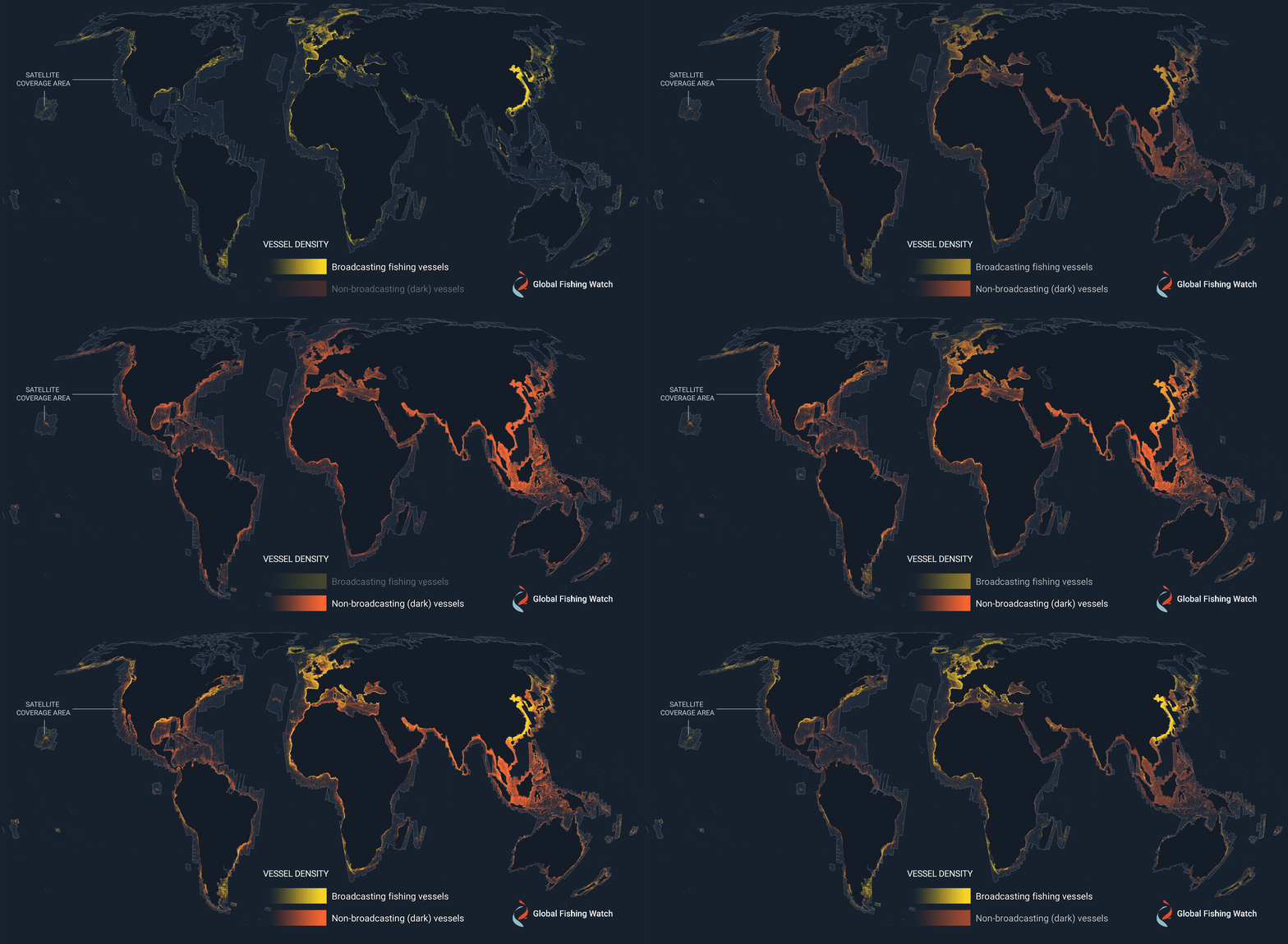
But our map is only as good as the data we receive—so while revolutionary, it’s not perfect. Some vessels switch off their AIS signals, others don’t publicly broadcast their location and some simply fail to appear in public monitoring systems at all. There are a number of legitimate reasons why a vessel might not appear in a public monitoring system—or broadcasting their location at all—but all too often these so-called “dark vessels” have been engaged in unscrupulous behavior such as illegal, unreported and unregulated fishing.
And so we needed to find another way to detect these vessels and bring the dark fleet to light.
Our Work
To get a more comprehensive picture of global fishing, we started combining vessel tracking data with other satellite data, including optical imagery and synthetic aperture radar (SAR). SAR, a powerful tool for remote sensing technology, works day and night in all types of weather, so vessels can be detected even through thick cloud cover.
This technique for producing fine-resolution images proved essential in our 2020 study, “Illuminating Dark Fishing Fleets in North Korea,” which drew on four different data sources to reveal around 900 vessels of Chinese origin fishing illegally in North Korea. SAR was also extremely valuable in studying previously unseen fishing activity in the Mediterranean and off the African coast, opening our eyes to activities we had never seen before. It was clear that our ocean was a lot busier than existing monitoring systems had shown.
In 2022, we made even further progress on this front by adding a new data layer to our map which shows previously undetected dark vessels.. We developed this by analyzing millions of gigabytes of SAR data from the European Space Agency’s Sentinel-1 satellites. Using some clever machine learning, we were able to identify vessels that weren’t publicly broadcasting their position and gain a better understanding of the true global footprint of fishing activity.
We are continually adding new data to our map, helping build an even more comprehensive picture of what is taking place at sea. These efforts received a major boost when Canadian space-tech company MDA provided us with access to its entire RADARSAT-2 archive–a record stretching back 14 years and including nearly a million images.
Thanks to the combination of satellite radar imagery and science based analytics, we have the ability to catalyze research and equip policymakers with insights that can reveal what was once unknown and more effectively fight illegal fishing practices.

“By seeing and characterizing the activity of these expansive dark fleets, we can begin to better understand and quantify not just illegal fishing but a great deal of human activity that is impacting our marine environment. These are exciting times when it comes to open, accessible data that anyone can use for free to understand and advocate for the fragile marine areas they care about most.”
Paul Woods, chief innovation officer, Global Fishing Watch

