Our APIs
Explore, visualize and freely download Global Fishing Watch data and synthesize multiple streams of information through our API portal. By openly publishing our APIs, we aim to transform global collaboration and catalyze solutions to address the ocean’s most complex problems.
Building innovative ways to access and integrate our dynamic data
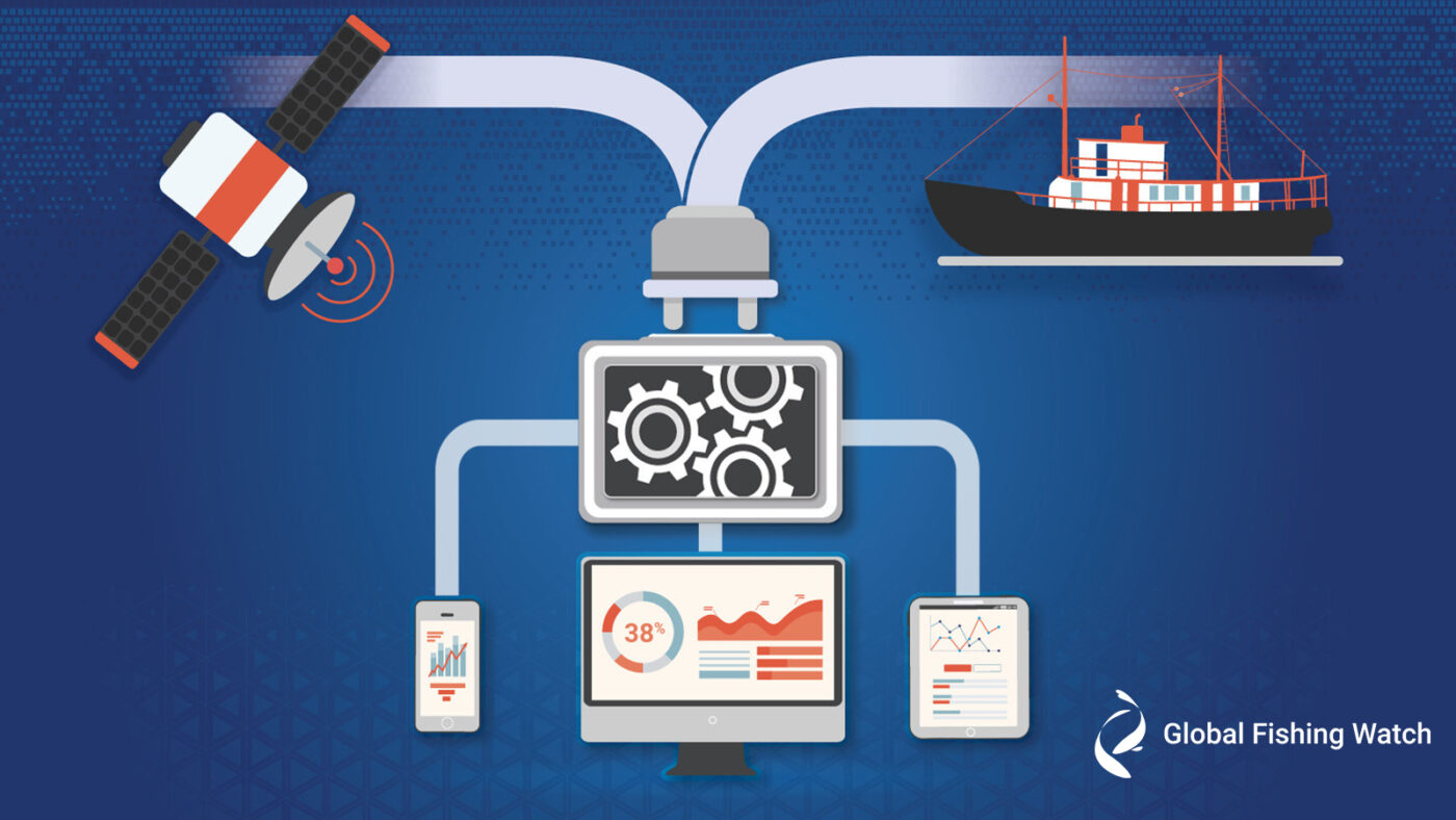
Global Fishing Watch has created a technology portal that provides application programming interfaces, or APIs, to revolutionize the way we research and monitor human impacts across the world’s ocean. Our APIs provide software instructions that enable automatic connection of our data and products to other systems so users can easily download and integrate our datasets, code, and models to power their own platforms. By providing streamlined access to information on current fishing vessel activity, identity and history, we are helping create solutions for a resilient, sustainable ocean.
How to access Global Fishing Watch APIs?
- Register for a Global Fishing Watch account
- Request an API key
- Agree to the terms of use and attribute Global Fishing Watch in anything you publish
- Participate in follow-up surveys
- Subscribe to receive API updates and events
You can find detailed technical information in our documentation.
Questions or feedback
We are constantly working to improve our tools and data offerings, and we encourage you to share feedback or your stories to help us improve. Send an email to: [email protected].
Free and open data to inspire next wave of ocean solutions
Explore Our API Functions

Fishing effort
Discover fishing patterns for nearly 70,000 vessels broadcasting on AIS, displayed across space and time at global scale, in a map visualization.
Fishing events
Find vessel position data showing possible fishing events in detail, anywhere on the ocean.

Vessel search and identity
Search all vessel types through multiple identifiers and cross-check identity information derived from AIS self-reported data and from public regional and national registries.
Encounters
Find data on vessel encounters and possible transshipment events on a global scale for improved knowledge of at-sea catch transfers.
Loitering
Locate information on vessel loitering to increase awareness of potential at-sea encounters and transshipment events.
Port visits
Find data on port visits and patterns of vessel behavior across space and time.
Vessel insights
Find data that merges AIS activity and authorizations to facilitate risk-based decision-making
The APIs in Action
Global Fishing Watch seeks to make its dynamic datasets available to anyone for integration into their own platforms and research. Since the launch of the portal, our APIs have been used by over 200 organizations across nearly 70 countries, ranging from government institutions and academia to nonprofits and small technology firms. As part of our commitment to be good stewards of the planet, we require our API users to provide a brief description of the impact they are seeking to make with the data provided to them by the portal. Areas of work include biodiversity and ecosystem resilience, fisheries management and technological innovation.
R package to support data analysis
Global Fishing Watch enables the research community to access data from its application programming interfaces, or APIs, directly through R—a specialized programming language for data processing, statistical analysis and data visualizations. The package, called gfwr, allows R users to request data from Global Fishing Watch’s APIs and receive data in a tidy format suitable for incorporation into new or existing R workflows. Installing gfwr gives academics, researchers, students and journalists the ability to easily pull data for analysis without any prior API experience.
See how we empower others to use our data here.
Improved Awareness of Vessel Activity
SeaVision is an online maritime situational awareness tool that supports international maritime operations. An initiative started by the U.S. Department of Transportation, SeaVision is being used by more than 4,500 individuals from 100 partner nations to track vessel movement and share information—all with the common goal of improving operations and building partnerships across the maritime community. SeaVision integrates the Events API to freely share Global Fishing Watch data on vessel activity and provides insight into vessel encounters and loitering in near real time, across global waters.
Ready to build? Get your free API key.
Collaboration for Integrated Ocean Management
The World Resources Institute’s open data platform, Ocean Watch, integrates data on apparent fishing effort, displayed clearly and interactively in gridded format on the Global Fishing Watch map, at global scale and by country. Policy makers, researchers and the public are able to use Ocean Watch to leverage near real-time information on fishing vessel activity in an accessible, simplified way. With an automated connection to Global Fishing Watch data, users can assess the impacts of fishing activity on ocean ecosystems at both the regional and global level, allowing them to take informed action, develop sustainable economies and protect fragile resources through integrated ocean management.
Find Events API technical documentation here.