Global Fishing Watch and Dona Bertarelli partnered to develop Global Fishing Watch Marine Manager, an innovative technology portal to support the effective design, management and monitoring of protected areas.
About Marine Manager
Marine protected areas are an essential tool in the recovery and conservation of our ocean and the essential services it provides. They help sustain biodiversity in the face of rising sea temperatures and ocean acidification, and create safe havens for wildlife, allowing populations to replenish. But management is often hampered by inadequate information to support decision-making.
To help address this, Global Fishing Watch and Dona Bertarelli developed Global Fishing Watch Marine Manager, an innovative technology portal that seeks to improve insight into marine protected areas. By monitoring the quality, efficiency and impact of long-term protections, Marine Manager aims to ensure robust and science-based management of protected areas and acknowledge the vital contributions they make to our ocean.
The portal empowers individuals to rapidly collate and analyze scientific data integral to the governance of marine protected areas and other area-based conservation measures.The revolutionary technology and accessible, science-based data can make a vital contribution to global efforts to improve oversight of human activity in and around marine protected areas and help facilitate stewardship of marine resources.

How the portal works
Global Fishing Watch Marine Manager is an innovative, open-access technology portal. It provides dynamic and interactive data on ocean conditions, biology and human-use activity in near real-time to support marine spatial planning, marine protected area design and management, and scientific research.

Human-use data includes commercial fishing activity and non-fishing vessel activity, including those involved in offshore oil drilling, seabed mining, cargo transportation and fuel supply. Anyone can view events along a vessel’s track and identify the ports a vessel visited after engaging in fishing activity.
Oceanographic data can be added to cover information like bathymetry and seamounts, as well as salinity and sea surface temperature data to understand climate change impacts over time. Biological and ecological data can be used to analyze primary biological productivity, such as chlorophyll a, and can help predict species habitat suitability or show important animal migration routes.

Advanced analysis can be completed to generate graphs that show when and where fishing activity takes place and how it changes over time, as well as view where activity has shifted following the implementation of new management measures.

Maritime zoning includes the boundaries of marine protected areas, exclusive economic zones, high seas boundaries, FAO major fishing areas, fishing grounds and the ability to upload other unique data specific to jurisdictions.
The portal in action
In the early stages of development, the portal was used across various sites to support management authorities. From the remote waters of Tristan da Cunha, home to the critically endangered Tristan albatross, to Guyana’s mangrove-lined ocean, Marine Manager was piloted to visualize and analyze dynamic activity data and understand more about what is happening in our ocean. The portal was also used in the iconic Galápagos Islands, Ascension Island, Niue and Palau to support oversight of marine protected areas.
The portal is available to anyone with an internet connection, allowing users to set up public and private workspaces for any area globally. This enables greater access to data, promotes collaboration and sharing among researchers, policymakers and other stakeholders, and helps to build a broader understanding of global fishing patterns and trends to implement and improve management.
Inaugural partners using the portal include management authorities responsible for the iconic Galápagos Islands—one of the most biologically diverse marine reserves in the world—and the globally-significant Ascension Island marine protected area—a protected area that has never had significant fishing activity.
Other important marine areas in Guyana, Tristan da Cunha and Niue are included in the launch of the portal, with more sites to join as the technology develops.
Global Fishing Watch hopes the new portal will transform the ocean community’s ability to understand, monitor and protect important marine ecosystems. The revolutionary technology and accessible, science-based data can make a vital contribution to global efforts to improve oversight of human activity in and around marine protected areas and help facilitate stewardship of marine resources.
Marine Manager Helps Protect Waters of the Eastern Tropical Pacific
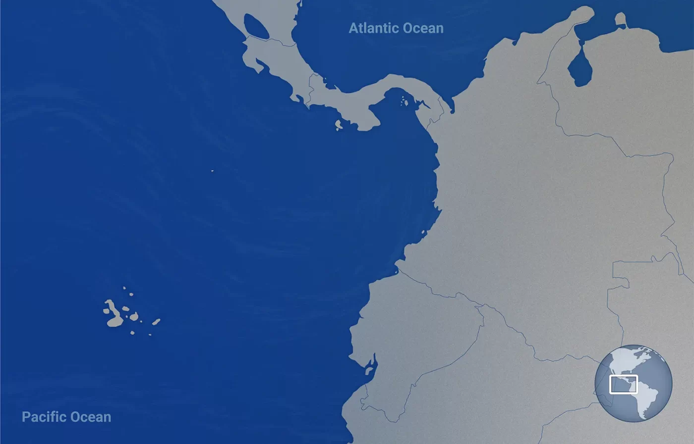
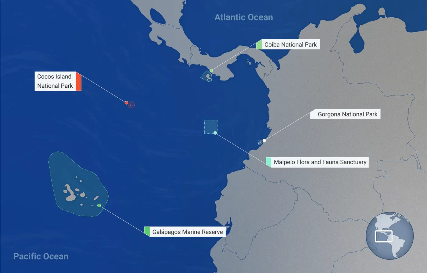
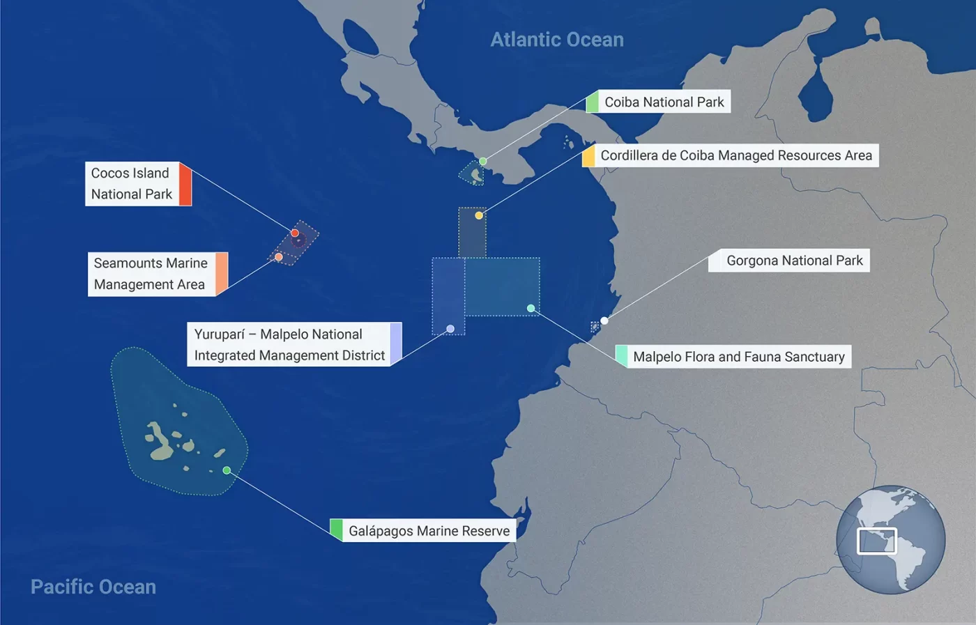
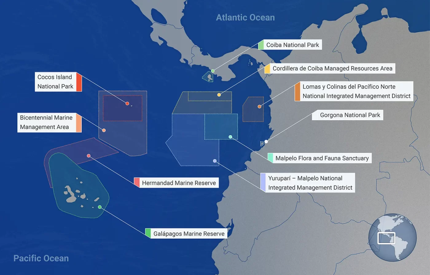
Global Fishing Watch’s Marine Manager is supporting stewardship of the Eastern Tropical Pacific Marine Corridor, commonly referred to as CMAR—a cluster of marine protected areas (MPAs) that span more than 772,000 square miles (2 million square kilometers) and connect the waters of Colombia, Costa Rica, Ecuador and Panama.
Rich in biodiversity, CMAR is teeming with wildlife. Tuna, sharks, sea turtles, whales, rays, seabirds and other various marine life occupy the ocean corridor in search for food, spawning and nursery grounds, as well as migratory routes that follow underwater mountain ranges.
Established in 2004 by Colombia, Costa Rica, Ecuador and Panama, CMAR is also a leading example of regional cooperation in the management and conservation of marine resources. What began as an initiative to protect the Malpelo and Gorgona Islands, Coiba Island, the Galapagos Islands and Cocos Island has now expanded to new types of marine protection, providing stronger safeguards and better connectivity for the multiple species thriving in it.
In 2021, these same four coastal States announced an expansion of the corridor with the inclusion of new protected areas, such as the Yuruparí-Malpelo Integrated Management District. And progression continues with CMAR’s latest additions: the Bicentennial Marine Management Area, the Hermandad Marine Reserve and the Lomas y Colinas del Pacífico Norte Integrated Management District.
To help inform management decisions and support data-driven conservation policies, local and regional authorities are using the marine manager portal to understand each protected area’s unique set of challenges and find solutions that address them. With support from Global Fishing Watch analysts, marine managers are also able to collectively identify areas of interest within each MPA and support coordination and information sharing among them.
The Eastern Tropical Pacific Marine Corridor
Our portal is endorsed as a Decade Action as part of the United Nations Decade of Ocean Science for Sustainable Development.
