

Jennifer Raynor
Dr. Jennifer Raynor discusses the rapid evolution of AI-enabled vessel tracking technologies and how this technology can drive better decisions at sea.
As chair of Global Fishing Watch’s science advisory board and member of the organization’s board of directors, Dr. Jennifer Raynor has a front-row seat to the rapidly changing picture capturing human activity at sea. Advances in artificial intelligence, satellite imagery and vessel tracking are not only increasingly revealing where fishing happens but also spotlighting once-hidden gaps left by conventional monitoring systems.
Raynor has helped shape that emerging field. An assistant professor of natural resource economics at the University of Wisconsin-Madison, her work has centered on how new sources of ocean data can inform conservation efforts and fisheries management in the name of greater transparency.

Her latest paper, “Satellite-Based Fishing Fleet Tracking: A New Foundation for Fisheries Science and Management,” published in July 2026, examines how a decade of technological advances has transformed fisheries science, from AI models capable of identifying apparent fishing activity to satellite imagery that can detect vessels that do not appear in public tracking systems.
We spoke with Raynor about the evolution of vessel tracking, the questions these technologies can now answer and how the next generation of AI-enabled ocean monitoring can bolster global efforts for ocean transparency.
How has satellite-based vessel tracking evolved?
There have been two critical breakthroughs in publicly accessible, global-scale vessel tracking datasets over the past decade, both led by Global Fishing Watch scientists.
The first was the release of their flagship data on apparent fishing activity in 2018, which uses AI models to infer when and where a vessel is likely fishing based on its movement patterns. For example, the model may learn that vessels move in a straight line and at a certain speed when trawling.
This was the first time that scientists, managers, policymakers, journalists and the public at large could access global-scale data on industrial fishing fleets. It offered a degree of transparency in human uses of the ocean that was previously unthinkable. Unfortunately, AIS data still has major blind spots. Captains can turn off or tamper with transponders, satellite reception is poor in many places, and many vessels are not required to use the system.
The second major breakthrough was the release of Global Fishing Watch’s vessel detection dataset in 2024, which uses AI models to find vessels in satellite-based radar images across the ocean. Critically, the only way for a vessel to avoid being seen is by not being in the area when the satellite flies overhead. The landmark study “Satellite mapping reveals extensive industrial activity at sea,” on which I was a collaborator, showed that about 75% of fishing vessels detected in satellite images were not publicly trackable via AIS. Revealing these previously invisible “dark fleets” again radically changed what we know about the scale and location of fishing activity.
Satellite tracking has revolutionized fisheries science. Your recent paper highlights its influence across four core domains. What are the standout applications, and how are they driving real-world impact?
It’s hard to overstate the scientific importance of Global Fishing Watch’s vessel tracking datasets. Hundreds of scientific papers have used them across a wide range of applications. In turn, this information drives real-world management decisions and impacts.
For example, one important application uses vessel tracking data to inform the design, monitoring and evaluation of marine protected areas. Within the past five years, most countries in the world have agreed to protect 30% of the ocean by 2030, and, for the first time, there is now a legal treaty in place that allows protection of the high seas (areas beyond national jurisdictions). We are in the middle of the most ambitious ocean conservation push in history, and its success fundamentally depends on how fishers react. Namely, do they stay out of protected areas, and if so, where do they go instead? Satellite-based vessel tracking data is currently the only way to answer these questions at a global scale.
The results so far are largely good news for conservation. My own work has used Global Fishing Watch’s data to show that poaching is surprisingly rare across the roughly eight million square kilometers of waters where industrial fishing is banned, and fishing activity also falls in nearby areas after protection. In addition, the fact that captains know they are being watched by satellites could be a significant driver of good behavior. For example, illegal, unregulated and unreported fishing in both the Galápagos Marine Reserve and Costa Rica’s Cocos Island National Park declined following expansions in near-real-time vessel tracking systems and coordinated enforcement efforts.
Your paper notes we have only scratched the surface of what is possible. What key gaps remain? What are the next frontiers in terms of both scientific discovery and practical management?
We have made huge strides, but there are still several important gaps and opportunities for further impact. There are three that I think are the most important right now.
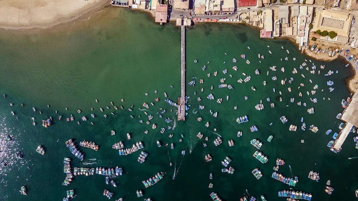
First, we need to improve tracking of the small-scale fleet, including artisanal, recreational and subsistence vessels. While this fleet accounts for a substantial amount of catch and is an important source of food security worldwide, information about its activities is limited. The fleet rarely uses AIS and high-resolution satellite imagery capable of revealing small vessels is very expensive to obtain. Global Fishing Watch is already leading the way on expanding coverage of this fleet through its five-year, $60 million Open Ocean Project, which seeks to map all human activities at sea. It will also be important to work with relevant stakeholders to ensure this information helps rather than hurts the sector.
Second, we need information on vessel identities. Satellite imagery is powerful because vessels cannot easily avoid detection; however, unlike AIS messages, vessel detections are just anonymous dots on a map. To track behavior over time and to hold vessels accountable, we need to know who is who. It is now possible to “fingerprint” vessels in high-resolution satellite images by tracking their shape, color or other unique characteristics. It is still computationally challenging to implement at scale, but I expect we’ll see significant progress on this in the next few years.
Third, we need better satellite coverage of the high seas. The scientific satellites currently used to detect vessels mainly cover coastal areas, where most fishing activity occurs. However, I expect vessel tracking to become increasingly important for monitoring new protected areas in the high seas, which will likely be too large and remote to enforce with traditional patrols. I hope that agencies will adjust their satellite programs accordingly.
What role should shared standards and policy play in validating machine learning and open-source methodologies for enforcement and scientific analysis?
Vessel tracking data are now being used in many high-stakes settings. They are the foundation for a large body of scientific research about human uses of the ocean. They inform management decisions and rulemaking. They may even be used as evidence of crimes. So, the data must be unimpeachable.
Our best defense against errors is transparency. AI models are complicated, and the process that turns raw satellite data into useful information can easily become a black box. That’s why it’s so important for data providers to make their code and model performance metrics openly available, and to participate in rigorous peer review. These steps can help outsiders to understand the data, identify limitations and ultimately make it better. This process is known as “open science,” and it is the gold standard for quality control.
Global Fishing Watch has been a leader in open science since its founding. They are also committed to making their data and other research outputs freely accessible to the public, with some datasets now tracking more than a decade of fishing activity. Their commitment to transparency has built tremendous credibility and trust in their data products.
The field is maturing, and we now have more researchers and organizations entering the vessel tracking space. This expansion means it is now more important than ever to develop standard protocols for disclosing model assumptions, underlying data and code, and known limitations. That is a high bar to meet, but we now have a model to do this well.