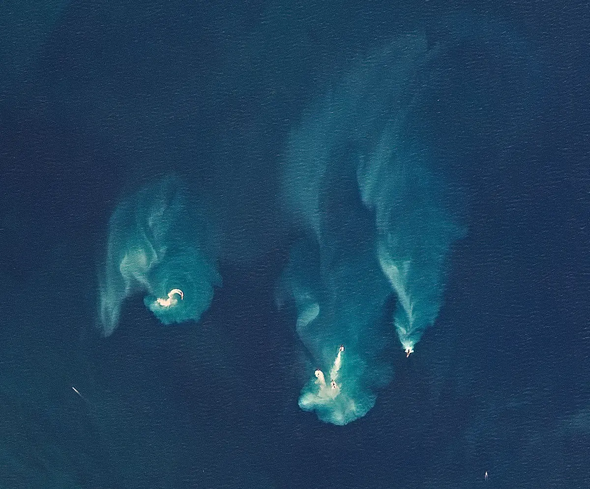
High-resolution optical imagery from Planet is expanding views and leading to significant advances in vessel detections around the globe.
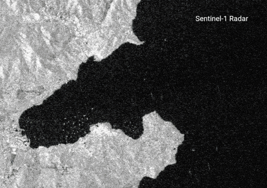
A new dataset release features detections based on optical images from the European Space Agency’s Sentinel-2 satellites, which triple vessel detections and extend visibility to all coastal waters.
Our delegation shares our work throughout the conference, hosting and participating in side events focused on transparency, data-driven solutions and sustainable management of marine resources.
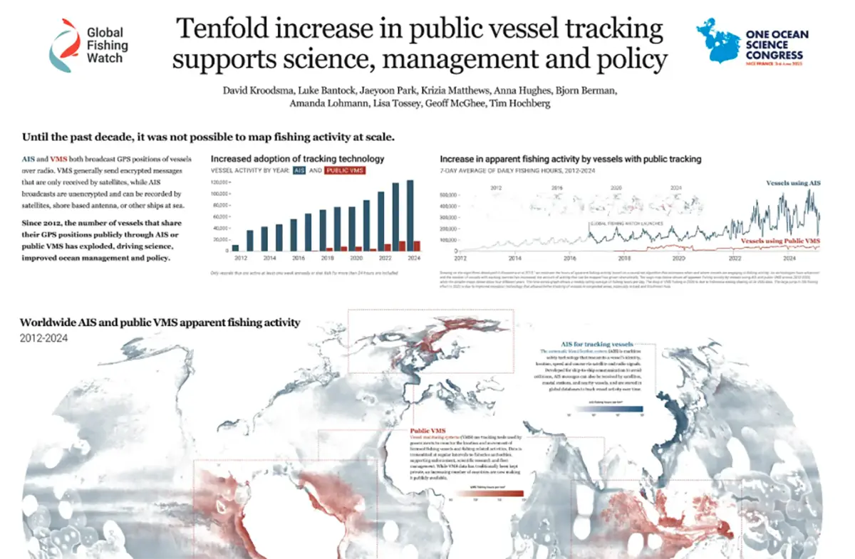
Chief scientist David Kroodsma presents a research poster highlighting how advances in vessel tracking technologies can support marine protection, enhance enforcement and inform evidence-based policy.
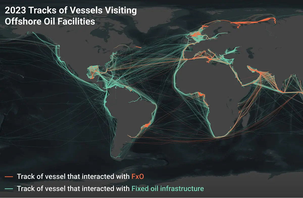
New satellite analysis reveals widespread pollution from offshore oil operations, threatening both the world’s ocean and climate.
The Organization for Economic Cooperation and Development formally adopts the recommendation on eliminating government support to illegal, unreported and unregulated fishing and recognizes the role of ultimate beneficial ownership transparency in achieving this objective.
This pilot study is the first to estimate the greenhouse gas emissions of all large industrial vessels operating in the ocean.
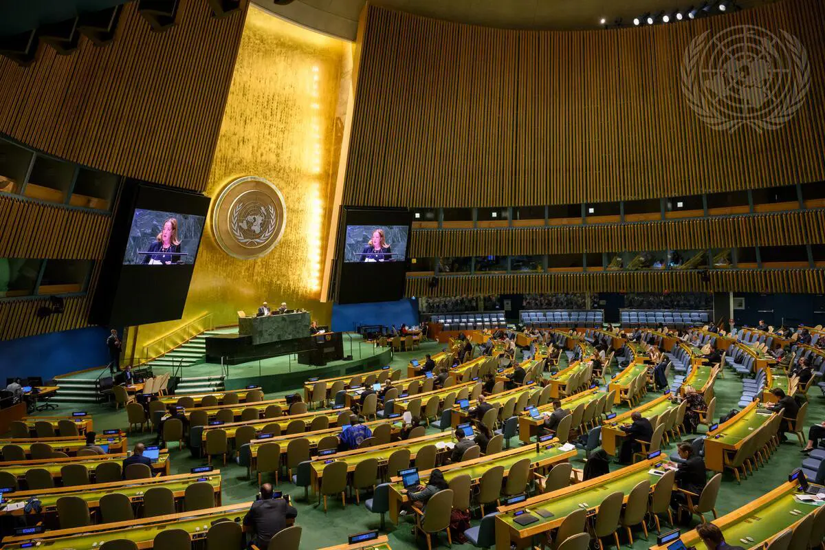
The United Nations General Assembly adopts a resolution on sustainable fisheries, hailed as a critical step in making transparency a “standard practice rather than an exception.”
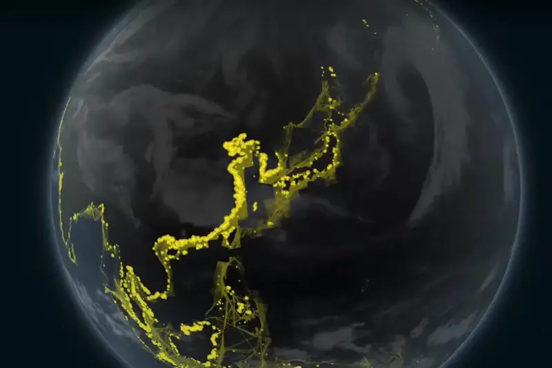
Satellite imagery, vessel GPS data and machine learning have been used to analyze millions of gigabytes of data to provide a first-of-its-kind snapshot of industrial activity at sea, published in the journal Nature.
A five-year USD $60 million funding commitment has been made to catalyze a new initiative to apply AI and satellite data to help end illegal fishing and safeguard the ocean.

Paul Woods is co-founder and chief innovation officer of Global Fishing Watch, serving as the principal architect of the technology platform.

David Kroodsma leads the research team, which includes data scientists and machine learning engineers and research partners around the globe.