
© Fred S. Pinheiro.
Once under international scrutiny for shortcomings in fleet oversight, the Central American country is emerging as a model for transparency, coordinated monitoring and stronger fisheries management.
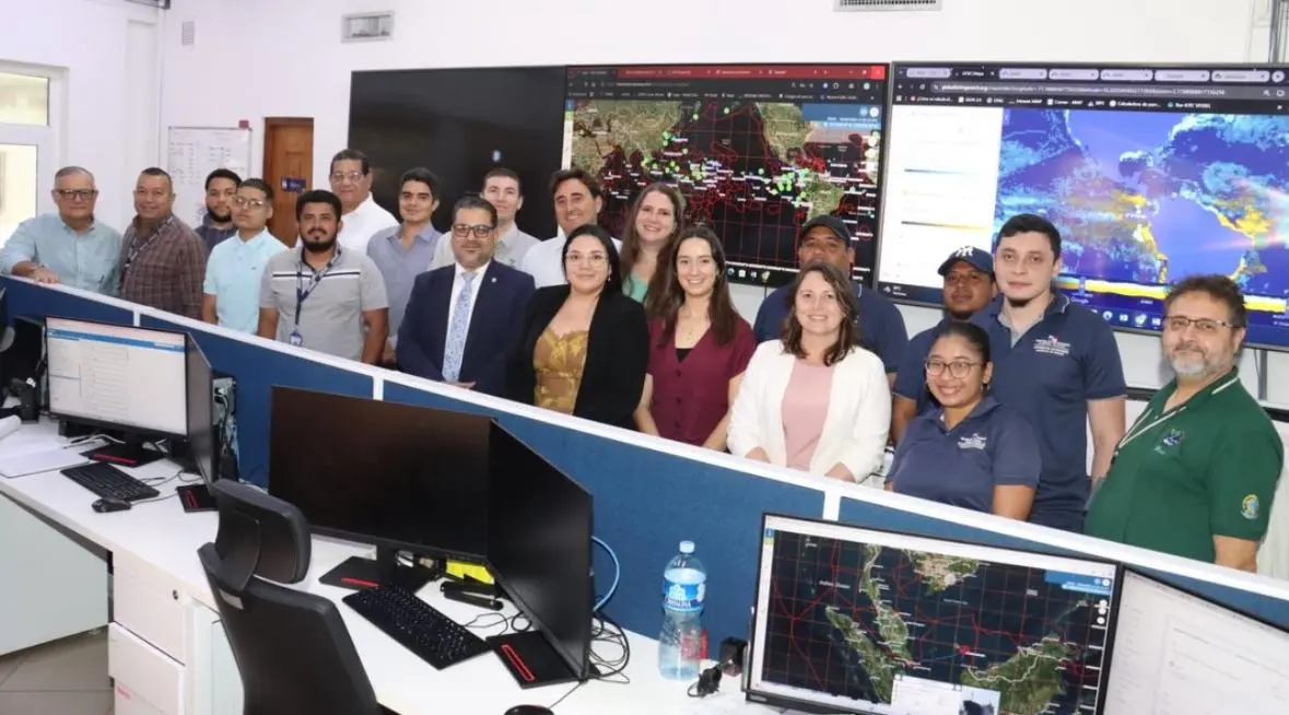
Osvaldo Ureña knows that patrolling thousands of square miles of ocean with a handful of patrol vessels will always be a losing battle. Every day, he and his team scan a wall of screens where bright lines trace vessel movements against heat maps showing sea temperature and salinity. Working across seven satellite monitoring platforms, including Global Fishing Watch, they look for patterns that could reveal suspicious behavior and help authorities anticipate where fishing activity may concentrate.
As coordinator of Panama’s Center on Monitoring, Preservation and Protection of Marine and Coastal Ecosystems, Ureña understands that effective enforcement begins long before a patrol vessel leaves port. It starts with knowing where to look, when to act and how to make the most of limited resources.

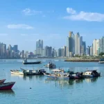
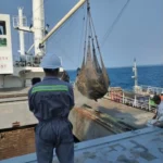
Since opening in 2025, the center has become a hub for ocean monitoring and fisheries analysis in the Central American country. Its multidisciplinary team — comprising operators, analysts and a marine biologist — turns data from multiple sources into operational intelligence. It’s these findings which go on to inform fisheries authorities as to where and when to deploy patrols.
Just a few years ago, this level of coordination would have been difficult to imagine. Four government institutions that traditionally operated independently — the Panama Maritime Authority, the Aquatic Resources Authority of Panama (ARAP), the Ministry of Environment (MiAmbiente) and the National Aeronaval Service — now work from a shared space, bringing together information and expertise to strengthen oversight of the country’s waters.
Back in the monitoring room, the paths of ships continue to creep across the screens, cutting through the Pacific and the Caribbean. The thousands of square miles of ocean haven’t shrunk, and the fleet of patrol vessels hasn’t multiplied overnight. But for Ureña, the battle is no longer blind. When Panama’s patrol vessels leave port, they aren’t searching across an open sea — they already know where to look.
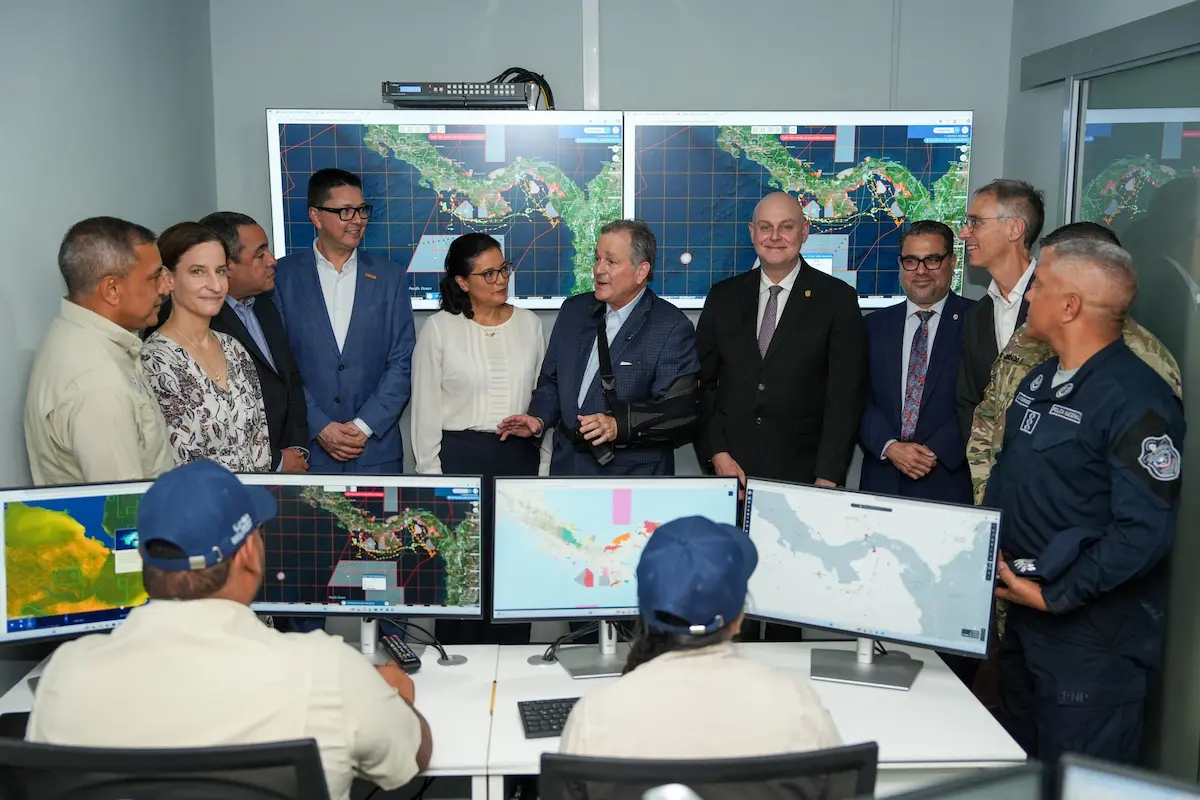
© 2025 ARAP
From warnings to action
But the path up to this point has been anything but straightforward. Indeed, in 2012, Panama received a yellow card from the European Union over shortcomings in its efforts to combat illegal, unreported and unregulated fishing. The country introduced reforms, and the warning was lifted in 2014. Five years later, however, Panama received a second yellow card, which remains in place.
In 2019, Panama made a decision that would help set it on a new course. It began publishing vessel monitoring system, or VMS, data from the country’s international fleet on the Global Fishing Watch map, making the activity of around 350 Panamanian-flagged fishing and fishing support vessels publicly visible.
Opening its data up was an important step toward transparency, but it was not the only one Panama would make. Two years later, the country’s authorities enacted its new Fisheries and Aquaculture law that, among other measures, introduced a requirement to publish information on proceedings related to potential fisheries violations, from the opening of a legal case through to its final resolution.
Panama also significantly expanded its marine protected areas. Between 2015 and 2023, MiAmbiente created and expanded the Banco Volcán and Coiba Ridge protected areas, which now cover more than half of Panama’s waters, surpassing the international 30×30 target.
Over time, transparency has become more than just a response to external criticism. It became a vital tool for improving marine and fisheries management across the country.
An increasingly transparent fleet
Throughout Panama’s efforts to reform its fisheries and maritime sectors, Global Fishing Watch has been a steadfast partner.
According to Eduardo Carrasquilla, administrator general of ARAP, the collaboration between Panama and Global Fishing Watch helped the country strengthen its “no objection” process in 2026. The process is the first assessment Panamanian authorities carry out before a vessel is approved to join the country’s registry. “The procedure incorporates mechanisms to verify who actually controls a vessel, what other vessels that person operates and whether there is a history of violations,” said Carrasquilla.
In January 2025, ARAP announced a new transshipment authorization guide, developed with Global Fishing Watch and the IMCS Network. For the first time, the guide established a standardized procedure for assessing and authorizing transshipments, using both national VMS data and public automatic identification system, or AIS, data available through the Global Fishing Watch platform.
Three months later, Panama announced an even more ambitious commitment: increasing transparency around the beneficial owners — the individuals who ultimately own or control vessels — of its international fleet. In June 2026, the country published that information and also shared VMS data from nearly 200 vessels in its domestic fleet on the Global Fishing Watch map.
The logic behind these reforms is clear. The more authorities know about who operates a vessel, where it moves and what activity it carries out, the better equipped they are to identify risks and take action.
Beyond regulatory reforms, the partnership has also helped Panama strengthen its enforcement efforts.
In January 2025, ARAP analysts detected 14 longline vessels operating inside Coiba Ridge, a protected area where fishing is prohibited.
To build the case, ARAP called in analytical backing from Global Fishing Watch to document each vessel’s activity and strengthen the evidence used in enforcement proceedings.
This marked the first time Panamanian authorities incorporated Global Fishing Watch’s vessel tracking analysis into their marine protected area enforcement process, laying the groundwork for sanctions, improved monitoring practices and, ultimately, measurable changes in fleet behavior.
Following the investigation, ARAP imposed fines of up to $50,000, sanctioned several captains and suspended licenses.
Under the country’s updated legislation, authorities can now suspend licenses while potential violations in national waters are under investigation, stripping potential illegal operators of their ability to fish while under review.
The deterrent appears to be working. Between October 2025 and January 2026, satellite tracking picked up zero vessels fishing inside the reserve.
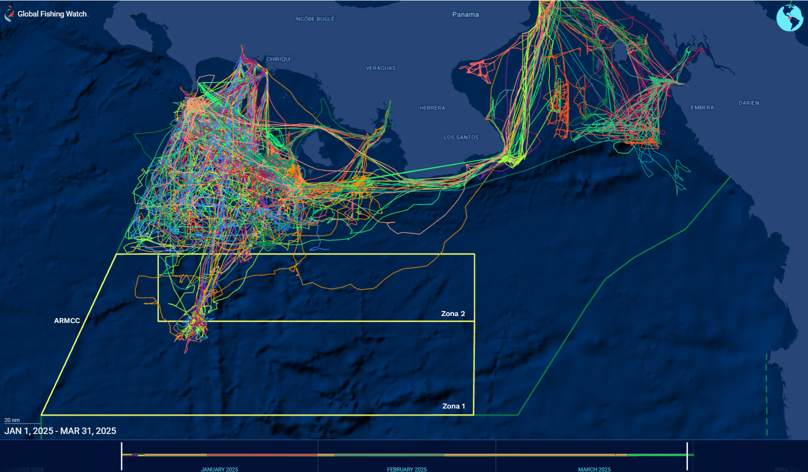
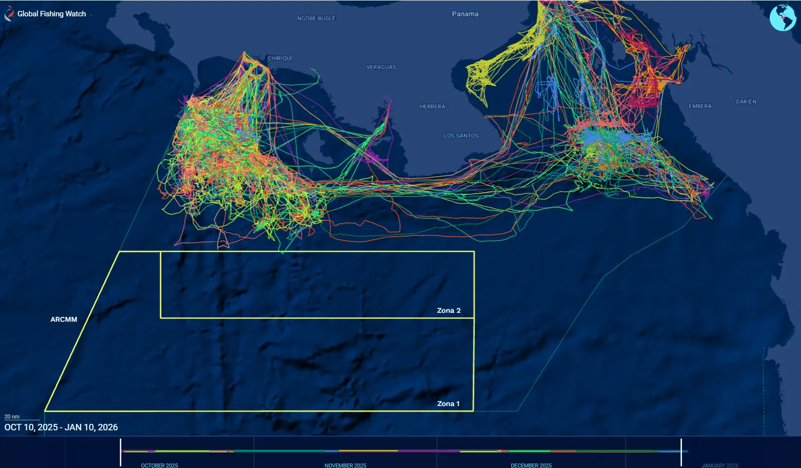

The vessels’ tracks, using VMS data from Panama’s longline fleet, demonstrate a clear change in the navigation patterns to avoid the MPA waters between October 2025 and January 2026.
© 2026 Global Fishing Watch
“Suspending a license is perhaps the strongest sanction that exists for a vessel owner,” Carrasquilla continued. “Today, we have a Coiba Ridge free of illegal fishing.”
For Ureña, the shift in behavior can be attributed to a combination of factors, ranging from sanctions and increased patrols by the National Aeronaval Service to monitoring efforts carried out by MiAmbiente technicians.
A new way of working
Panama’s transformation is also changing how institutions work together to protect its oceanic resources. In marine protected areas, for example, MiAmbiente and fisheries authorities now share monitoring and enforcement responsibilities. For the ministry, incorporating monitoring technology has represented a fundamental, yet positive, shift.
“The ministry did not have this type of technology-based monitoring and enforcement capacity,” explained Osvaldo Rosas, a legal expert with MiAmbiente. “Using alerts generated by satellite platforms, technical staff can prepare inspection reports and refer them to the appropriate institution to initiate enforcement proceedings.”
“The reports can also be referred to the Public Prosecutor’s Office, which determines whether an investigation into a potential crime should be opened. MiAmbiente has also begun working with the Environmental Prosecutor’s Office to strengthen the use of electronic data as evidence, he added.
For Gabriel Caballero, Global Fishing Watch’s officer in Panama, this evolution reflects a fundamental change: data is no longer used solely to understand what is happening at sea, but to support decision-making and enforcement actions.
What comes next
Despite the progress made, Panama still faces challenges. According to the government, the next step is to achieve full traceability of catches from the sea through export. The country is developing a comprehensive traceability system and expects to conduct its first pilot tests in 2026.
The yellow card issued in 2019 remains in place, but the circumstances have drastically changed, and authorities are confident it will be lifted in the near future.
Today, Panama has tools, data and coordination mechanisms that did not exist when it received its yellow card. The country’s authorities publish information on vessel tracking, licenses, enforcement proceedings and beneficial ownership. Its institutions use satellite data to guide patrols and generate evidence. And delegates from other countries now visit Panama to learn from its experience.
For Caballero, that shift captures Panama’s transformation better than any statistic.
“A few years ago, the country was responding internationally to shortcomings in its control systems,” he recalled. Now, he said, Panama had moved “from having to explain its weaknesses to being able to share its experience.”
That may be the most important change of all: Panama is no longer simply reacting to weaknesses in its system. It is building on what it has learned, sharing more data and strengthening its institutions to demonstrate what is possible when transparency becomes a central tool for management and a commitment to continuous improvement is sustained over time.
A continuum of milestones
- November 2012
- October 2014
- September 2015
- March 2019
- July 2019
- December 2019
- March 2021
- June 2021
- November 2023
- January 2025
- June 2025
- September 2025
- October 2025
- May 2026
- June 2026
- September 2026
Scroll to see more →