New Longline Night-Setting Insights Release
- Release:
- Tags: API, Improvement, Map, Marine Manager, Vessel Viewer
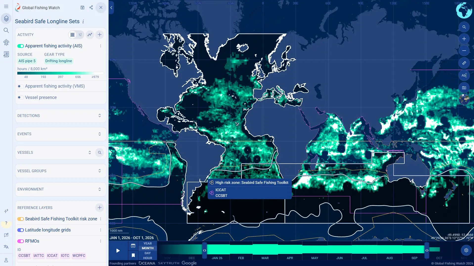
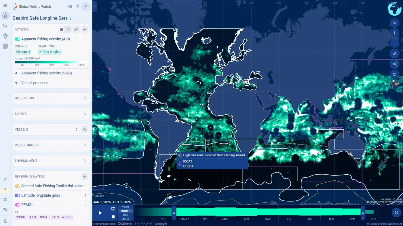
Global Fishing Watch has expanded its longline tracking capabilities with new day and night-setting data. Developed in collaboration with Sustainable Fisheries Partnership, these insights build directly on an advanced model created with Birdlife International to distinguish between daytime and nighttime setting events. The update provides unprecedented visibility into global longline operations, empowering managers and researchers to better track fleet compliance with seabird bycatch mitigation measures.
Longline fishing vessels frequently operate in high seas areas that overlap with the foraging ranges of vulnerable seabird species like albatrosses. To prevent seabirds from getting caught on hooks or drowned by fishing bait, the five tuna regional fisheries management organizations (RFMOs) set rules on how longline vessels deploy their lines. One recommendation includes adopting night setting — putting lines out for fishing only between dusk and dawn — when seabirds are less active. Although the first tuna RFMO conservation management measures were introduced in 2007, monitoring vessel compliance remains a challenge.
The workspace maps and tracks the global drifting longline fleet using automatic identification system (AIS) positioning data. By analyzing vessel movements, the tool predicts when line setting — or “set” events — occur relative to nautical dawn and dusk.
The workspace empowers users to:
- Monitor global drifting longline fleet operations and fishing footprints. With access to AIS data spanning from 2012 up to 72 hours prior, users can analyze longline vessel movements and explore vessel identities, operational histories and day versus night-setting from 2020 onward.
- Review longline operations in key areas that matter. The workspace is preloaded with the five tuna RFMO convention areas and bycatch risk zones based on the Seabird Safe Fishing Toolkit. This toolkit provides pelagic longline fisheries and vessels over 24 meters with resources and monitoring guidance to adopt seabird-safe fishing practices. Users can map individual or grouped longline vessels against risk zones to spot fishing activity in vulnerable seabird areas.
- Generate area insight reports. Users can easily generate fishing activity reports summarizing longline operations in areas of interest — for example, activity specific to the Western and Central Pacific Fisheries Commission (WCPFC) RFMO area. Insights include global snapshots, operations in key ocean regions and detailed views of a single tuna RFMO.
- Generate longline fleet insight reports. To monitor a specific group of longline vessels or track longline fleets of a particular flag, users can easily create vessel groups of up to 1,000 vessels and map their operational footprint. From there, vessel group insight reports can be generated to review set events, locations and daytime versus nighttime set types. A sample vessel group report summarizes drifting longline vessels and their set times in the Western and Central Pacific Fisheries Commission (WCPFC) RFMO area.
- Build and collaborate with peers. Users can save searches, track longline vessels of interest and create longline fleet set event insight reports. Workspaces can also be shared for collaborative analysis and setups can be saved within workspace for regular monitoring.
The drifting longline set events and insights data are also available in our Insights API.
While every attempt is made to ensure these longline setting insights are accurate, the data is currently released as a prototype. Global Fishing Watch recommends using these insights alongside official vessel registries, local intelligence and original tracking data when reaching definitive legal or regulatory conclusions.
Submit or vote on suggestions via our platform requests board.
Write to [email protected] for general queries, and [email protected] for API queries.