© Global Fishing Watch
Discover how these complementary systems work, where each excels and why using them together strengthens fisheries monitoring, control and surveillance.
Overview
Governments increasingly rely on vessel tracking for managing fisheries, enforcing regulations and strengthening maritime security. Effective vessel tracking must be integrated, transparent and interoperable. At Global Fishing Watch, we define this transparency as the act of making specific ocean and vessel data — along with the policies and decisions that surround them — available and accessible to those that need them. Because we are committed to promoting international cooperation and transparency around ocean data to advance a new era of ocean governance, we recognize that true integration requires understanding the strengths and limitations of the two primary technologies used today: automatic identification systems (AIS) and satellite-based vessel monitoring systems (VMS).
Although both systems provide vessel location data, they were designed to serve different purposes. AIS is an open broadcasting system that increases transparency by making vessel movements publicly visible. VMS is a secure and regulated system developed to support fisheries monitoring, control and surveillance (MCS) efforts. Over time, its application has expanded to support a broader range of fisheries management functions
Used together — and alongside other remote sensing technologies such as satellite imagery and radar — AIS and VMS provide governments with a more complete picture of vessel activity at sea. The following questions explore how these complementary systems operate, where their capabilities differ and why integrated tracking is essential for modern fisheries management.
1. What is AIS?
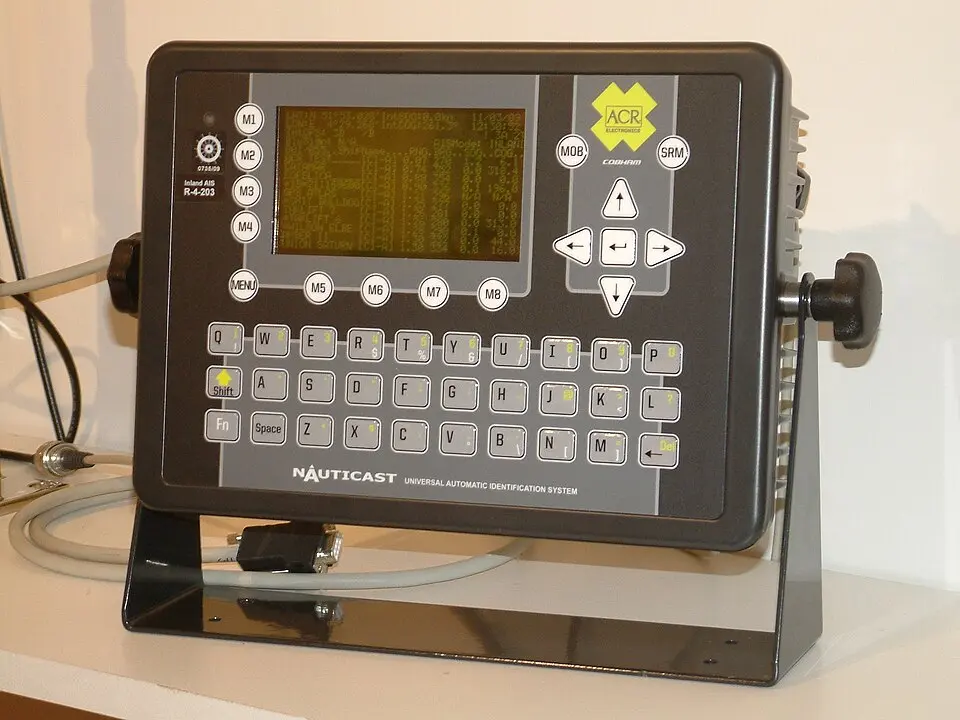
AIS is a global vessel tracking system originally designed for maritime safety and collision avoidance. It automatically broadcasts a vessel’s identity, position, course and speed through an onboard transponder. The International Maritime Organization’s (IMO) International Convention for the Safety of Life at Sea requires certain classes of vessels to carry AIS.
How does AIS work?
From an onboard transponder, AIS continuously broadcasts vessel information that can be received by nearby vessels, shore-based receivers and low-Earth-orbit satellites, allowing vessel movements to be monitored over vast distances, including remote ocean regions. More than 120,000 fishing vessels from dozens of flag States can be tracked through AIS transmissions at any given time. Although these vessels represent only a portion of the world’s fishing fleet, they account for up to 80 percent of fishing activity on the high seas. (1)
© Wikimedia commons
What information does AIS transmit?
AIS messages contain two main categories of information: dynamic information, which changes continuously as a vessel navigates, and static or vessel-related information, which identifies the vessel and changes infrequently.
Dynamic: Real-time data that changes continuously as the vessel navigates
- GPS position
- Course
- Heading
- Speed
Static: Permanent or semi-permanent information that identifies the vessel and rarely changes
- Official maritime mobile service identity (MMSI) number from the relevant flag State authority
- Vessel name
- International radio call sign
- IMO number, when applicable
- Vessel type
- Vessel dimensions
- Destination
AIS messages contain two main categories of information: dynamic information, which changes continuously as a vessel navigates, and static or vessel-related information, which identifies the vessel and changes infrequently.
How is AIS used?
AIS messages contain two main categories of information: dynamic information, which changes continuously as a vessel navigates, and static or vessel-related information, which identifies the vessel and changes infrequently.
- Track fishing effort by mapping apparent activity and analyzing vessel movement patterns to support evidence-based management.
- Assess regulatory compliance across vast jurisdictions.
- Support scientific research and marine spatial planning.
- Improve seafood traceability, which is increasingly vital for market access and consumer confidence.
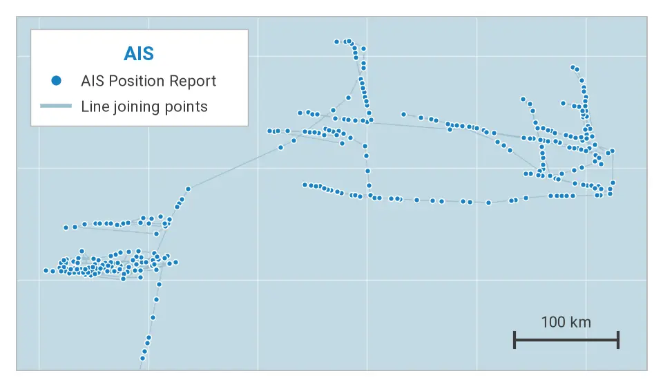
AIS is a valuable source of vessel activity information. Its analytical value is further enhanced when combined with complementary data sources, including VMS, satellite synthetic aperture radar (SAR), optical imagery and nighttime light detection, which improve coverage, strengthen verification and help identify vessels or activities that may not be visible in a single dataset.
Figure 1. High Seas Longline AIS Vessel Track
© 2026 Global Fishing Watch
2. What is VMS?
For more than 25 years, the Food and Agriculture Organization of the United Nations (FAO) has recognized VMS as a core component of fisheries MCS systems. VMS is a secure, automated satellite-based system used by fisheries authorities to monitor the location and movement of fishing vessels.
How does VMS work?
Unlike AIS, which broadcasts information openly to anyone with a receiver, VMS transmits position reports through secure satellite communications. The data can be encrypted and is sent via authorized service providers to fisheries authorities and other relevant stakeholders.
A VMS transponder installed on the vessel automatically sends information in data packages — electronic messages containing vessel position and other operational information.
These messages typically include:
- Unique vessel identification
- Geographical position
- Date and time
- Course and speed
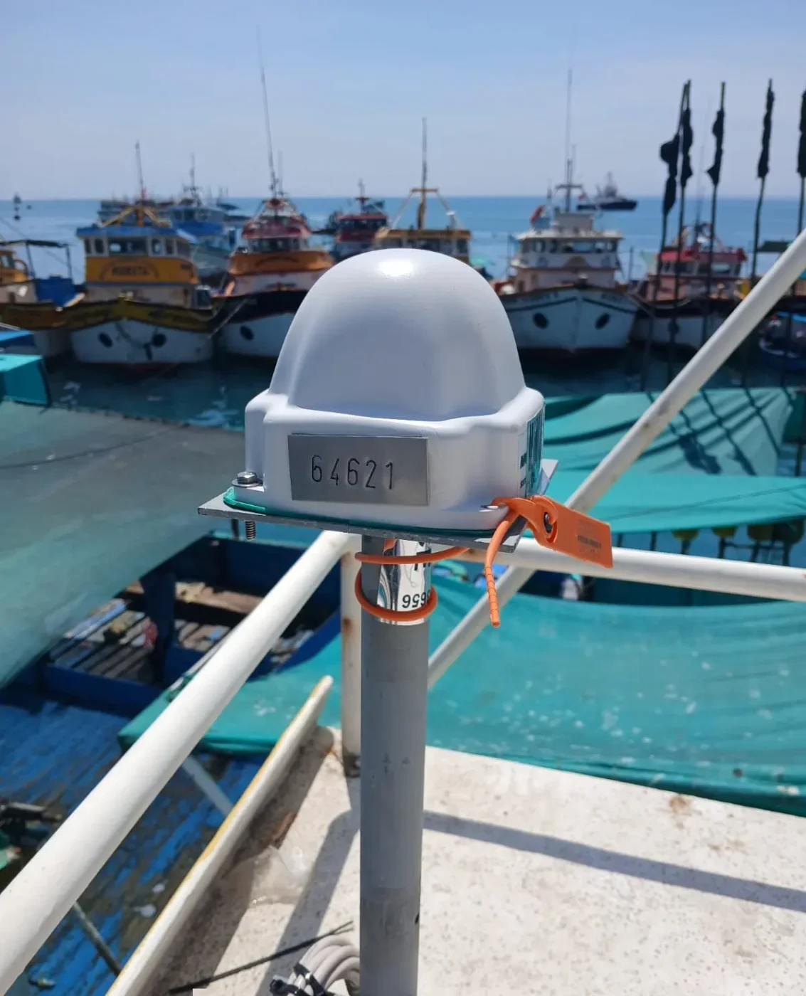
© SISESAT-PRODUCE-PERU
How is VMS used?
VMS data is used by fisheries authorities to support a wide range of fisheries management initiatives, other non-fisheries work and general oversight activities.
Key applications of VMS data include:
- Monitoring compliance with fisheries regulations
- Tracking fishing effort
- Supporting fish stock assessments
- Informing marine spatial planning and research
- Supporting the designation of marine protected areas and assisting with their management
- Coordinating emergency response at sea
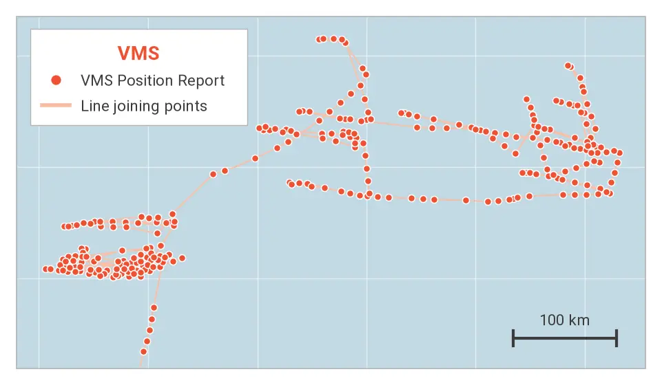
Over time, these individual position reports combine to form vessel tracks. Platforms like the Global Fishing Watch map display this near-real-time data — including speed, heading and course — to reveal a vessel’s activity. Instead of analyzing isolated data points, users can visualize comprehensive movement patterns. As shown in Figure 2, these visual tracks form the foundation of VMS monitoring and enforcement applications.
Figure 2. High Seas Longline VMS Vessel Track
© 2026 Global Fishing Watch
3. How do regulations govern the use of AIS on fishing vessels?
There is no universal requirement for fishing vessels to carry AIS. Instead, the use of AIS on fishing vessels may be regulated through conservation and management measures issued by regional fisheries management organizations (RFMOs) and/or national legislation. Regional bodies, such as the Commission for the Conservation of Antarctic Marine Living Resources and the Indian Ocean Tuna Commission, have adopted measures requiring or incorporating, respectively, the use of AIS for certain authorized vessels operating within their convention areas. National requirements also vary, with some countries requiring AIS for specific vessels or areas of operation.
These differences mean that AIS requirements can vary significantly between fisheries and jurisdictions. Effective regulation therefore depends not only on requiring vessels to carry AIS, but also on establishing clear operational rules, including active-transmission mandates, applicable exemptions, protocols for reporting equipment failures and consequences for noncompliance.
4. How is VMS regulated in support of fisheries monitoring?
Unlike AIS, VMS requirements are established primarily through national legislation, RFMO conservation and management measures and bilateral or regional fisheries access agreements rather than a global mandate. This can result in a mixture of disparate requirements and coverage.
Many countries require certain categories of fishing vessels to carry VMS as a condition of their fishing license, although the thresholds vary by jurisdiction and may be based on vessel size, fishery or area of operation. RFMOs, including the International Commission for the Conservation of Atlantic Tunas , the South Pacific Regional Fisheries Management Organization and the Western and Central Pacific Fisheries Commission, among others, also require authorized vessels operating within their convention areas to use VMS.
VMS has become one of the primary tools fisheries authorities use to monitor fleet activity and support fisheries control. The regular transmission of vessel position and movement information allows authorities to maintain situational awareness of fishing activity, monitor vessel compliance with local regulations and identify potential risks or anomalies for further investigation. This information can support risk-based monitoring, inspections and enforcement, as well as help verify compliance with fisheries regulations.
Authorities leverage VMS data in three primary ways:
- Day-to-day monitoring: VMS data allows fisheries analysts to track fleet behavior, identify vessels operating outside their authorized areas and detect potential violations in real time.
- Strategic planning and investigations: Beyond daily monitoring, VMS data is critical for planning targeted at-sea patrols and conducting historical investigations. Analysts routinely cross reference a vessel's documented track with logbooks and catch reports to identify discrepancies.
- Legal proceedings: VMS data is generally admissible as evidence in administrative or judicial proceedings, although legal cases involving vessel tracking data have yet to be brought forward in a few jurisdictions. The evidentiary value depends on demonstrating that data is accurate, reliable and in compliance with the applicable rules of evidence — the set of legal standards a court uses to determine admissibility. In a number of jurisdictions and RFMOs, vessel tracking data has supported investigations and enforcement actions involving unauthorized fishing and other types of violations.
5. What determines the visibility and coverage of fishing vessels in AIS data?
The visibility of fishing vessels in AIS data depends on several factors, including AIS carriage requirements, vessel size and type, where vessels operate, the availability of satellite and terrestrial receivers and whether AIS equipment is transmitting continuously. Improvements in satellite AIS coverage over the past decade have significantly expanded the ability to monitor fishing activity across the global ocean.
Vessel size
AIS adoption is highest among large industrial fishing vessels and declines sharply among smaller fleets.
- Large vessels (more than 24 meters): Approximately 66 percent carry AIS.
- Medium vessels (12–24 meters): About 15 percent carry AIS.
- Small vessels (fewer than 12 meters): Less than 1 percent carry AIS.
As a result, many small-scale and artisanal fishing vessels remain largely invisible to global AIS monitoring.
Geographical coverage
AIS reception also varies across the world’s ocean based on several key factors:
- High vessel density -where overlapping transmissions may overwhelm satellite receivers.
- Remote ocean areas and high latitudes - where satellites pass overhead less frequently, creating temporary gaps in coverage.
These coverage limitations should be considered when interpreting AIS data, particularly in areas with high traffic or limited reception. Where greater certainty is required, AIS data may be interpreted alongside other available sources of information such as VMS.
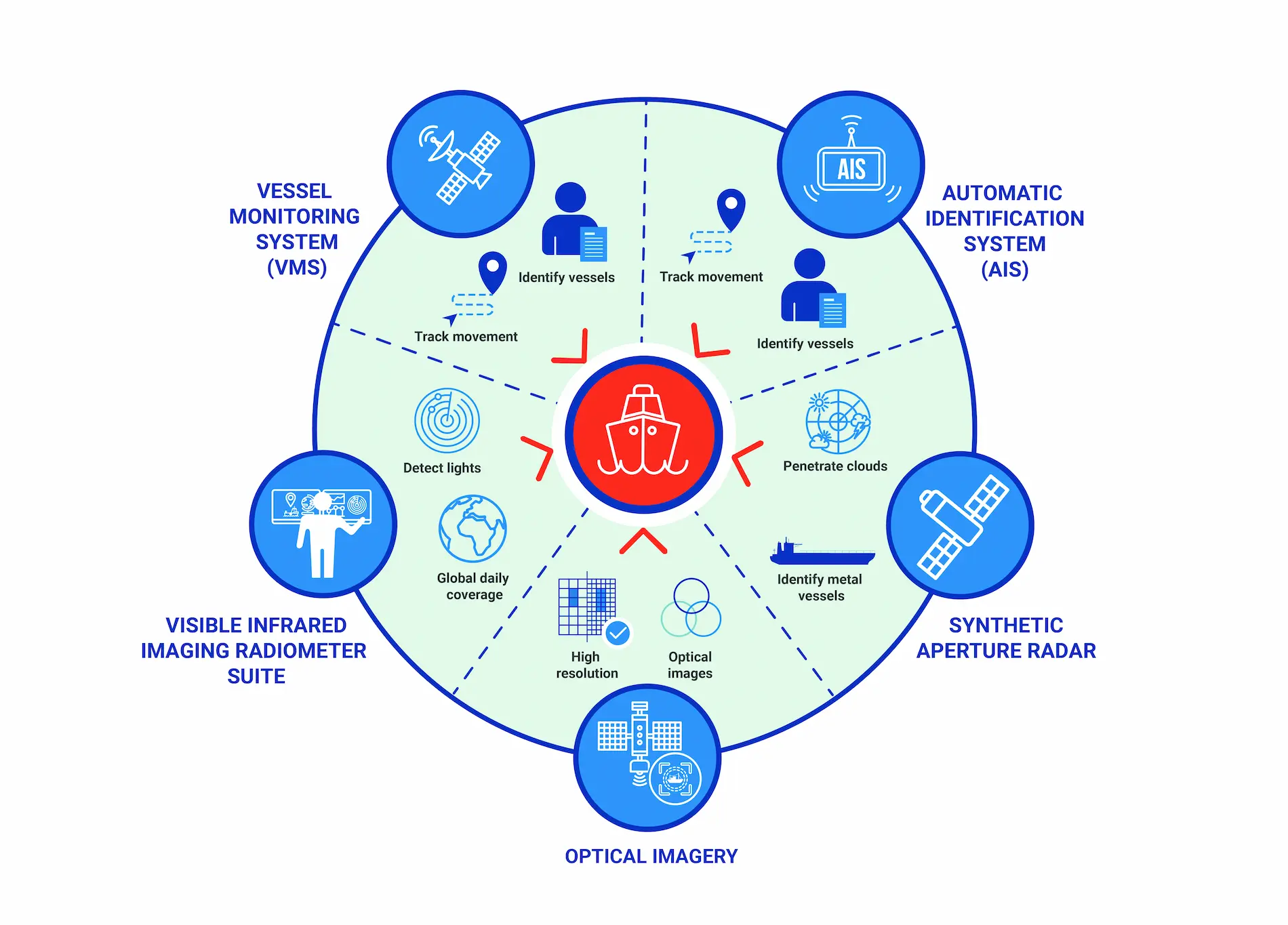
What technologies work alongside AIS to track vessels?
Authorities can strengthen oversight by combining AIS with other monitoring technologies:
- VMS provides secure, authority-controlled position data.
- Satellite radar imagery detects vessels regardless of weather or daylight conditions.
- Optical satellite imagery helps verify vessel identity and activity.
- Night-light detection identifies vessels using powerful lights, such as the squid fishing fleet.
Figure 3. Vessel Tracking and Monitoring Technologies
© 2026 Global Fishing Watch
Rather than providing the same information, these technologies offer complementary observations that can help fill gaps and strengthen analysis. Used together, they can help authorities detect vessels that may not be visible in AIS, corroborate reported positions, cross-check vessel identities and identify inconsistencies that may warrant further investigation.
A common vessel identifier, such as an IMO number, further strengthens this approach by allowing information from different monitoring systems and databases to be linked to the same vessel.
6. How do AIS and VMS support the detection of illegal, unreported and unregulated fishing?
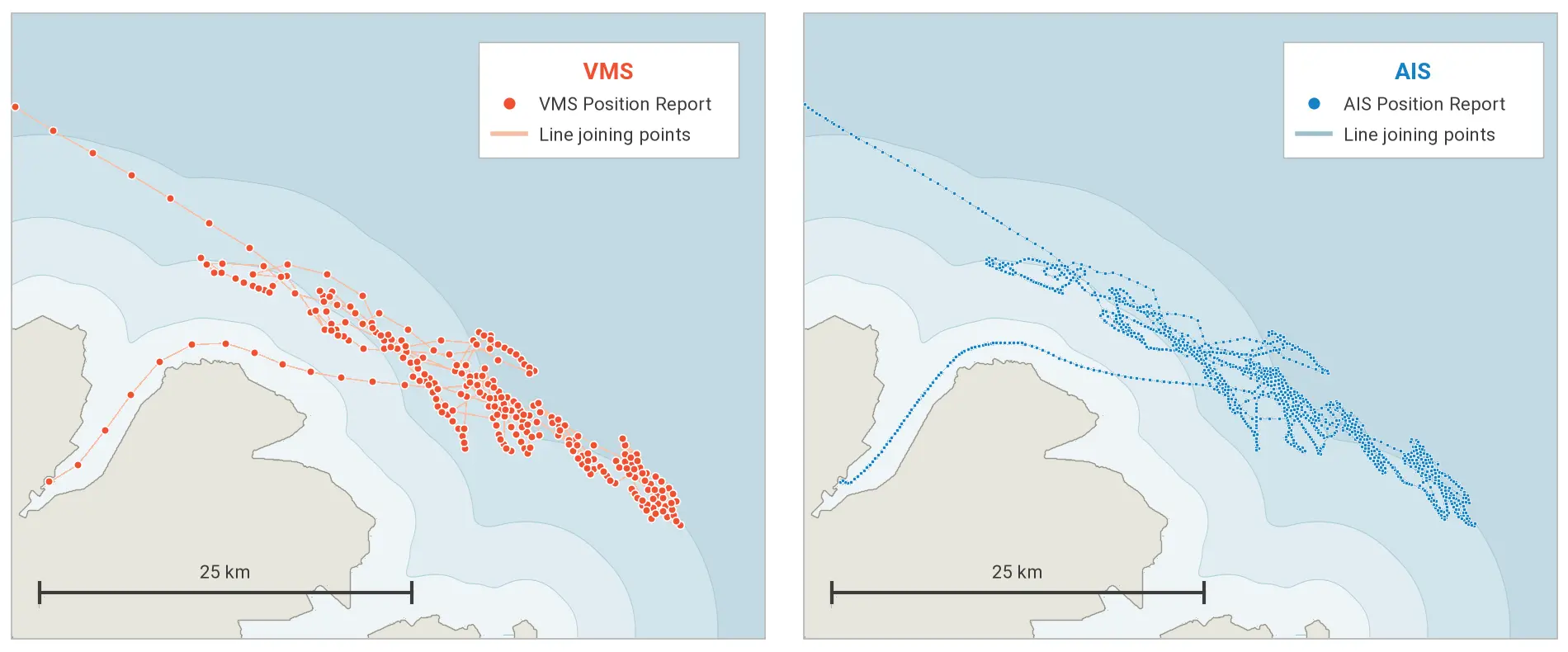
Although AIS and VMS were designed to serve different functions, their complementary strengths improve the reliability of vessel activity analysis enabling authorities to compare, verify and interpret vessel activity more effectively.
Figure 4. A Coastal Fishing Vessel Track Comparison: AIS and VMS
© 2026 Global Fishing Watch
AIS promotes transparency and risk detection
As detailed in “Illegal, Unreported and Unregulated Fishing Risk Insights: A New Framework for Analyzing Vessel Behavior,” analyzing AIS data highlights behavioral risk indicators, such as suspicious transmission gaps, identity anomalies, prolonged periods at sea and interactions with vessels associated with high risk activities. These indicators can help authorities identify vessels that may warrant further scrutiny, prioritize investigations and enforcement efforts which allow governments to target and optimize inspection resources, including through port State controls.
Because AIS broadcasts vessel positions openly, it enables authorities, researchers and civil society to monitor activity across large areas of the ocean. Analyzing this data allows stakeholders to detect anomalies,potential fisheries risks and regulatory concerns that require further assessment, such as:
- Potential spatial violations: Cross referencing vessel tracks against marine protected areas, seasonal closures or other restricted zones.
- Transshipment risks: Detecting vessels in close proximity at sea for extended periods.
- Identity anomalies: Pinpointing inconsistent data, false broadcasts or potential AIS spoofing.
- Transmission gaps: Tracking vessels that intentionally disable their AIS near restricted waters or suspicious operations.
AIS data can support investigations and enforcement actions on their own in some jurisdictions and circumstances. Where appropriate, authorities may also combine AIS with other sources of information such as VMS, SAR, optical imagery and vessel registry information to strengthen the evidentiary basis of a case or meet applicable national legal requirements.
VMS supports control and enforcement
VMS provides secure, regulated tracking data that fisheries authorities use to monitor licensed fishing vessels and investigate potential violations.
VMS tracking data serves as a critical compliance and enforcement tool, allowing authorities to:
- Verify spatial and temporal compliance : Confirming whether vessels operate within authorized fishing areas and comply with closed areas, seasonal closures and other spatial restrictions.
- Validate catch reports: Cross-checking a vessel's declared fishing locations against its actual VMS tracks to support logbook verification, catch documentation and scientific assessments.
- Identify unauthorized fishing activity: Identifying vessels operating in national waters without the required VMS equipment transmitting or permit.
- Prioritize inspections and enforcement actions: Identifying vessels that may require inspection based on unusual movement patterns, suspected non-compliance, or entry into restricted areas
- Improve fisheries management: Analyzing fishing effort and fleet distribution to support management decisions, compliance strategies and resource allocation for monitoring and control.
- Reconstruct timelines: Using historical vessel position records to support investigations and establish the sequence of vessel activities can help reconstruct vessel movements and support compliance histories, flagging and registration inquiries and evidentiary use in any type of legal proceeding.
VMS relies on satellite positions like GPS to provide fisheries authorities with accurate vessel location data for monitoring, control and enforcement. Transmission through secure communication systems to authorized users helps establish the chain of custody of the evidence.
7. Can AIS and VMS data be used as evidence in legal proceedings?
Vessel tracking data, including both AIS and VMS records, is widely accepted as admissible evidence in administrative and judicial proceedings across many jurisdictions. However, the weight given to this evidence will depend on adherence to the applicable national legal frameworks, the facts and circumstances of the case, and the presentation of all of the evidence, including the technical data.
Supporting legal evidence
In legal proceedings, vessel tracking data is typically presented alongside other relevant evidence to establish case facts. Expert testimony often accompanies this data to explain system operations, demonstrate data reliability and detail how findings were interpreted during the investigation. The admissibility and evidentiary value of vessel tracking data, such as maps or screenshots, is typically treated as technical or scientific evidence and may be sufficient to support administrative or judicial proceedings.
8. What are the technical and operational limitations of AIS and VMS?
© Jeffry Surianto
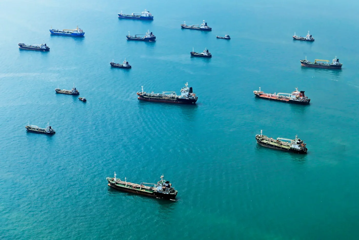
AIS and VMS have technical and operational limitations that can affect how vessel movements are monitored and interpreted.
AIS
Like any vessel tracking technology, AIS has limitations that should be considered when interpreting vessel activity.
- Incomplete adoption: There is no universal requirement for fishing vessels to carry AIS, particularly among smaller ships, leading to fragmented and often entirely voluntary adoption across different jurisdictions.
- Technical and operational signal gaps: Gaps in AIS transmissions can be caused by accidental equipment failure, power loss, configuration issues or limitations caused by satellite coverage, vessel density or geographic location, particularly in remote or high-latitude areas. AIS may also be switched off for legitimate operational or safety reasons, such as upon arrival in port or, where permitted, in high-risk zones to prevent targeting by those engaged in piracy.
- Multiple vessels on the same device: Vessels inappropriately using the same MMSI can lead to confused reports.
- Position tampering or falsification: Systems — both AIS and VMS — can report seemingly legitimate positions, but authorities must learn to spot red flags like inland coordinates or other suspicious position reports.
- Self-reported information: Vessel identity data is entered manually and may contain errors or be intentionally altered by those trying to conceal illicit operations.
- Intentional disabling: Operators may deliberately switch off AIS equipment or manipulate transmitted information to obscure a vessel’s identity, position or activity. Such behavior may warrant further investigation but should be assessed alongside other available information.
- Signal gaps or inaccurate transmissions: Even when AIS equipment is properly installed and certified, operators may switch off or relocate devices, potentially disrupting or altering the information transmitted. Signal gaps or inaccuracies may also result from equipment failure, reception limitations, or legitimate safety and security concerns, such as piracy risks. As a result, AIS anomalies should be assessed alongside other available information.
Authorities can often detect suspicious gaps through monitoring systems that flag anomalies, such as unexpected signal loss, reappearance, unrealistic movements or positions on land. In line with IMO guidance, AIS must remain in operation at all times and may be temporarily switched off only when the master believes that continued operation could compromise the safety or security of the vessel, its crew or its cargo. In those authorized exceptions, the incident — including the specific reasons, duration and location — must be recorded in the ship’s logbook and, where the vessel is operating within a mandatory ship reporting system, reported to the competent authority. While detection of disabling events is possible, follow-up enforcement is not always consistent and a growing number of flag and coastal States require operators to report any AIS disabling to authorities in near-real time so they can act quickly on suspected illegal activity. Unauthorized disabling should be subject to investigation and sanctions by flag, port or coastal States and may lead to sanctions.
VMS
VMS is designed for regulatory oversight but also has operational constraints.
- Restricted access: Data is generally available only to authorized national or regional fisheries authorities, meaning a coastal State cannot access foreign-flagged data within its exclusive economic zone without a formal data-sharing agreement.
- Low frequency polling rates: VMS position reports are generated at predetermined intervals, also referred to as polling rates, which in many systems may be every one to two hours or more. As a result, short duration activities occurring between the successive position reports may be more difficult to detect.
- Limited interoperability: Differences in VMS technologies, transmissions, reporting standards and data formats can make it difficult to share and compare VMS data across jurisdictions.
- Tampering: While detectable, tampering is also possible with VMS and can result in gaps in transmission or false position reports.
Some of these constraints can be addressed through deliberate regulatory and operational decisions. Authorities can require more frequent position reporting, establish data-sharing requirements for foreign-flagged vessels authorized to operate in their waters and adopt common standards and protocols that improve interoperability and information exchange.
Despite these limitations, VMS units are designed to make intentional deactivation difficult and detectable. Deliberate switching off or tampering with VMS is prohibited in many jurisdictions and may constitute a serious compliance violation. Gaps in VMS transmissions can also be flagged by monitoring systems as risk indicators warranting further assessment.
9. Who has the legal authority to access VMS data?
© Global Fishing Watch
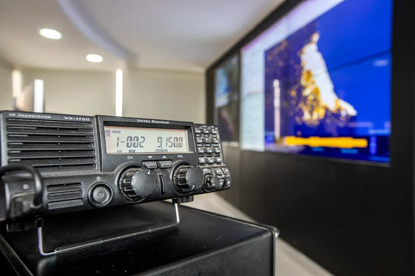
VMS data is restricted with access typically limited to authorized government agencies. While access is governed by national legislation and regional fisheries management measures, authorities may choose to share VMS data with third parties under formal agreements and appropriate safeguards. Depending on the applicable legal and institutional framework, authorized recipients of VMS data may include the following entities:
- Flag State fisheries monitoring centers: National authorities and designated government agencies responsible for monitoring domestic and flagged fleets.
- Maritime enforcement agencies: Domestic entities — such as the coast guard, navy or marine patrol — tasked with on-the-water compliance and law enforcement.
- Regional management bodies and international agreements: RFMOs and neighboring coastal States operating under bilateral or regional agreements to track vessels across jurisdictional boundaries.
While VMS has historically been treated as proprietary, global views on public access are shifting in favor of transparency, encouraging countries to expand public access to VMS data. Several forward-thinking governments now publish their VMS data through the Global Fishing Watch platform — often with a short time delay to balance security and proprietary interests.
10. What role do AIS and VMS play in the future of fisheries monitoring?
AIS and VMS have transformed how governments monitor fishing activity, but technology alone cannot address illegal, unreported and unregulated fishing while regulatory frameworks remain fragmented. As fisheries management becomes increasingly data driven, combining multiple sources of information is essential for improving transparency, compliance and sustainable ocean governance.
The future of fisheries monitoring will depend not only on advances in technology, but also on stronger regulatory frameworks, more robust implementation, greater interoperability between systems, improved data sharing and a more effective use and exchange of vessel tracking information. Together, these efforts can help authorities make better-informed decisions and strengthen the sustainable management of marine resources.
Strengthening global vessel tracking will require governments to:
- Standardize data-sharing protocols among flag, coastal and port States to facilitate timely and consistent exchange of vessel tracking information.
- Maritime enforcement agencies: Domestic entities — such as the coast guard, navy or marine patrol — tasked with on-the-water compliance and law enforcement.
- Regional management bodies and international agreements: RFMOs and neighboring coastal States operating under bilateral or regional agreements to track vessels across jurisdictional boundaries.
As more countries adopt these practices, authorities will be better equipped to monitor fishing activity, detect potential violations and promote greater transparency across the global ocean.
Looking ahead
While the answers to these 10 questions highlight the distinct strengths and limitations of AIS and VMS, they also offer opportunities to strengthen vessel monitoring and fisheries management. Maximizing the value of these systems requires clear regulatory frameworks, appropriate data-sharing arrangements, standardized data practices and reliable vessel identifiers.
Used together and supported by other monitoring technologies, AIS and VMS can help authorities improve transparency, strengthen compliance and enforcement and build a more comprehensive understanding of fishing activity.
Endnotes
- Global Fishing Watch internal AIS data, 2025. Using the latest vessel identity information, there are 155,702 distinct fishing MMSI with at least 24 hours of activity.
Downloads
Related Expert

Director of International Policy, Global Programs