Global Fishing Watch has released updates to the map. Anyone can now:
- Analyze and visualize activity of vessels at sea that may not appear in cooperative tracking systems.
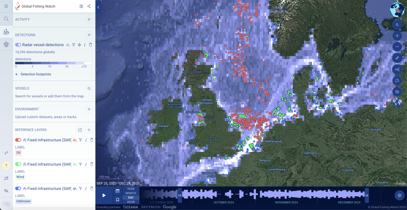
- Global Fishing Watch has added an open global radar detections layer, derived from synthetic aperture radar or SAR, to display at-sea vessels, in any weather conditions.
- SAR can show vessel detections that can not be picked up by other cooperative tracking systems (e.g. AIS, automatic identification systems, or VMS, vessel monitoring systems).
- The addition of an experimental AIS matching filter allows anyone to interrogate the SAR vessel detections layer and determine which detections are likely matched to identifiable vessels and which detections may not be transmitting identification information in cooperative tracking systems.
- For vessels that don’t have an AIS match, Global Fishing Watch has introduced an experimental machine learning filter to determine whether the vessel is likely fishing, likely non-fishing or unknown, based on various factors including inferred vessel length, bathymetry, distance from port and environmental values.
- Understand where fixed infrastructure – like oil platforms or wind farms – are located and how vessels may interact with them.
- A fixed infrastructure reference layer can be added to any workspace, and filtered to show points of infrastructure associated with oil or wind activities.
- Using the SAR data, Global Fishing Watch use an algorithm to detect “anomalies” or bright pixels scene in satellite scenes, and then use a machine learning model to exclude vessels and determine the probability that it’s a known class of infrastructure: wind infrastructure, oil infrastructure, other infrastructure, and noise.
- Download vessel tracks for further analysis or research.
- Vessel tracks can be downloaded from the map for ongoing analysis and research activities.
Find our user guide, supporting information and tutorials on the Global Fishing Watch website. Share feedback through the built-in feedback form in the left sidebar on the map or add feature requests to our public Canny board. Email [email protected] for support.
Release – Thursday 4 January
Global Fishing Watch has released updates to the map and vessel viewer tool. Anyone can now:
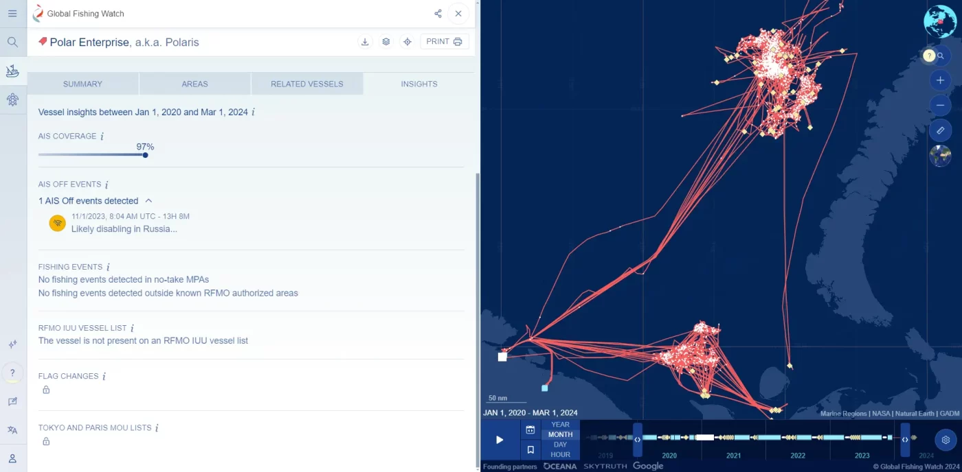
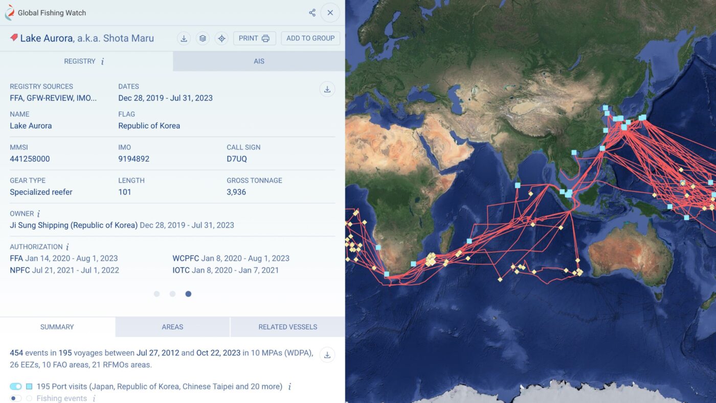
- Analyze and understand a vessel’s history pattern through new vessel profiles.
- The addition of vessel profiles offers a quick and powerful way to access more information about a vessel’s identity and activity information.
- Rapidly view self-reported and registry-backed identity criteria, including owner and authorization information, as well as a timeline of vessel activity.
- Collaborate between colleagues and departments by sharing vessel profiles, adding them to vessel groups, downloading profiles or saving them offline as PDF files for further work.
- Watch the video tutorial.
- Search for vessels using both self-reported identity information and information from over 40 public vessel registries.
- Vessel search now includes information across over 40 public international, regional and national vessel registries for a more accurate merging of vessel identities and records.
- Range maps are included directly in search results to quickly understand whether the vessels are of interest.
- Improved advanced search with multiple filters and customizable views.
- Watch the video tutorial.
- Benefit from general platform improvements.
- We have implemented general improvements across many aspects of our platform based on user feedback, including:
- An easier way to confirm filters across layers;
- The ability to toggle all vessel tracks on or off at once;
- Performance enhancements; and,
- The user guide is now available in Portuguese.
- We have implemented general improvements across many aspects of our platform based on user feedback, including:
Find our user guide, supporting information and tutorials on the Global Fishing Watch website. Share feedback through the built-in feedback form in the left sidebar on the vessel viewer and map or add feature requests to our public Canny board. Email [email protected] for support.
Release – Thursday 26 October
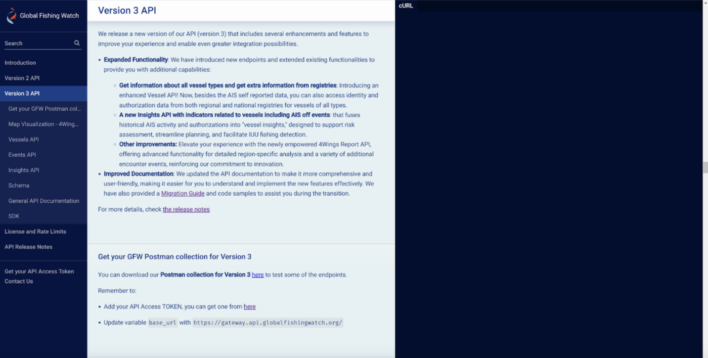
Global Fishing Watch has released a new major version of GFW APIs (Application Programming Interface). Anyone can now:
- Access information about all vessel types and get extra information from public registries
- With the latest version release of an enhanced Vessel API, besides the AIS self reported data, you can also access comprehensive identity and authorization data from both regional and national public registries for vessels of all types.
- Unlike the previous version, which had limitations on fishing, carriers, and support vessels, we’ve unlocked the full potential of Global Fishing Watch vessel data, making it available for all vessel types.
- Investigate a new Insights API with indicators related to vessels
- A powerful API that compiles a collection of “vessel insights” by consolidating vital data about a vessel’s historical activity (derived from AIS) and its authorizations.
- These insights have been crafted to empower decision-making, streamline operational planning, and enhance due diligence efforts.
- Our aim is to simplify the process for users in identifying vessel attributes that may signal a need for more scrutiny.
- More features, enhance performance and improved documentation
- We’ve enhanced the 4Wings Report API with enhanced functionality that allows for in-depth analysis within a specific buffer zone associated with a particular region.
- We’ve taken a significant leap forward by introducing a variety of new encounter events involving different vessel types, along with AIS off events.
In addition to this new major version, we will continue to retain and support API Version 2 for several months. As a result, both versions will be accessible on the API documentation site. For precise information regarding deprecation timelines, please consult the APIs Release Notes.
To learn more check out the examples in the API documentation on the Global Fishing Watch site. Share feedback through this form. Email [email protected] for support.
Release – Thursday 26 October
Global Fishing Watch has released updates to the map and marine manager portal. Anyone can now:
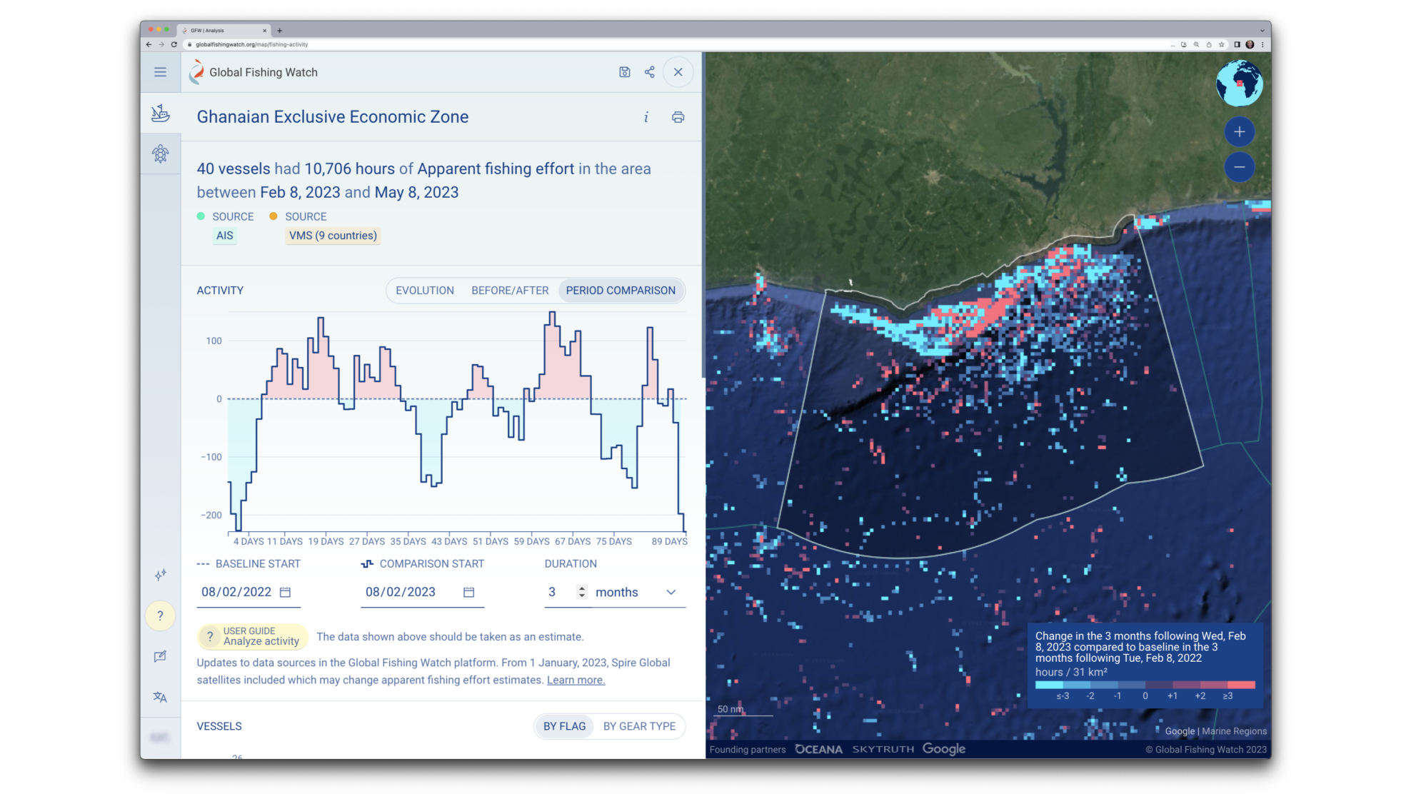
- Rapidly analyze and understand fishing or vessel activity in any area or time range of interest
- The addition of dynamic reports offers a quick and powerful way to access more information about any EEZ, MPA or area of interest in the Global Fishing Watch platform, allowing anyone to quickly:
- View basic statistics about vessels and activity in an area;
- Understand when activity takes place from a time series;
- See a breakdown of which flag states and gear types are present in that area; and,
- Examine which vessels are most active and quickly search within the list and download a subset.
- Preview: Watch the video tutorial.
- The addition of dynamic reports offers a quick and powerful way to access more information about any EEZ, MPA or area of interest in the Global Fishing Watch platform, allowing anyone to quickly:
- Access the ProtectedSeas Navigator layer to learn more about managed areas and their regulations
- The new ProtectedSeas Navigator reference layer can be toggled on to view marine protected areas, filter the layer by their ‘Level of Fishing Protection’ ranking and link directly to the Navigator for detailed information on fishing regulations. Learn more.
- View names and identity information for non-fishing vessels
- Thanks to our new partnership with Spire Global, we are now licensed to show names and identity information for non-fishing vessels in the platform.
- Benefit from the implementation of platform improvements
- We have implemented general improvements across many aspects of the Global Fishing Watch platform, including:
- Direct links to our user guide from the map;
- User guides now available in English, Spanish, French and Chinese.
- The ability to filter the RFMO layer by name to keep the map focused on the layers of interest
- The addition of requested formats for coordinates (degrees, minutes, seconds);
- Improved visualization of points datasets; and,
- Performance enhancements.
- We have implemented general improvements across many aspects of the Global Fishing Watch platform, including:
Find our user guide, supporting information and tutorials on the Global Fishing Watch website. Share feedback through the built-in feedback form in the left sidebar on the marine manager portal and map. Email [email protected] for support.
Release – Thursday 11 May

Global Fishing Watch has released updates to the map and marine manager portal:
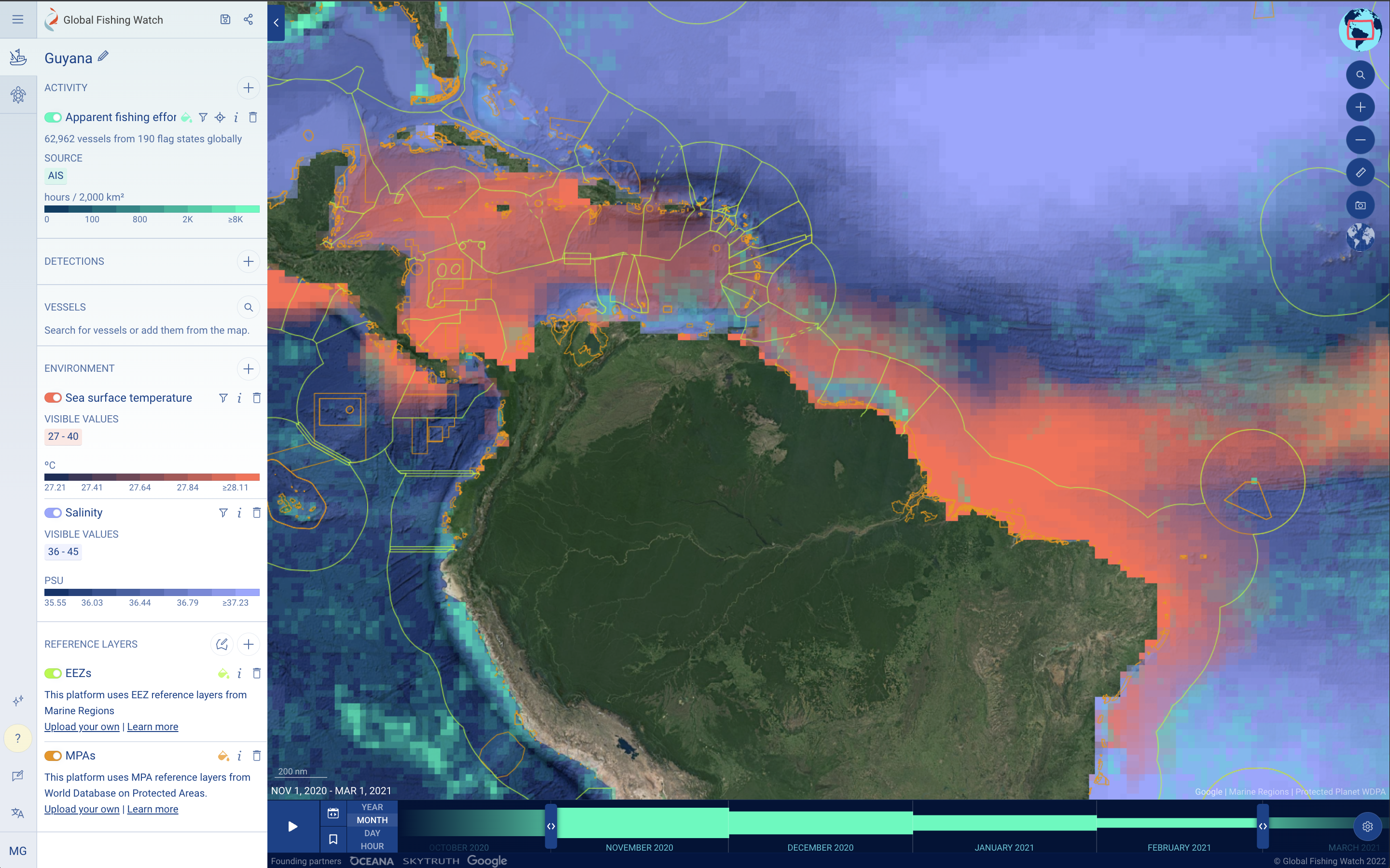
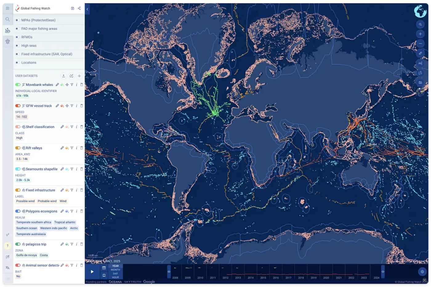
- Global environmental data – Through close collaboration with Google Earth Engine, we’re bringing in daily resolution environmental data – including sea surface temperature, salinity and chlorophyll-a concentration – with the touch of a button.
- What’s more you can filter the environmental data heatmap to only show certain areas where environment data meets the range you’ve set. This can be really powerful if species of interest only exist in specific temperature or salinity ranges.
- Vessel group analysis – Stakeholders can understand where groups of vessels are active over space and time with the ability to create custom groups and filter activity layers by groups
- For technical reasons, this will be initially restricted to viewing 3 months activity on screen at a time.
- More options for data downloads – Global Fishing Watch has added new functionality to download a list of active vessels from AIS apparent fishing effort in any reference layer, whether exclusive economic zones (EEZs), marine protected areas (MPAs) or reference layers that you upload directly. This can be useful where you don’t need to download spatial data and would just like to see which vessels were active.
- Location names – Adding in location names to the map from Google Maps so anyone can understand activity related to coastal locations and at higher zoom levels.
- Ability to switch mode of filtering between include and exclude – Stakeholders can switch filters between ‘include’ and ‘exclude’ options to support faster analysis e.g. View the activity of all vessels in the EEZ of a certain country except vessels flagged to that country to see where foreign flagged vessels may be active.
- Sorting layers in the map – Anyone can sort the reference layers, environment layers and uploaded layers in any workspace
- Change color and centre view on activity – Change colors of any activity layer in the map and marine manager portal. Previously, stakeholders could only centre activity on a track to focus in workspaces. Now, you will also be able to centre the map based on activity layers. This is particularly useful if you have filtered activity by groups and are only viewing a small amount of activity.
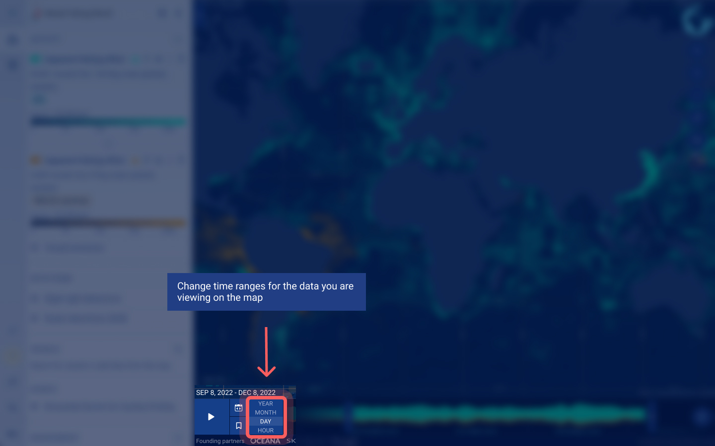
Global Fishing Watch has released updates to the map and marine manager portal timebar:
- Speed through time – Global Fishing Watch has added new buttons to quickly change your time range between years, months, days and hours more easily. When switching, two behaviors have been added:
- If your time range includes the latest available data, like the last few months of activity, the map will keep the most recent data in the new time range for you.
- If your time range does not include the latest available data, like a previous year’s data, the update will snap to the middle of the previous range.
- Improved map and timebar sync – Activity on the Global Fishing Watch map now accurately reflects the exact time range you’ve selected on the timebar. Analysis features and data downloads have always matched the exact time range, but previously, due to technical constraints, the map may have visualized activity a few hours or days outside of your time range. The timebar also now accurately shows when datasets begin and end, like the exact date a transparency country partner began sharing vessel monitoring system (VMS) activity.
- Smart activity data aggregation – For time ranges under three months, more specific daily data is shown. Above this, activity data is aggregated by month. Similarly, for time ranges under 6 years, monthly data is shown. Otherwise, activity data is aggregated by year.
Find supporting information and tutorials on the Global Fishing Watch website. Share feedback through the built-in feedback form in the left sidebar on the marine manager portal and map. Email [email protected] for support.
Release – Thursday 15 December
2022 July – Global Fishing Watch APIs – new portal to make application programming interfaces (APIs) open and available to the public for free
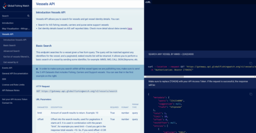
Global Fishing Watch has released a portal that provides access to a set of APIs, or application programming interfaces, which enable two software systems to communicate with one another and automatically retrieve data. APIs are the foundation of all our technology at Global Fishing Watch and allow us to integrate, share, access and scale our human-use activity data—first to power our map and now across the global ocean community. You can integrate our APIs to find data on:
- Fishing effort
- Fishing events
- Vessel search and identity
- Encounters events
- Loitering events
- Port visits
To learn more check out our blog and find API documentation on the Global Fishing Watch site. Share feedback through this form. Email [email protected] for support.
Release – Thursday 19 July
2022 June – Global Fishing Watch map – First global layer of radar detections (SAR) and improvements to vessel tracks
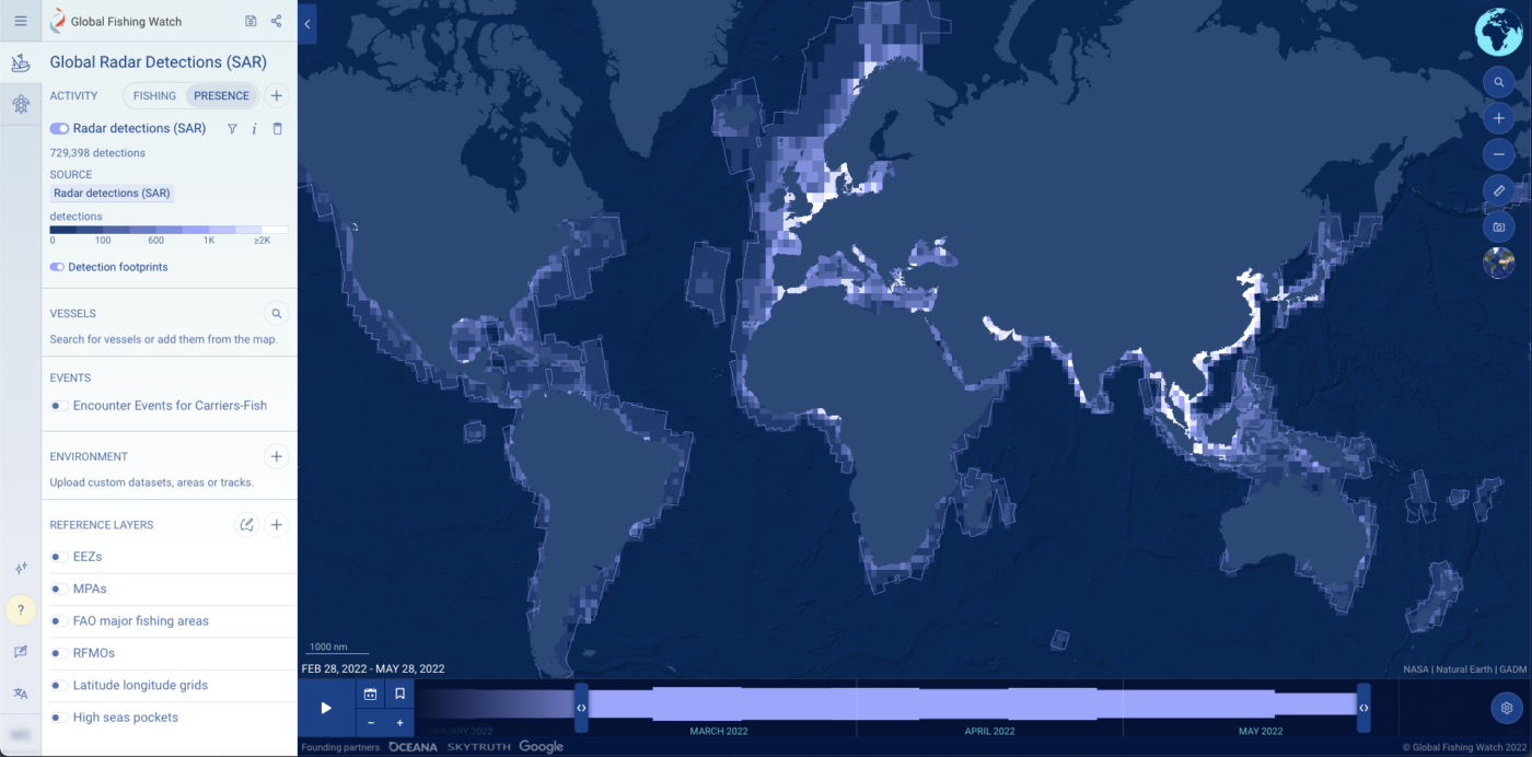
Global Fishing Watch has released updates to the map and marine manager portal:
- Radar to view vessels at sea that may not appear in cooperative tracking systems – Global Fishing Watch has added a global radar detections layer, derived from synthetic aperture radar or SAR, to display at-sea vessels, in any weather conditions. SAR can show vessel detections that can not be picked up by other cooperative tracking systems (e.g. AIS, automatic identification systems, or VMS, vessel monitoring systems).
- Viewing apparent fishing activity alongside presence of other non-fishing vessels in the same map – Understanding how our ocean is used goes beyond just fishing. For the first time, you can now view non-fishing activity to understand presence of vessels directly alongside apparent fishing effort and detections in the map.
- Clearer distinctions of vessel events through time – We’ve improved how events on a track are visualized alongside an improved method to understand the activity of any vessel at a specific time using the timebar.
Find supporting information and tutorials on the Global Fishing Watch website. Share feedback through the built-in feedback form in the left sidebar on the marine manager portal and map. Email [email protected] for support.
Release – Wednesday 8 June
2022 April – Global Fishing Watch map – Matching identity information and night light detections for vessels in the Global Fishing Watch map
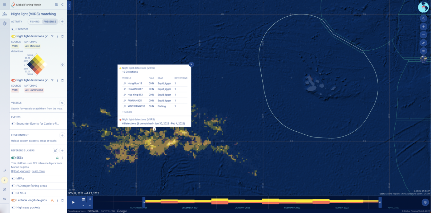
Global Fishing Watch has released updates to the map and marine manager portal:
- Shining a light on vessels fishing at night – Global Fishing Watch has developed an advanced experimental system to match available automatic identification system (AIS) data to respective night light vessel detections (VIIRS).
- Radiance of lights at night – Filter the night light vessel detections layer by radiance – how much light the VIIRS sensor “sees”. This can be useful for analysts to differentiate between different fishing methods at night.
- FAO major fishing areas – Human activity can be analyzed around FAO major fishing areas and subareas.
- Latitude and longitude grids – Understand more about the area you’re investigating with the addition of latitude longitude grids (also known as graticules) to your map.
- Dynamic environmental data coloring – In the marine manager portal, environmental layers now dynamically respond to the area you are looking at and the time range you’ve selected to support improved visualization and analysis.
Find supporting information and tutorials on the Global Fishing Watch website. Share feedback through the built-in feedback form in the left sidebar on the marine manager portal and map. Email [email protected] for support.
Release – Thursday April 7
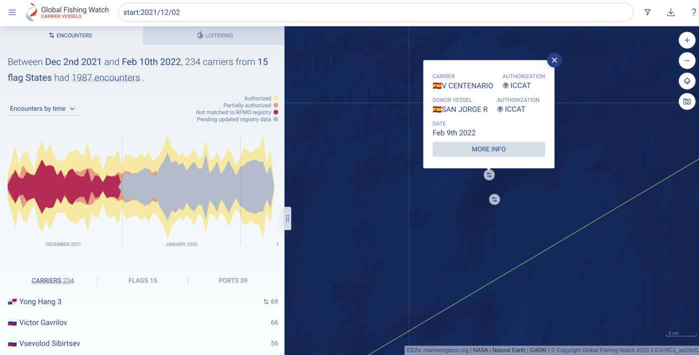
2022 February – Global Fishing Watch Carrier Vessels – Encounters and loitering data in near real time
Global Fishing Watch has released updates to the carrier vessel portal:
- 72 hours delay for the data – Our data is now updated more frequently with only a 72 hour delay.
- New pending status – “Pending updated registry data” – As we are updating the data more frequently, we are identifying those events where authorization status from registry information is still pending.
- Updating “Unknown authorization” as “Not matched to RFMO registry” – We want to clarify the situation where events have registry information but no discovered authorization. This does not mean events where not authorized, just that the information can not be found.
2021 December – Global Fishing Watch Marine Manager – Changes in activity over time, flexible download formats and more
Global Fishing Watch has released updates to the marine manager portal and map:
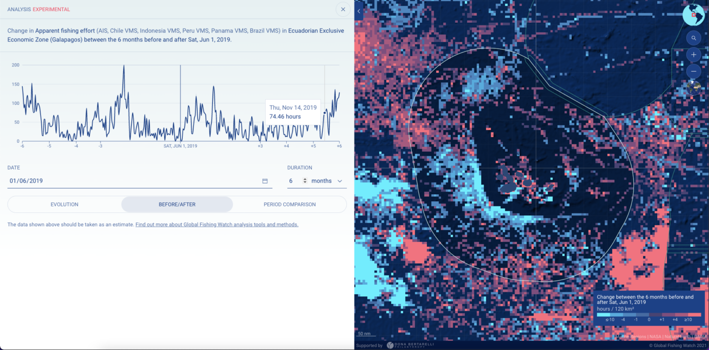
- Understanding changes in activity over time – Anyone with an internet connection can now compare a baseline of apparent fishing activity in a particular area against another time period, and analyze those changes over time. A researcher interested in how fishers respond to marine protected areas (MPAs), for instance, can compare vessel traffic within the MPA before and after its establishment.
- Drawing custom reference layers – In addition to our built-in reference layers showing exclusive economic zones and MPAs, users can easily draw their own reference layer right on the map. They don’t need to be a GIS or mapping specialist to delineate areas where they want to rapidly analyze human activity.
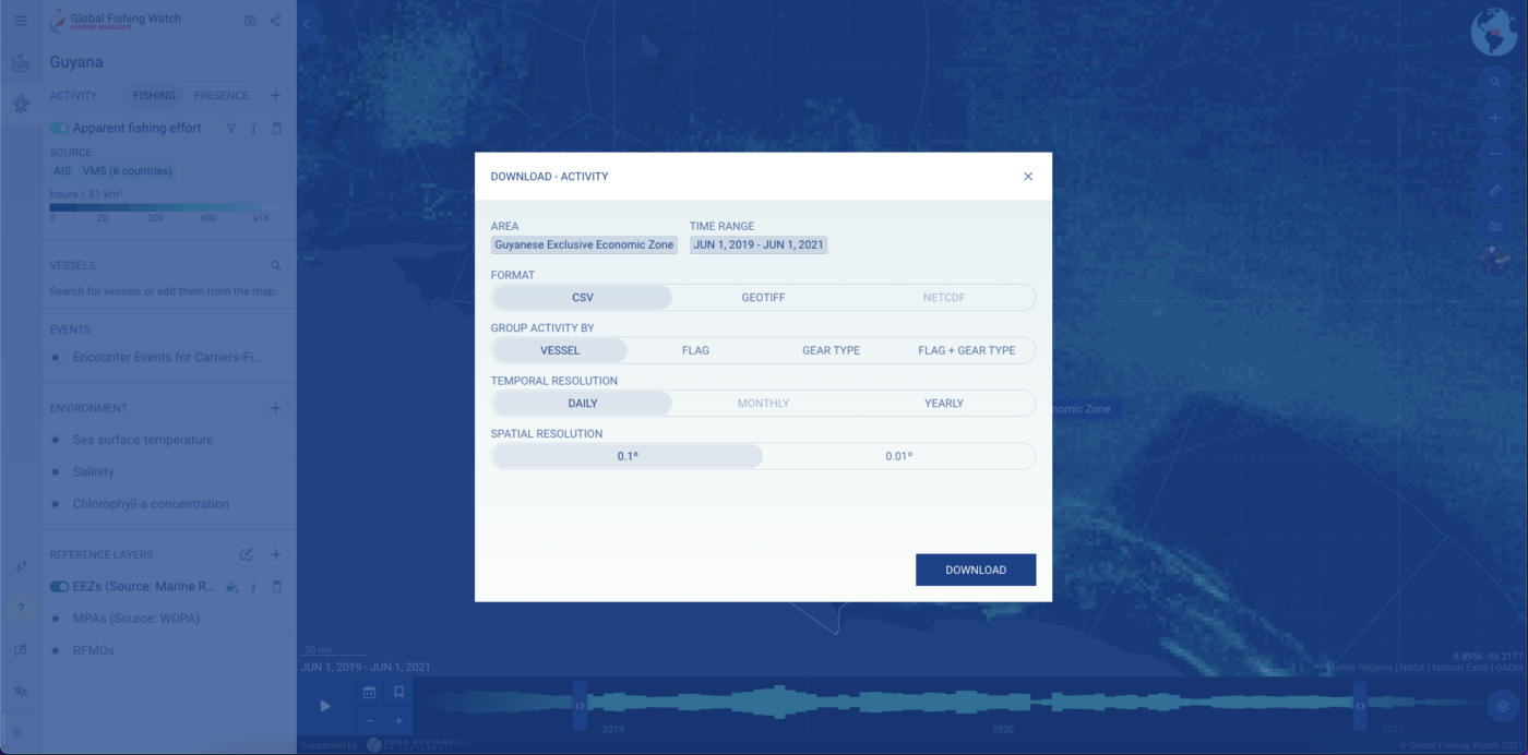
- Downloading datasets in the format you need – Data that is more user friendly can save researchers a lot of time and headache. With improvements to the marine manager portal, users can download data in multiple formats with new options in spatial and temporal resolution, meaning that managers and researchers now have access to fishing activity data with minimal data wrangling, helping streamline research and management plans.
- Understanding when and where vessels go to port – In addition to fishing, encounter and loitering events on vessel tracks, you can now view when and where vessels go to port.
- Performance improvements – We have implemented performance improvements completed with help from our partner sites ensure the map and marine manager portal works well even in remote areas.
Find supporting information and tutorials on the Global Fishing Watch website. Share feedback through the built-in feedback form in the left sidebar on the marine manager portal and map. Email [email protected] for support.
Release – Thursday 9 December.