- Impact
- Technology
- Media Center
- Stories & Updates
- About
Who we are
Leadership
Team
Reporting
- ENGLISH
- Impact
- Technology
- Media Center
- Stories & Updates
- About
Who we are
Leadership
Team
Reporting
- ENGLISH
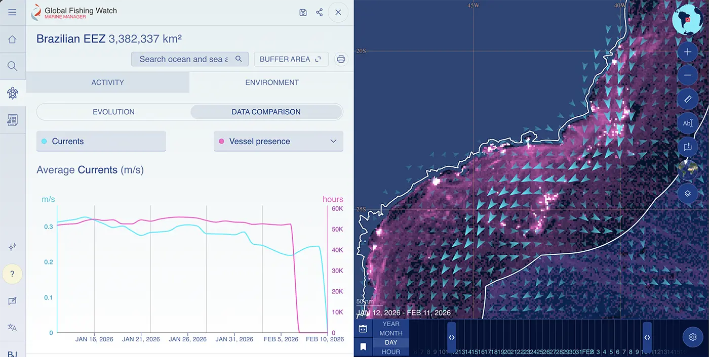
In response to user feedback, environmental layers and expanded analysis capabilities are now available in Marine Manager, making it easier to interpret vessel behavior and work across datasets in one place.
In addition to existing datasets and analytical tools, anyone can now:
Add environmental context to vessel movement
Compare multiple datasets within a single analysis
Analyze user-uploaded point data
Explore our user guide, supporting information and tutorials to support your work on marine management.
Share your thoughts through the built-in feedback form in the left sidebar of Marine Manager or add feature requests to our public Canny board.
Email [email protected] with any questions you might have.
We use cookies to keep our site running smoothly and to understand how you interact with us. Allowing cookies helps us give you the best, personalized experience. If you opt out, some parts of the site might not work as beautifully as they should.


