Tim White is a PhD candidate at Stanford University’s Hopkins Marine Station. His recent publication in Science Advances, Predicted hotspots of overlap between highly migratory fishes and industrial fishing fleets in the Northeast Pacific, focuses on how vessel tracking and fish habitat models can help inform management of sharks and tunas.
How do you sustainably manage fish that cross oceans? Some fish travel thousands of miles every year, crossing international boundaries and management jurisdictions. In order to manage them, we need to know where they migrate and where people fish them, but this info is surprisingly difficult to gather for sharks and tunas of the open ocean.
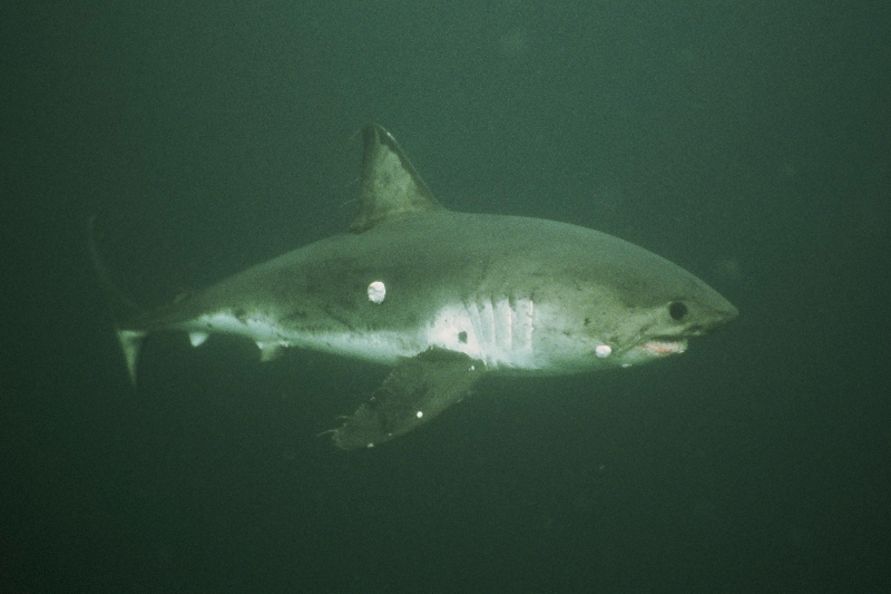
Powered by new animal tracking technology, landmark studies over the last two decades have revealed the migration pathways of many iconic marine species. Scientists discovered, for example, that white sharks migrate from the California coast to the “White Shark Café,” an oceanic region located 2,500 km West of the Baja Peninsula. Researchers also tracked Pacific bluefin tuna as they swam across the entire Pacific.
Yet, these exciting insights from electronic tracking have only recently become available for fisheries. Until Global Fishing Watch publicly released data on global fishing activity, our research team knew more about the movements of fish than fishing boats! Vessel tracking data have traditionally been kept private by national governments, so our team of biologists, oceanographers, and data scientists partnered with Global Fishing Watch to learn more about the fishing vessels that sharks and tunas may encounter as they navigate the northeast Pacific Ocean.
Together, we tracked over 900 industrial fishing vessels from 12 countries using satellite detections from Global Fishing Watch. We opportunistically focused on the northeast Pacific because of data already available for the region thanks to the Tagging of Pacific Predators (TOPP) program – a huge, collaborative project aimed at understanding the movements of marine predators. TOPP produced over 800 tracks of seven migratory sharks (white, blue, shortfin mako, and salmon sharks) and tunas (Pacific bluefin, yellowfin, and albacore tuna) in this region – a treasure trove of fish movement data. This allowed for development of models that let us predict the best habitat for a species at any given time based on remotely-sensed environmental conditions, like sea surface temperature and primary productivity.
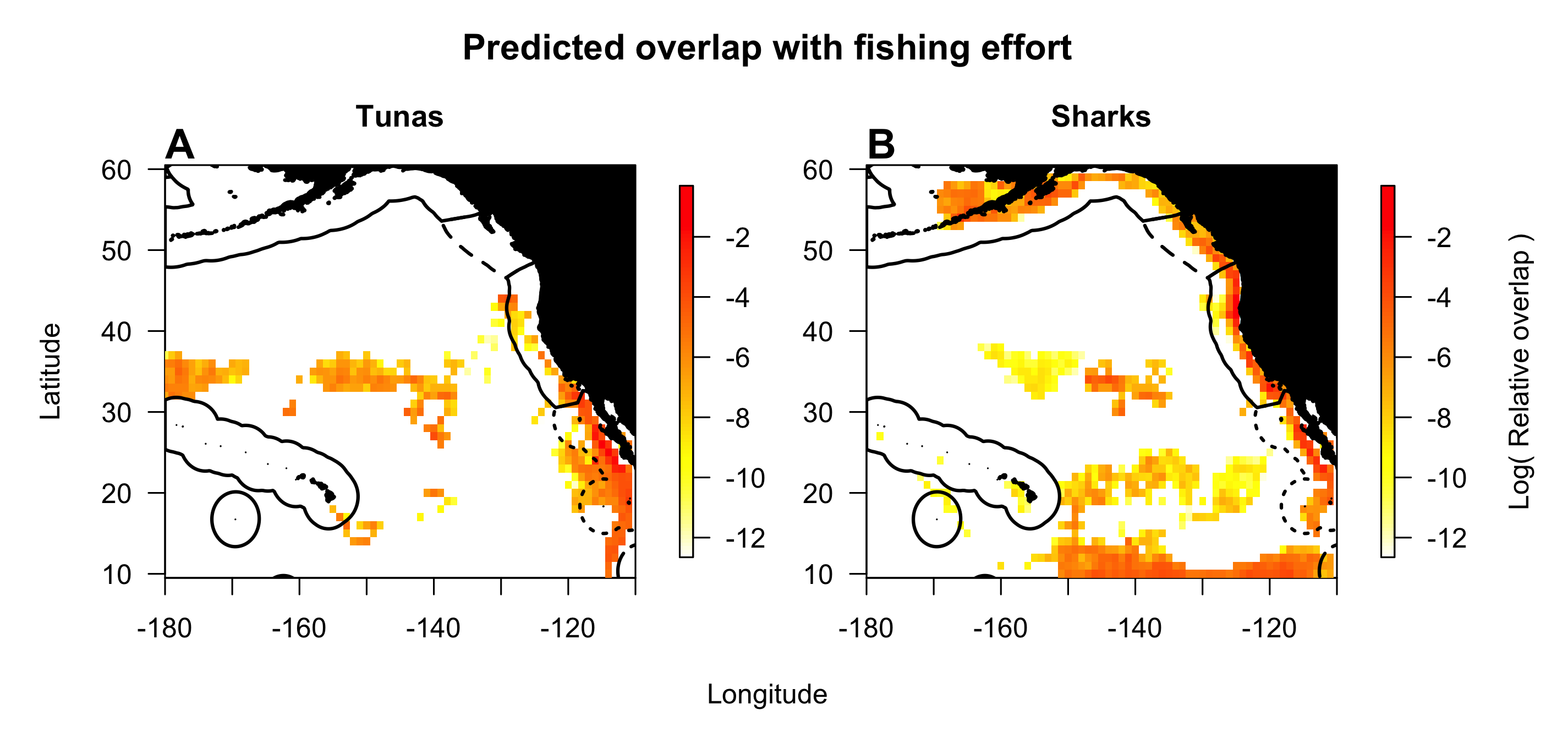
We predicted where and when the best fish habitat – where a given species was most likely to be found- was located in 2015 to 2017. We then combined this info with our maps of fishing activity to figure out where fish are most likely to overlap with fishing boats along their migrations.
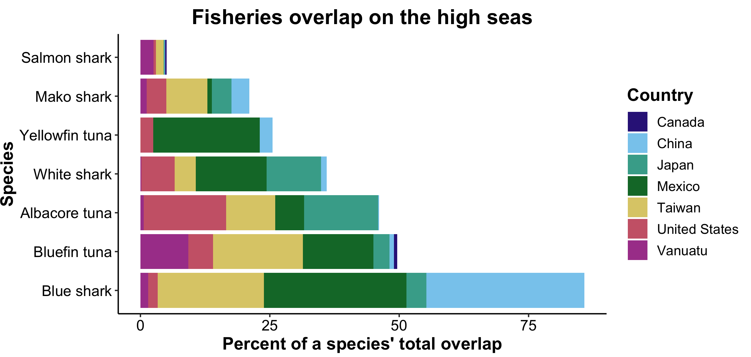
Hotspots of overlap between fish and fisheries indicate where threatened species, like Pacific bluefin tuna or shortfin mako sharks, may be in need of conservation attention. For example, 49% of Pacific bluefin tuna overlap with fisheries occurs in international waters (the “high seas”). This means that efforts to protect high seas biodiversity – such as the historic treaty being currently developed at the United Nations– play a critical role in conserving these sharks and tunas. Other species are sustainably fished in our study region (e.g., albacore tuna); overlap for these species could be interpreted as efficient fishing activity as opposed to a potential conservation concern.
Large marine protected areas were notable “coldspots” of overlap between fish and fishing. Two such areas in our study region – Papahānaumokuākea Marine National Monument and Johnston Atoll of the Pacific Remote Islands Marine National Monument – contain very little fishing, though we see very high rates of fishing in broad regions beyond their boundaries.
We also measured which nations did the most fishing within important fish habitat. I was surprised to learn that boats from just five nations (China, Chinese Taipei, Japan, the United States, and Mexico) accounted for over 90% of the high seas overlap that we predicted within our study region. The high seas are our planet’s global commons. I think this result suggests that in absence of new regulations, the benefits of fishing the high seas – and the impacts on threatened fish species – will continue to be driven by a handful of countries. It’s important to note that results may differ in other regions, but this is what we see across a vast section of our planet’s largest ocean.
I see plenty of reason for optimism in our results. Improving management of our planet’s global commons seems like an overwhelming task given the number of nations that have a stake in the high seas; reaching consensus across the entire planet will surely be a massive challenge. But results like this suggest that monitoring and potentially modifying the fishing effort of just a few active nations could bring about real improvements to the sustainability of high seas fishing.