Rise in Unregulated Squid Fishing Poses Challenges—and An Opportunity
Highly mobile fisheries present more possibilities for data-driven approach to inform regulation.
New Fusion of Global Datasets Advances Understanding of Vessel Identity and Activity
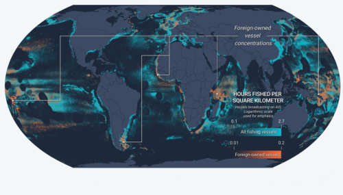
Novel research provides new tool to improve global fisheries oversight Illegal, unreported and unregulated (IUU) fishing accounts for up to $23.5 billion every year and is enabled by vessels frequently changing their name, flag State

Hotspots of Unseen Fishing Vessels Illuminate Areas of Concern for Illegal, Unreported and Unregulated Fishing
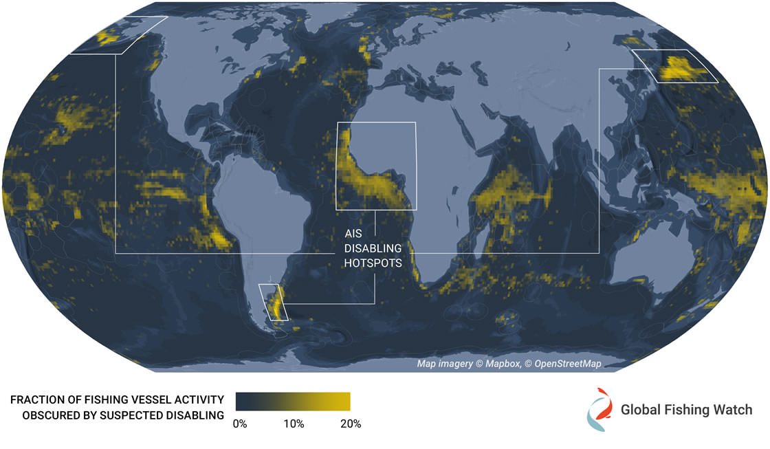
New study provides first global dataset examining intentional disabling of automatic identification system devices across commercial fisheries The ocean is vast and ship crews rely on several tools to navigate it safely. One of these
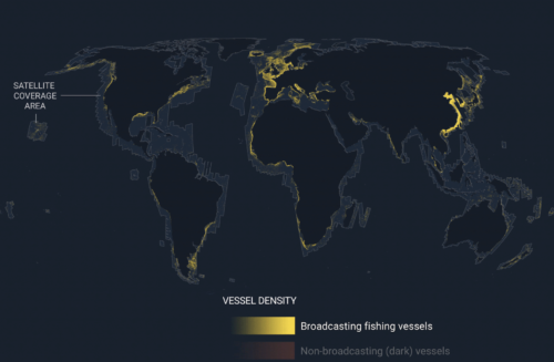
Emerging technology gives first ever global view of hidden vessels
Satellite radar and machine learning publicly reveal previously unseen vessel activity around the world Washington, D.C. – Global Fishing Watch has developed and publicly released the first ever global map of previously undetected dark fleets,