For more information, contact: Kimbra Cutlip / [email protected] /+1 443.871.1632
See the public Indonesia workspace map revealing Indonesian VMS data alongside AIS data. https://globalfishingwatch.org/indonesia-vms
ALL MEDIA INCLUDED HERE IS ALSO AVAILABLE ON THIS GOOGLE DRIVE
Youtube Video available here: https://youtu.be/U0vgrj9GhoU
FOR IMAGES BELOW
Credit: Global Fishing Watch, Inc., 2017
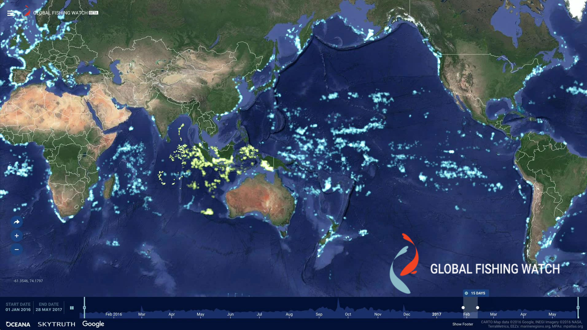
Captions: Global Fishing Watch uses publicly broadcast AIS signals to track fishing vessels. On the Global Fishing Watch heat map, every lighted point represents a fishing vessel. The blue points are vessels detected through AIS. The green points represent nearly 5,000 additional vessels revealed through Indonesia’s government Vessel Monitoring System. This data has never been made available to the public before now.
- CLICK ON AN IMAGE TO SELECT.
- A NEW WINDOW WILL OPEN.
- RIGHT CLICK TO DOWNLOAD HIGH RESOLUTION FILE.
Animated Gif Comparing AIS only with the addition of Indonesian VMS data
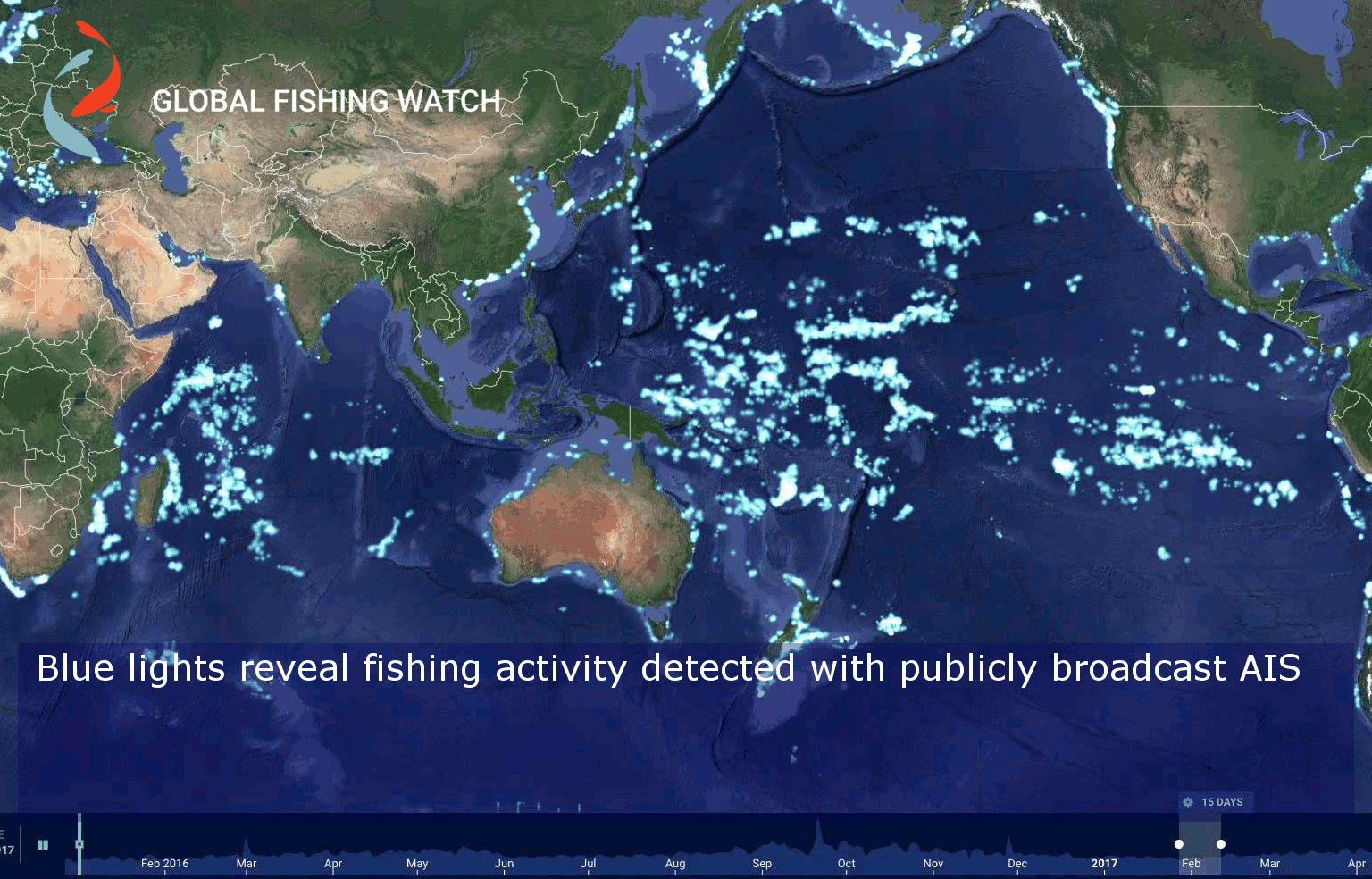
IMAGE 1: Side by side comparisson: 3.04 MB

Image 2: Vertical Comparisson 2.88 MB
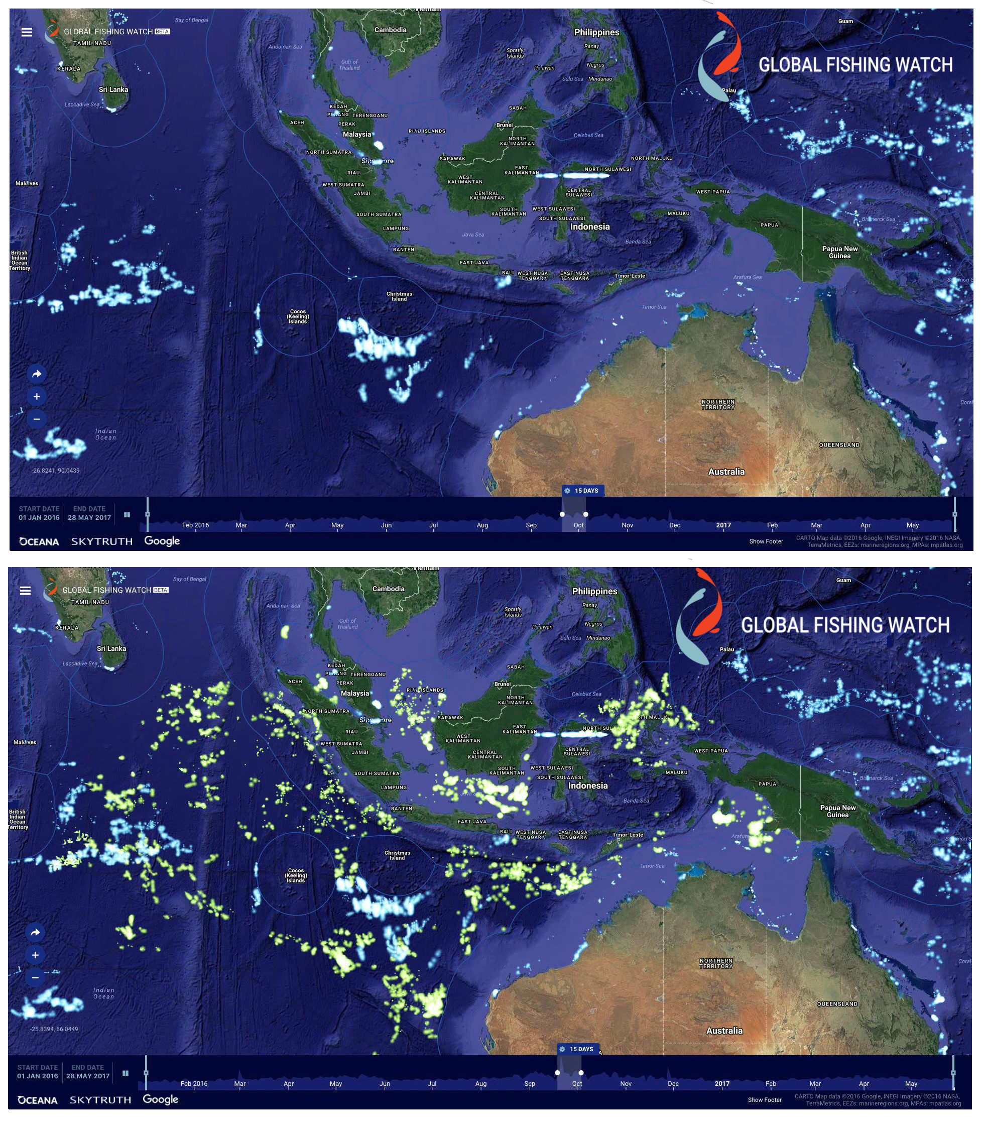
Global Fishing Watch uses publicly broadcast AIS signals to track fishing vessels. On the Global Fishing Watch heat map, every lighted point represents a fishing vessel. The blue points are vessels detected through AIS. The green points represent nearly 5,000 additional vessels revealed through Indonesia’s government Vessel Monitoring System. This data has never been made available to the public before now.
Image 3: Indonesian waters with AIS and VMS shown 2.0 MB
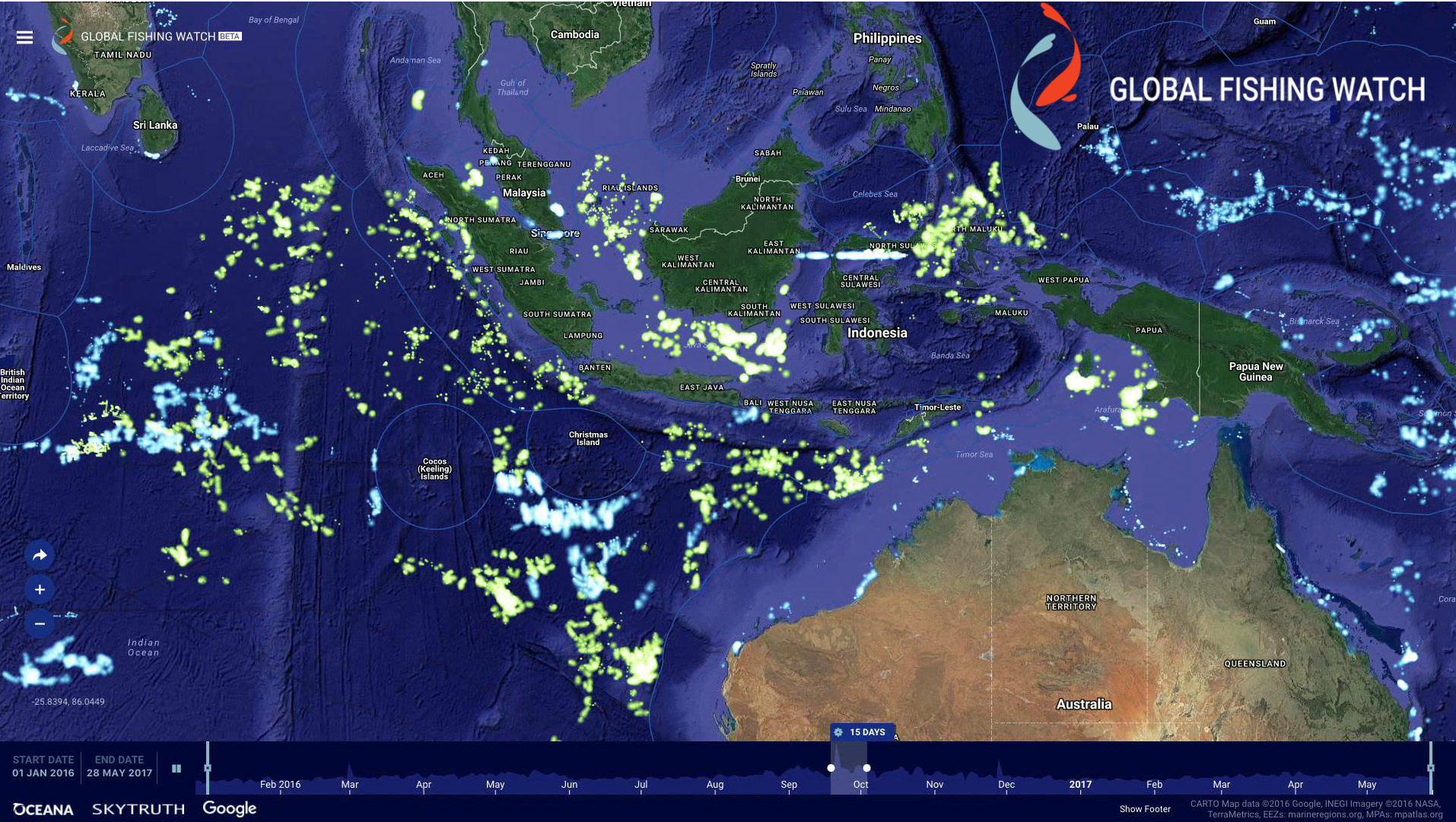
Global Fishing Watch uses publicly broadcast AIS signals to track fishing vessels. On the Global Fishing Watch heat map, every lighted point represents a fishing vessel. The blue points are vessels detected through AIS. The green points represent nearly 5,000 additional vessels revealed through Indonesia’s government Vessel Monitoring System. This data has never been made available to the public before now.
Image 4: Global View .5 MB