On this remote island, the ocean is identity and heritage — and now, through satellite technology, the foundation for a resilient future
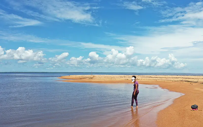
The island of Rapa Nui, or Easter Island, has long occupied a larger-than-myth place in popular imagination. Located more than 3,200 kilometers from the Chilean mainland in the southeastern Pacific Ocean, its towering mo’ai, a collection of some 1,000 statues carved from volcanic rock, dot the island’s rugged landscape — a tribute to the storied ancestors of the Rapa Nui people and a testament to the enduring connection between the community and their home.
For generations, the Rapa Nui people have lived in symbiosis with the sea, protecting its biodiversity and ensuring the continued survival of their way of life. According to Sebastián Yancovic Pakarati, a councilor with the Rapa Nui Council of the Sea, known locally as the Koro Nui o te Vaikava, the ocean surrounding Rapa Nui is not only the cornerstone of their heritage but also the foundation of their future.
“The sea shapes us; the sea leads us,” says Pakarati. “It guides the development we need, and we want to project that into the next thousand years.” But today, as marine ecosystems strain under the twin pressures of climate change and overfishing, the Rapa Nui’s environment and their livelihoods face growing threats. In response, they are taking action, uniting ancestral knowledge with modern technology. By harnessing the power of Global Fishing Watch’s Marine Manager, developed in partnership with Dona Bertarelli, the Rapa Nui are strengthening their ability to monitor human activity at sea and manage the vast protected waters surrounding their island.
Marine Manager sites


Related content

A community-led vision for ocean protection
In 2018, the Rapa Nui took ambitious strides toward ensuring their ocean conservation efforts translated into tangible measures. Following extensive consultations between the Government of Chile and Rapa Nui’s Indigenous community, Chilean authorities established the Rapa Nui Multiple-Use Marine and Coastal Protected Area in an effort to safeguard the island’s waters for posterity. Spanning roughly 270,000 square miles (700,000 square kilometers), the protected area reflects a shared vision: to protect marine biodiversity while preserving traditional artisanal fishing practices that sustain the island’s cultural and economic life.
Rapa Nui Marine Protected Area
- Established: 2018
- Size: ~270,000 square miles
- Governance: Indigenous co-management
- Fishing allowed: Artisanal only
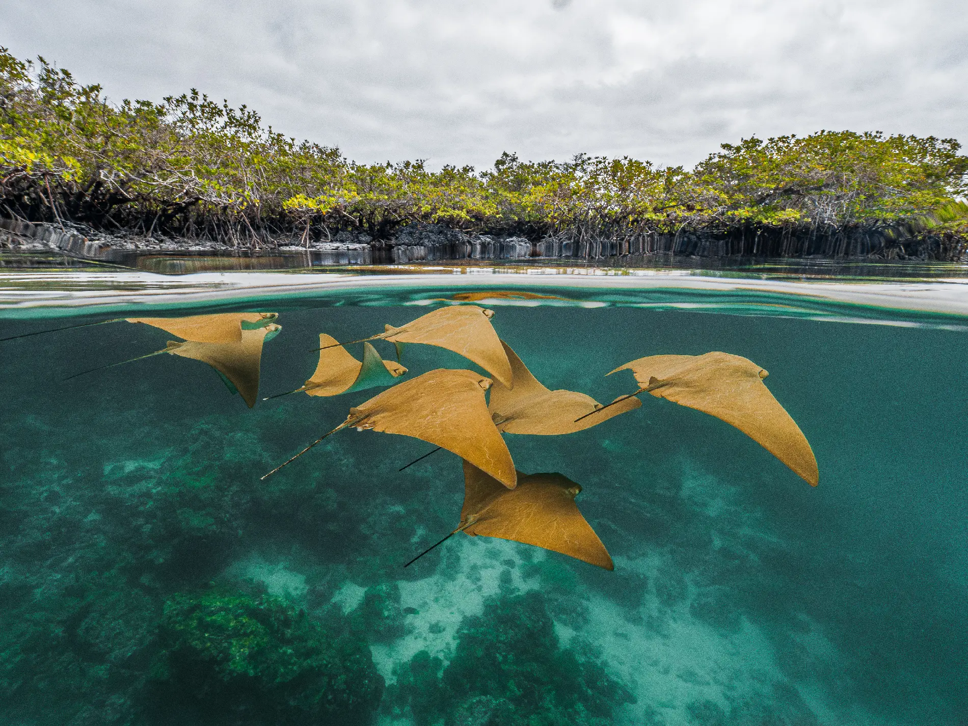
- Biodiversity: Protects 140+ endemic species, including the Easter Island butterflyfish and the Nazca bigeye.
- Ecological function: Critical breeding and spawning ground for large pelagic fish — yellowfin tuna, sharks, swordfish and marlin —and home to healthy coral reef systems.
© Global Fishing Watch / Hanz Plenge
Today, fishing around Rapa Nui remains entirely artisanal, with fishers continuing ancient and ancestral practices. Industrial fishing, for its part, is prohibited to preserve ecological balance and the livelihoods of the local community, which continue to focus their fishing activity on high value species like yellowfin tuna, Pacific chub and swordfish.
“Here, fishing is a system,” Ludovic Burns Tuki, coordinator of Koro Nui o te Vaikava, explains. “An economic system that allows us to subsist, and also a social system that gives people a place within the Rapa Nui community.”
Yet protecting such a vast ocean territory presents significant challenges for the Rapa Nui. While their ocean management efforts rely on local knowledge and ancestral know-how with great success, the sheer scale of the protected area makes it difficult to monitor activity beyond coastal waters without additional resources or technological support.
Seeing beyond the horizon
Protecting an ocean territory that is larger than many countries requires more than patrol boats and human observation. To support effective implementation of the marine protected area, Rapa Nui authorities have turned to Marine Manager, which helps them reveal patterns of human activity at sea through satellite-based vessel tracking data.
By integrating data from automatic identification systems (AIS) and vessel monitoring systems (VMS) with oceanographic datasets, Marine Manager provides near-real-time insights into vessel movements and activity patterns. This information enables protected area managers to understand exactly what is happening across their waters and along the boundaries of its exclusive economic zone.
Through Marine Manager, Rapa Nui authorities are able to:
- Monitor industrial fishing fleets operating near the boundaries of the protected area.
- Identify patterns in fishing, transit and maritime traffic.
- Strengthen compliance with local and national regulations.
- Support science-based decision making and long-term management planning.
- Build technical capacity among community stakeholders.
With support from Global Fishing Watch’s Marine Manager, Rapa Nui authorities can now visualize vessel activity inside and around the marine protected area, track changes over time, cross-reference information with environmental layers, and make informed decisions to safeguard biodiversity and livelihoods. © 2026 Global Fishing Watch
The platform facilitates vital collaboration between the Council of the Sea and Chile’s National Fisheries and Aquaculture Service (SERNAPESCA) local office. It also enables artisanal fishing organizations and community members to participate in monitoring efforts, strengthening co-management and transparency. Members of the Koro Nui o Te Vaikava, including local fishers representing different associations, are now playing a more active role in overseeing activity within the MPA. Using the Global Fishing Watch map, the community can verify the identity and track the history of vessels entering protected waters, particularly industrial vessels that may request temporary access for reasons such as refueling or medical emergencies. The platform provides the local community with a critical tool to assess whether these vessels are complying with regulations, helping build trust and accountability in an area where concerns over unauthorized activity have persisted.
Technology to support tradition
Establishing a marine protected area is only the first step toward conservation. The greater challenge lies in ensuring that protection measures are effectively implemented and enforced. Marine Manager helps transform monitoring from a limited local capability into a shared, data-driven governance model.
“Marine Manager helps us with satellite control and monitoring of the entire industrial fleet outside the island,” notes Faturangi Tepano, the head of SERNAPESCA’s office in Rapa Nui. “It strengthens our team’s capacities, but Global Fishing Watch has also created opportunities for artisanal fishing organizations and the community to participate in this process and learn to use the platform.”
By making ocean activity visible, Global Fishing Watch’s platform reduces uncertainty regarding industrial fleets operating around the island and strengthens local capacity to safeguard marine ecosystems.
Rapa Nui demonstrates how indigenous knowledge, community leadership and transparent data can work in concert to strengthen marine conservation and advance ocean governance. By combining centuries-old stewardship traditions with modern monitoring tools, the island is advancing a co-management model that empowers local communities while supporting science-based decision making. Global Fishing Watch is honored to collaborate with the Rapa Nui community and Chilean authorities to expand access to data and tools that support effective marine protection.