Search results for: Fishing Map

A sea turtle swims underwater over a rocky, sunlit ocean floor as rays of sunlight filter through the clear water from above.

Technology and Innovation for Marine Protected Areas Management

The ocean covers nearly 70 percent of the planet–14 million square kilometers–providing a huge challenge for monitoring activity and enforcing regulations across its vast expanse. That activity includes illegal, unreported and unregulated (IUU) fishing, which accounts for up to $23 billion worth of seafood every year, or one in every five wild-caught fish.

Our work in Brazil

Brazil Our work Global Fishing Watch works closely with Brazilian authorities to ensure effective fisheries management and promote the sustainability of the country’s essential fish stocks. As our collaboration deepens, we are advancing efforts in monitoring and surveillance, and spearheading initiatives in transparency and biodiversity conservation. Our shared goal is to reduce illegal, unreported and […]

At UNOC3, the World Finally Talks Transparency — Now, Will it Act?

NICE, France — As the third United Nations Ocean Conference (UNOC3) closed today, global leaders showed tentative signs of moving beyond business as usual. Tucked into the ocean summit’s final outcome document, delegates finally recognized technology and transparency as critical tools to protecting our ocean and meeting global sustainability targets like 30x30

The Global Fishing Watch logo and text appear on a digital, blue, wave-like background with glowing dots, evoking the look of a data visualization of the ocean.

Open Ocean Research Grant Program

Open Ocean Research Grant Program Contact: [email protected] Global Fishing Watch’s open ocean research grant program aims to enhance ocean governance by publicly sharing data on human activity at sea through the expansion of our community of practice. By collaborating with global researchers to apply our core technologies in the ocean governance space, this grant program […]

New Data Reveals Bottom Trawling In Protected Areas

Greater transparency needed to stop illegal fishing in the Mediterranean Members of the Med Sea Alliance, a diverse coalition of nonprofit organizations, today launched a new data atlas which, for the first-time, maps areas permanently closed to bottom trawling across the Mediterranean and investigates illegal trawling in these areas. The Atlas is an online tool […]

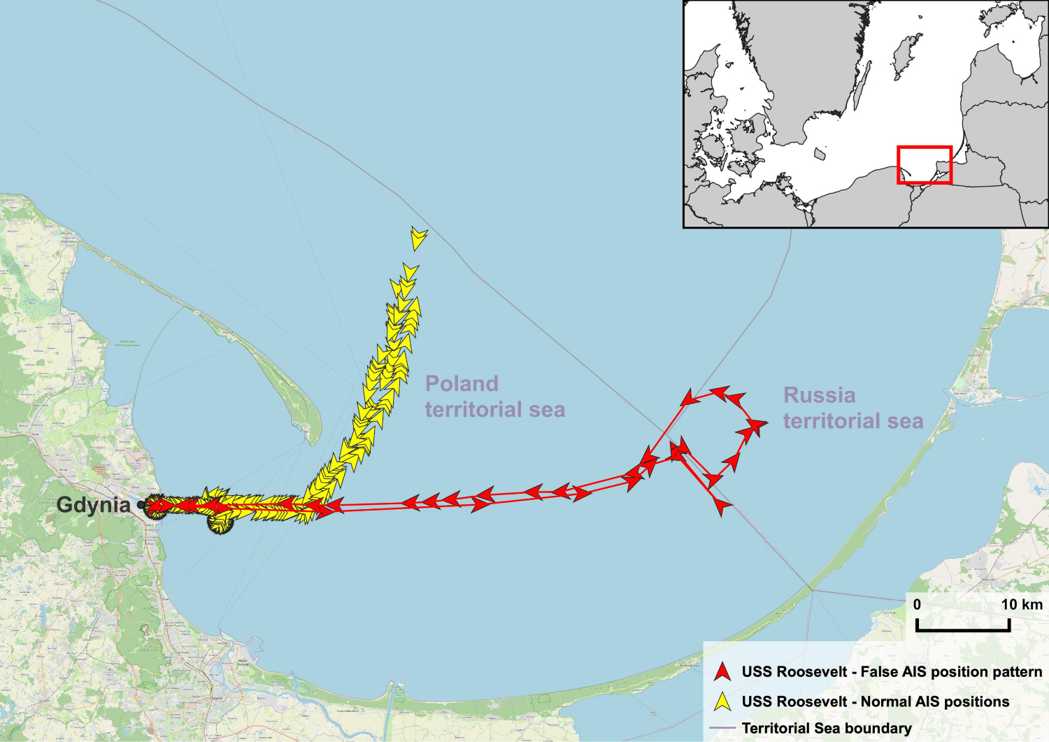
Systematic Data Analysis Reveals False Vessel Tracks

Analysis of tracking data from automatic identification system broadcasts reveals vessel locations have been simulated for a number of ships, including military vessels. This false information could compromise vessel safety, decrease confidence in a crucial collision avoidance system and potentially spark international conflict. Over the years, data analysts working with Global Fishing Watch and SkyTruth […]

Scroll to Top

Help us improve the site

Take a quick website survey to help us build a better experience for visitors like you.