Search results for: What is VMS

Split view of a sailboat on the ocean, with the top half showing sky and distant coastline, and the bottom half revealing underwater coral reefs through remarkable ocean transparency and clear blue water.

Transparency

Transparency Related expert: Courtney Farthing and Geoffrey Muldoon   –  Resources Transparency is critical to understanding activities taking place across the ocean and where those activities pose a risk to marine ecosystems, fisheries and coastal communities. It is also vital to reducing illegal and unreported fishing and promoting responsible ocean stewardship. Global Fishing Watch’s 2030 […]

User Guide – Portuguese

Guia de Mapas English | Español | Français | Portuguese |中文 Menu Introdução O mapa Global Fishing Watch é a primeira plataforma on-line de acesso aberto para visualização e análise da atividade humana baseada em embarcações no mar. Alimentado por tecnologia de satélite e aprendizado de máquina, o mapa mescla vários tipos de dados de […]

User Guide – French

Guide d’utilisation de la carte English | Español | Français | Portuguese |中文 Menu Introduction La carte Global Fishing Watch est la première plateforme en ligne en libre accès pour la visualisation et l’analyse de l’activité maritime humaine à bord de navires. Utilisant la technologie satellitaire et l’apprentissage automatique, la carte fusionne plusieurs types de […]

User Guide

User Guide English | Español | Français | Portuguese |中文 Menu Introduction The Global Fishing Watch map is the first open-access online platform for visualization and analysis of vessel-based human activity at sea. Powered by satellite technology and machine learning, the map merges multiple types of vessel tracking data to provide a view of global […]

Version 4 Data Pipeline Release

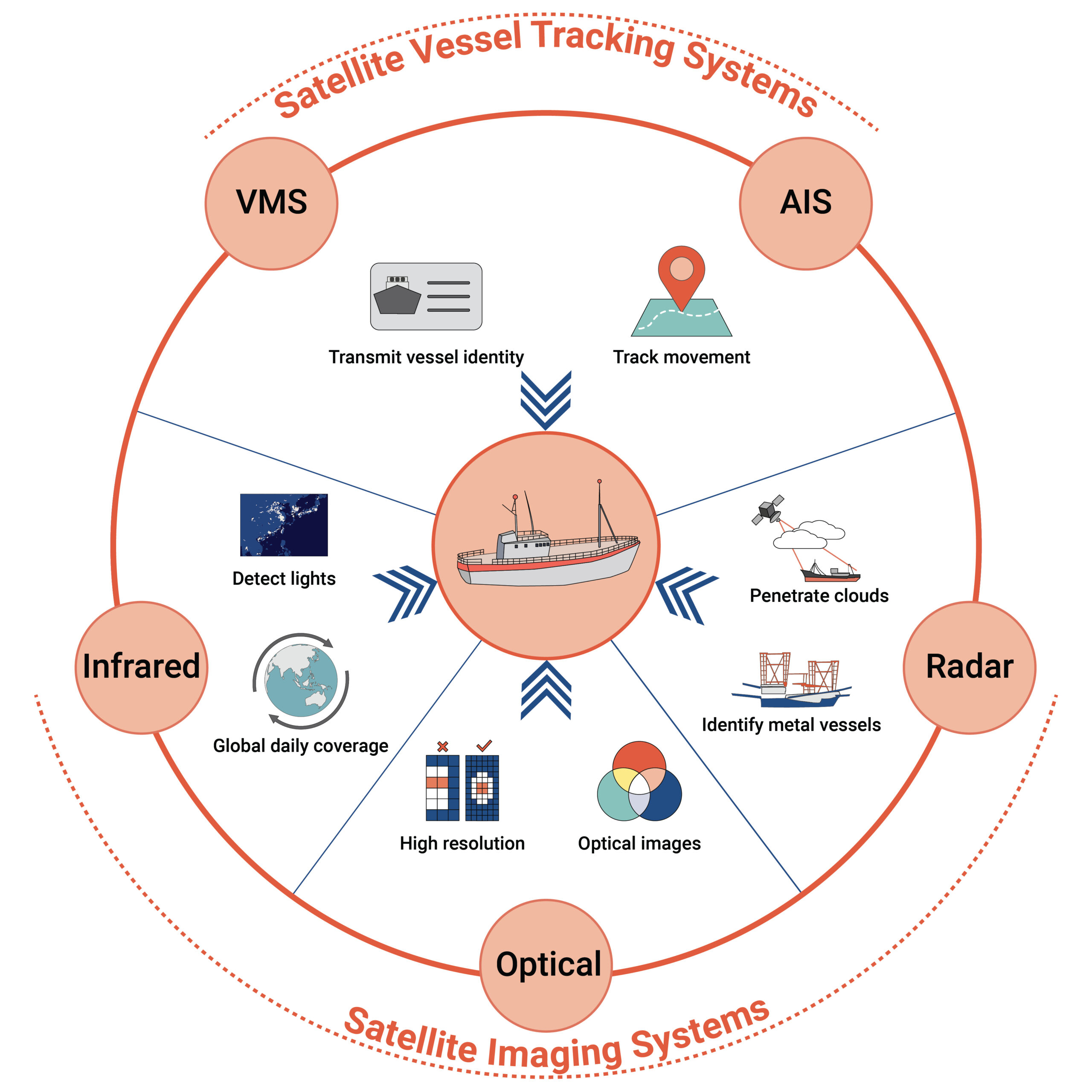
Global Fishing Watch has launched an improved version — version 4 — of our automatic identification system (AIS), vessel identity, object detection and vessel monitoring system (VMS) data pipelines.

Our Technology

Our Technology Harvesting big data Processing the data Sharing the results Just a decade ago, building an accurate picture of human activity at sea across the globe would have been impossible. But thanks to advances in satellite technology, cloud computing and machine learning, Global Fishing Watch is now making it a reality. We are revolutionizing […]

photo chile

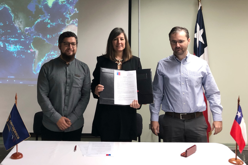
Chile to publish vessel tracking data through Global Fishing Watch

Oceana and Global Fishing Watch Applaud Chile’s Leadership on Fisheries Transparency The Chilean government today signed an agreement to make its vessel tracking data publicly available through the Global Fishing Watch (GFW) map, which tracks the movements of commercial fishing* vessels in near real-time. The agreement, which was made between Chile’s National Fisheries and Aquaculture […]

Bright Lights Reveal the “Dark” Fleet: Media Kit

CAPTION: Arufura Sea, January, 2018. Vessel Monitoring System (VMS) data from Indonesia is shown in the Global Fishing Watch map as yellowish dots. This image is overlayed with data from NOAA’s satellite-based Visible Infrared Imaging Radiometer Suite (VIIRS) which detects many vessels not broadcasting VMS. VIIRS-detected vessels are shown here as blue sailboats. CREDIT: Global […]

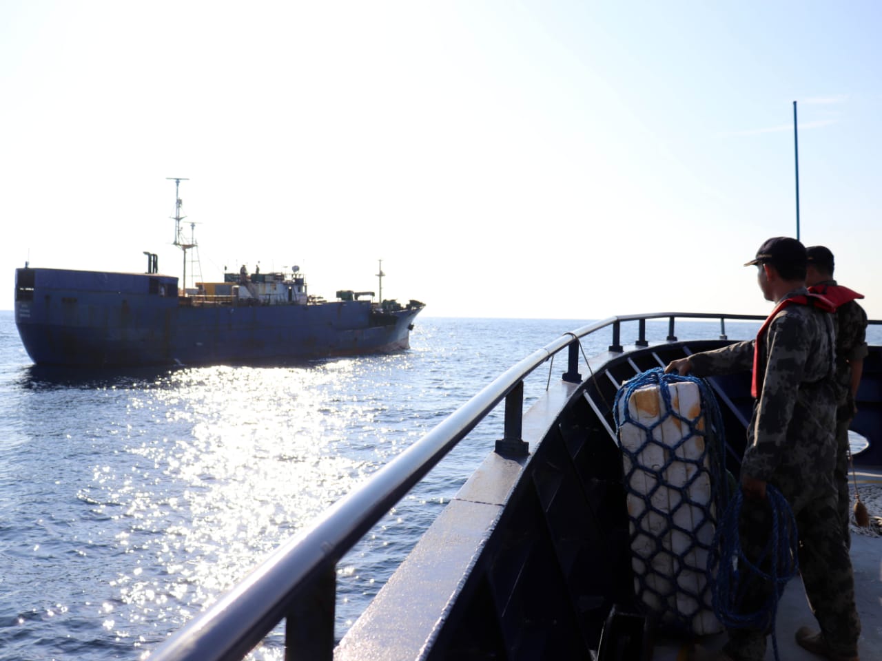
Interception of MV NIKA

Sharp decline in foreign fishing boats in Indonesian waters – Global Fishing Watch analysis

Jakarta, Indonesia – The presence of foreign fishing vessels in Indonesian waters has declined significantly since a ban was enacted in November 2014 by the Minister of Maritime Affairs and Fisheries, Susi Pudjiastuti, according to new analysis by Global Fishing Watch (GFW).  By analysing data from the Automatic Identification System (AIS) (1), an open source vessel tracking […]

Scroll to Top

Help us improve the site

Take a quick website survey to help us build a better experience for visitors like you.