Search results for: Fishing Map

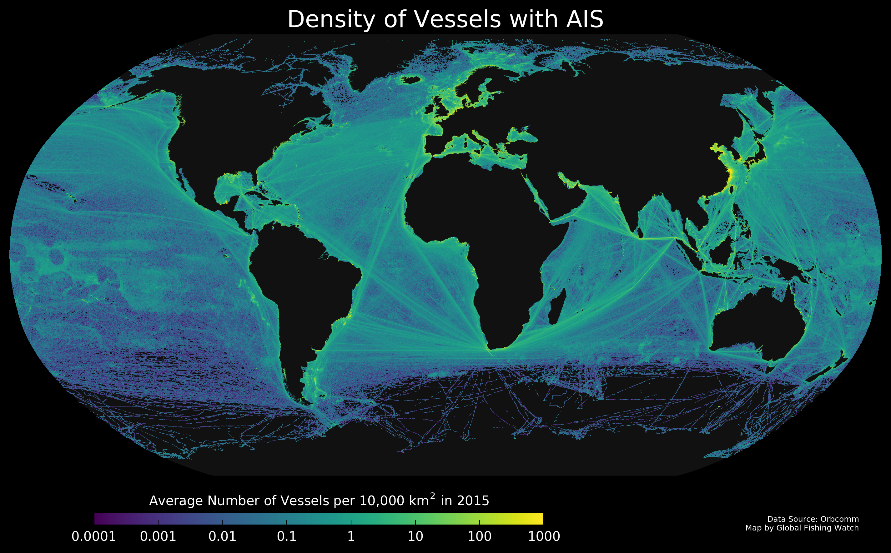
vessel density global map

What Does Five Billion Look Like?

Every day we download more than 20 million data points, giving us the positions of the about two hundred thousand vessels in the world. To see where these vessels traveled in 2015, I plotted their positions to create the map you see above. This map shows all vessels carrying AIS, and not just fishing vessels, and […]

What is VMS?

Vessel monitoring system, or VMS, tracks vessels in a similar way to AIS, but has historically been restricted to government regulators or other fisheries authorities. Several countries have released their VMS publicly on the Global Fishing Watch map. VMS systems broadcast positions at set intervals and some systems allow operators to increase transmission frequency when […]

When should I use an API?

GFW API will be useful for you, if you looking for: Near real time data: up-to-date information with only 3 days of delay.  Better user experience for your users: you can ensure a smooth and integrated user experience with relevant and up-to-date data for your users. The data is delivered when available and not only […]

How do I opt out of receiving marketing communications?

We’ve made it easy for you to manage what types of emails you receive. Simply navigate to the bottom of the email you received and look for the ‘update your preferences’ link. From there, you may manage the emails you receive. You may also opt out of all marketing emails by using the ‘unsubscribe from […]

Can I download raw VMS data?

The VMS data remains under the ownership of the respective national authorities and we cannot release it publicly beyond displaying it on our map.

What is a loitering event?

Loitering is when a single vessel exhibits behavior indicative of a potential encounter event. Loitering is estimated using automatic identification system (AIS) data, including vessel speed, duration in a given location, and distance from shore. Loitering occurs when a vessel travels at average speed of < two knots, while at least an average of 20 […]

Aerial view of a tropical coastline with lush green trees, a narrow beach, and clear blue ocean water revealing a coral reef near the shore.

Annual Report 2024

2024 Annual Report JUMP TO: Message from the CEO Our Impact Global Fishing Watch in Action Innovation Updates Joint Analytical Cell By the Numbers Financials Governance Message from the CEO Global Fishing Watch’s mission is to secure a healthy, productive and resilient ocean using technology and transparency to transform ocean governance. In 2024, we made […]

Two large fishing vessels float on calm, open water under a clear blue sky, with distant land and other ships faintly visible on the horizon.

Annual Report 2025

2025 Annual Report JUMP TO: Message from the CEO Our Impact Success Stories Global Fishing Watch in Action Innovation Updates By the Numbers Financials Governance Message from the CEO In 2025, Global Fishing Watch made excellent progress toward our ambitious 2030 strategy, fueled by advances in technology, expansion of our user base and innovative tools, […]

Terms of Use

Terms of Use Last Modified: May 21, 2021 These Terms of Use (“Agreement” or “Terms”) are an agreement between Global Fishing Watch, Inc., a Delaware non-profit corporation (“Global Fishing Watch”), qualifying for federal tax exemption under Section 501(c)(3) of the Internal Revenue Code of 1986, as amended, and you and your company organization (“You” or […]

Scroll to Top

Help us improve the site

Take a quick website survey to help us build a better experience for visitors like you.