Search results for: What is AIS

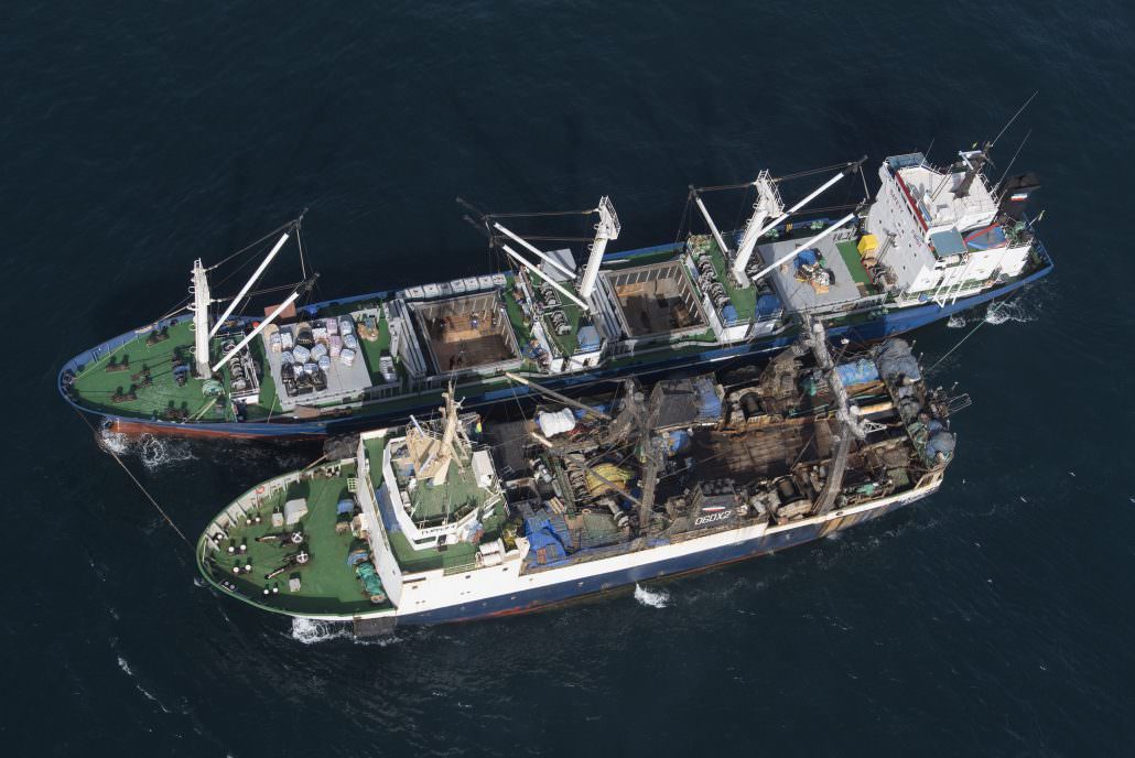
Illegal transhipment of fish between Saly Reefer and Flipper 4 fishing vessel. Greenpeace is on tour in West African waters to address the problem of overfishing in the region. (photo courtesy of Greenpeace)

Machine learning and satellite data provide the first global view of transshipment activity

This week marks the publication of the first-ever global assessment of transshipment in a scientific journal. Researchers at Global Fishing Watch and SkyTruth, in the journal Frontiers of Marine Science, published “Identifying Global Patterns of Transshipment Behavior.” What is transshipment? Why does it matter? What have we learned and what remains unknown? Read on to […]

Atlantic Ocean map showing low to high detail levels with coastal regions in green, yellow, and orange shades.

Platform-Wide Enhancements

This release includes updates to underlying activity data, high-resolution maps and general platform improvements.

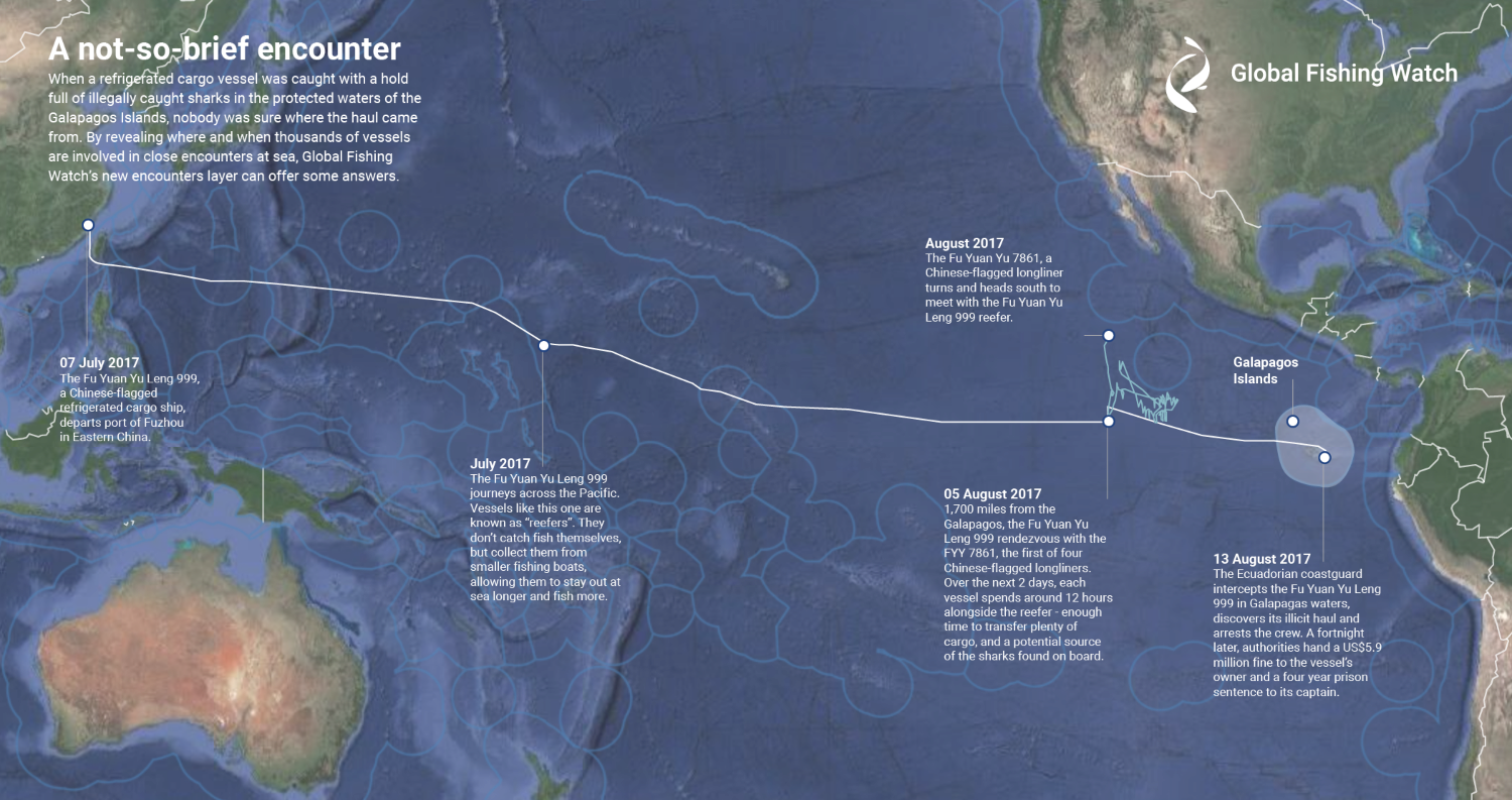
Infographic Galapagos Shark Encounter

Multimedia assets: Close encounters of the fishy kind

New data reveals suspected vessel rendezvous at sea and sheds light on the ‘dark’ fleet Global Fishing Watch (GFW) has increased ocean transparency by releasing the first-ever ‘live’ global view of likely transshipping at sea — a practice that can mask illegal fishing activity, and imagery of night-time fishing and its location, exposing vessels often […]

Updated Fishing Lists – Version 0.2

For the first release of Global Fishing Watch, we included only vessels that had more than 1000 positions in a given year, and broadcast their identity as fishing vessels 100 percent of the time in their AIS identity messages. The list of these mmsi can be seen here. However, many vessels have fewer than 1000 position […]

A smiling man in a collared shirt is featured with text: IN CONVERSATION with Cian Luck, Senior Fisheries Analyst.

How Data and Transparency Are Transforming Ocean Governance

In Conversation with Cian Luck A conversation on the quest to unveil hidden fishing vessel activity at sea Cian Luck, a senior fisheries analyst with the global programs team at Global Fishing Watch, studies his computer screen. Shades of blue collide across his monitor to form a map of the Earth’s ocean while flares of […]

Vessel Viewer: Ensuring Data and Intelligence-Led Fisheries Monitoring and Management

The ocean covers nearly 70 percent of the planet–14 million square kilometers–providing a huge challenge for monitoring activity and enforcing regulations across its vast expanse. That activity includes illegal, unreported and unregulated (IUU) fishing, which accounts for up to $23 billion worth of seafood every year, or one in every five wild-caught fish.

Registry Info

Overview Where possible, Global Fishing Watch matches self-reported identity data with public vessel registry sources to allow cross-checking of information. In addition to self-reported identity data, Global Fishing Watch gathers, cleans and combines vessel identity information from over 40 public registries. These registries include regional and national sources. View the full list of registries in […]

Scroll to Top

Help us improve the site

Take a quick website survey to help us build a better experience for visitors like you.