

Ask Global Fishing Watch
Small Vessel Detection
Yuexin Li, Machine Learning Engineer, Remote Sensing
How Does AI Detect Small-Scale Fishing Vessels in Satellite Imagery?
More than 2 million small fishing vessels operate around the world but they rarely broadcast their position on the automatic identification system (AIS), creating one of the most persistent blind spots in ocean monitoring.
Global Fishing Watch is closing this gap using Planet high resolution imagery (capable of detecting small boats under 12 meters) and rethinking our machine learning models to interpret the data.
Global Fishing Watch plans to share a small-vessel detections dataset with research partners in a future release.
How It Works
Stage 1 – Raw Detection: At Planet’s 3-meter resolution, 5- to 10-meter vessels look like a handful of pixels in our detector. This makes them easy to confuse with glint, whitecaps or the wake of a passing boat. The result is a noisy pool of apparent vessel detections, with their respective score, length, speed and heading estimation.
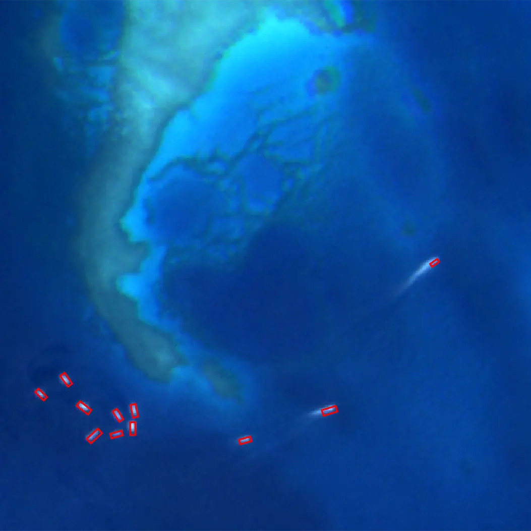
Stage 2 – Noise Classification: Images of each possible vessel detection in that noisy pool are classified, incorporating different image embeddings (numerical vectors produced by an AI model that translate visual patterns like shape, size and texture into computer-readable data), and contextual features describing the environment where the detection is located (e.g., distance from shore, wind speed, etc.).
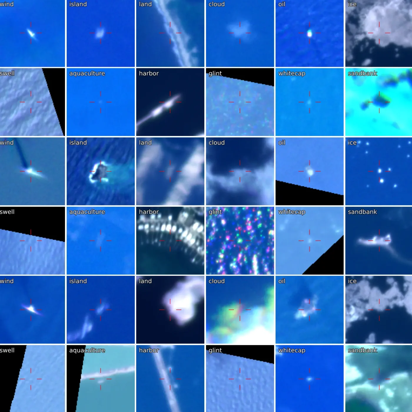
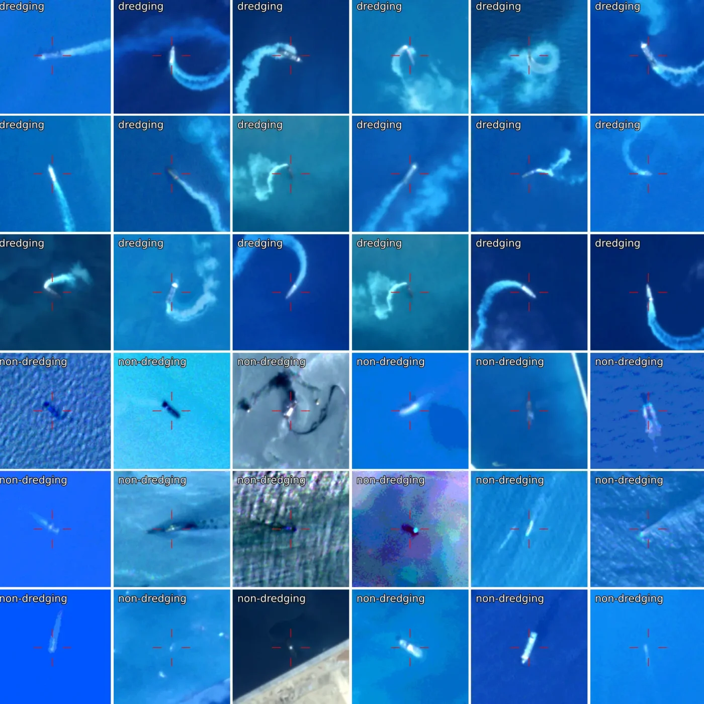
Stage 3 – Vessel Classification: The process of telling a real vessel from a wave or a rock carries enough visual and contextual information to aid additional models down the line to distinguish fishing from non-fishing vessels, or even specific activities like trawling or dredging.
Stage 4 – Applied Analysis: The data is ready for analysis. For example, a mapping of previously unseen small-scale fishing activity across the coastlines of Africa reveals that, while industrial fishing vessels generally respect African preferential access areas, zones reserved for small-scale fishing often fail to align with where small-scale fishers actually operate.
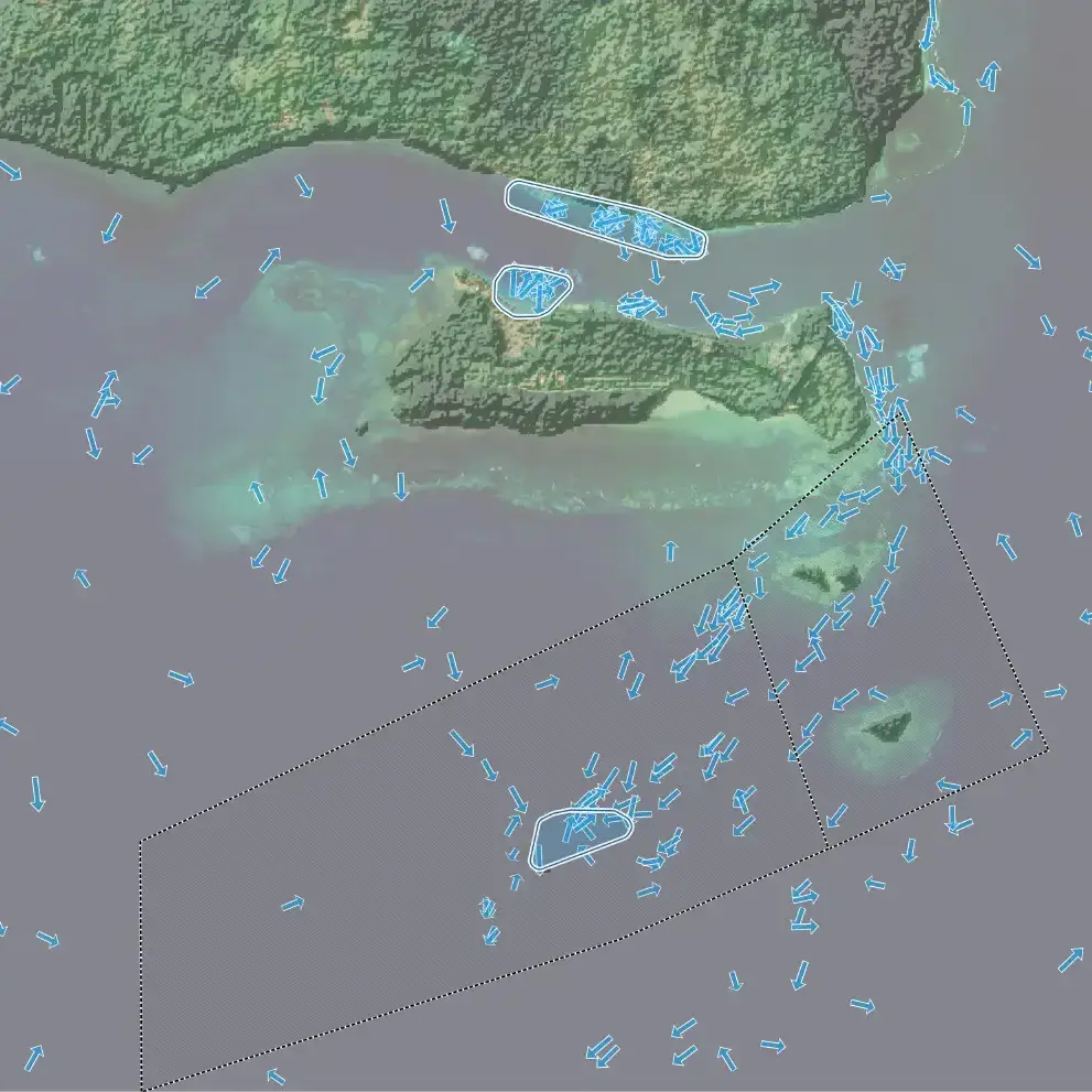
Global Fishing Watch uses high-resolution satellite imagery and AI to track small fishing vessels, shining a light on one of the ocean’s biggest monitoring blind spots.
©Global Fishing Watch, 2026