Tracking the Global Footprint of Fisheries: Media Kit
Tracking the Global Footprint of Fisheries: Media Kit Read More »
What is Global Fishing Watch? Global Fishing Watch aims to create transparency, accelerate research and innovation, and promote sustainability in fisheries. Founded as a collaboration between Oceana, SkyTruth, and Google, Global Fishing Watch became an independent 501(c)3 organization in June 2017. Through our public mapping platform, we allow anyone to view global fishing activity in
Tracking Fishing from Space: Fact Sheet Read More »
CAPTION: Arufura Sea, January, 2018. Vessel Monitoring System (VMS) data from Indonesia is shown in the Global Fishing Watch map as yellowish dots. This image is overlayed with data from NOAA’s satellite-based Visible Infrared Imaging Radiometer Suite (VIIRS) which detects many vessels not broadcasting VMS. VIIRS-detected vessels are shown here as blue sailboats. CREDIT: Global
Bright Lights Reveal the “Dark” Fleet: Media Kit Read More »
Bright Lights Reveal the “Dark” Fleet A new partnership between Global Fishing Watch and NOAA matches night-time imagery with monitoring data from fishing vessels. January 16, 2018: Global Fishing Watch has entered into a new data-sharing partnership with the U.S. National Oceanic and Atmospheric Administration (NOAA) to improve understanding of the activity of fishing vessels
Bright Lights Reveal the “Dark” Fleet Read More »
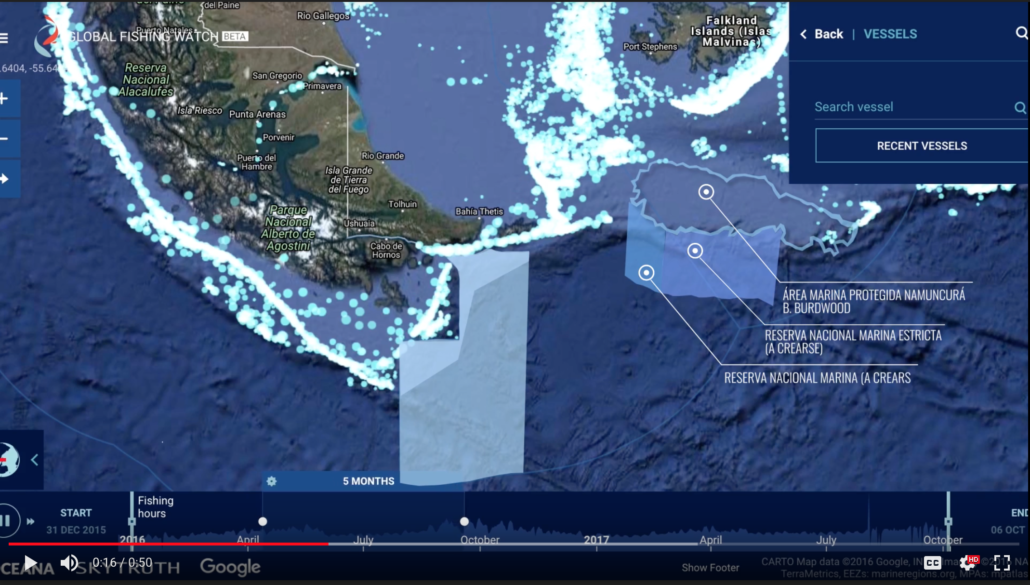
Commercial fishing is an important revenue source for Argentina, and the industry’s interests are strong, but the government is committed to protecting at least 10 percent of its territorial waters by 2020. Although reconciling the need for Marine Protected Areas with the economic interests of the fishing industry can be challenging, Global Fishing Watch has
Making the Case for Argentine MPAs Read More »

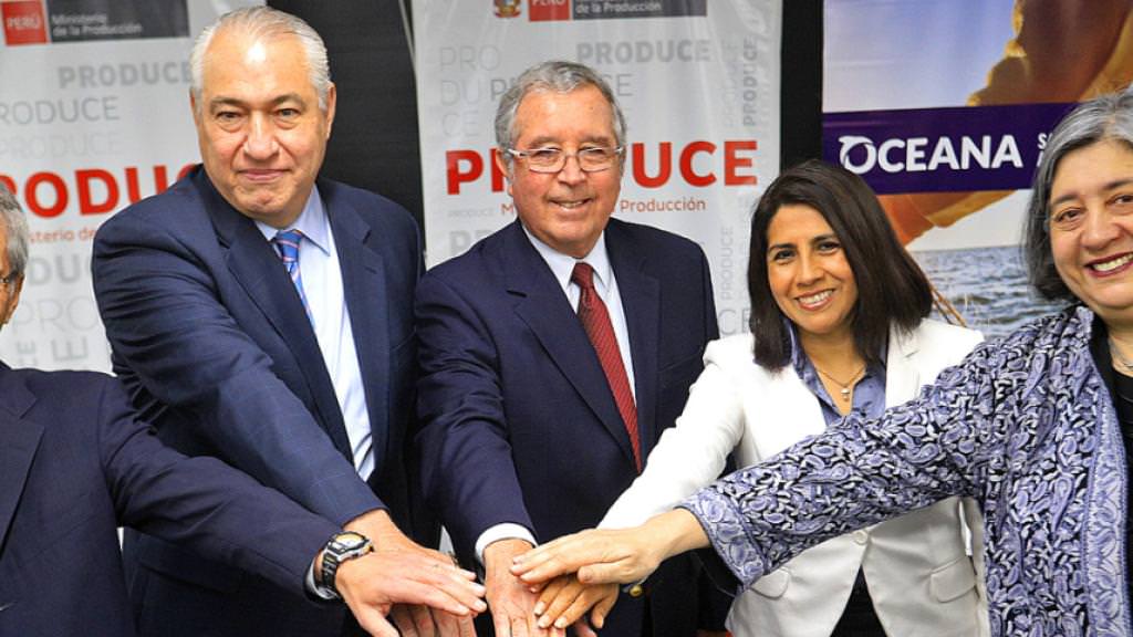
Last week, members of our team traveled to Peru to participate in a workshop on fishing algorithms and data, co-hosted by Oceana Peru and the Instituto del Mar de Peru (IMARPE). We made the journey because Peru is releasing its fishing vessel data to the world – the Peruvian Vice Minister of Fisheries, Hector Soldi,
Collaborating, Adapting Algorithms for Peru’s VMS Read More »
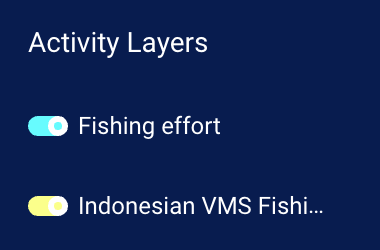
On World Ocean Day in June 2017, we partnered with Minister Susi Pudjiastuti and the Indonesian Ministry of Marine Affairs and Fisheries to publicly release Indonesian Vessel Monitoring System (VMS) data. This was the first ever public release of VMS data. Previously accessible only in a dedicated public workspace on our site, this data is
VMS Layer Now Available in Fishing Activity Map Read More »

Wei Zhou, ocean campaigner at Greenpeace East Asia’s Beijing office, used Global Fishing Watch to understand the impact of recent changes to fisheries policy in China on the extent of fishing in the Chinese EEZ. On September 16, 2017 at noon, over 10,000 fishing vessels based in Zhejiang and Fujian Provinces in China headed out to start
Understanding the Impacts of the Chinese Fishery Moratorium Read More »
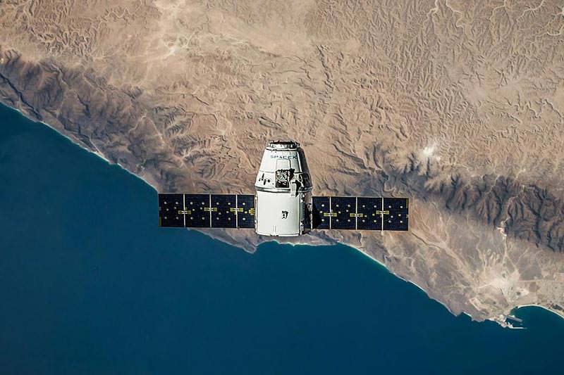
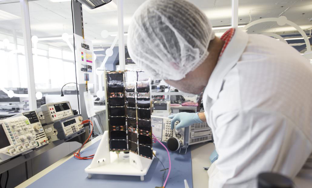
Media contact: Kimbra Cutlip Kimbra (at) GlobalFishingWatch.org +1 443.871.1632 [MULTI-MEDIA AVAILABLE HERE] Nov 1, 2017: Global Fishing Watch is pleased to announce that, through a partnership with Spire Global, Inc, it has doubled the amount of data used to identify and track nearly 60,000 commercial fishing vessels on the world’s oceans. The Global Fishing Watch
Global Fishing Watch Doubles Its Data with Help of Nano-satellites from Spire Sense Read More »
Today, we are pleased to announce that, through a partnership with Spire Global, Inc, we have doubled the amount of data we use to identify and track nearly 60,000 commercial fishing vessels on the world’s oceans. Publicly broadcast Automatic Identification System (AIS) messages received by satellites and ground-based receivers comprise the largest source of data in the
Adding Nano-Satellite Data Doubles Our Resolution Read More »
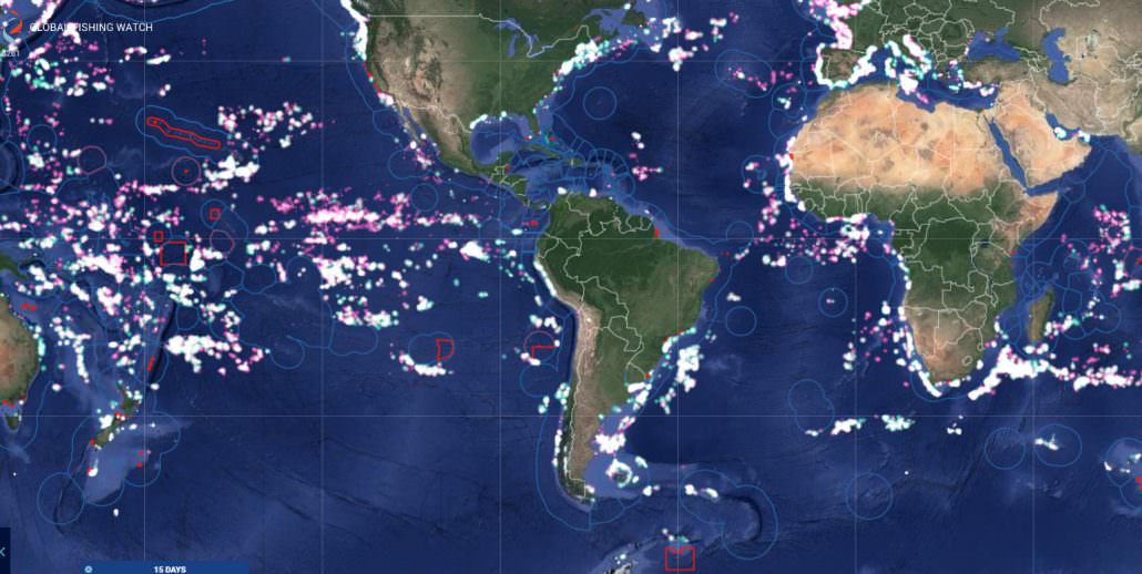
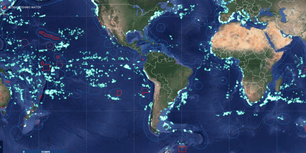
Right Click the images below to download in high res. Please credit Global Fishing Watch 2017 The animated Gif below shows Global Fishing Watch platform before the addition of data from Spire’s nano-satellites and after. Note: each lighted point on the map indicates a fishing vessel engaged in fishing. The new data points do not
Spire Partnership Nearly Doubles Data in Global Fishing Watch- Media Kit Read More »
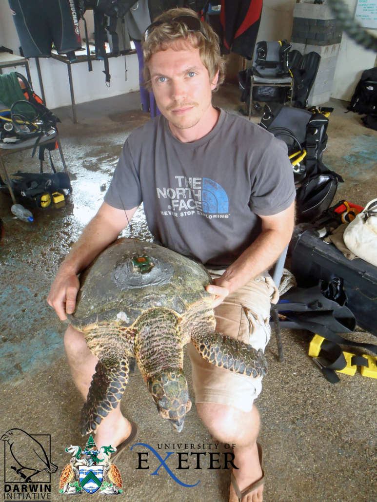
Sam Weber worked previously for the Ascension Island Government and is currently at the University of Exeter helping to establish the largest Marine Protected Area in the Atlantic around Ascension Island.
Understanding Fishing Activity Around Ascension Island Read More »

Commercial fishing is an energy-intensive business, and not just for the fishers hauling in the catch. Fishing vessels burn a lot of fuel. In fact, according to Naya Olmer, Marine Program Associate at the International Council on Clean Transportation, industrial-sized commercial fishing vessels are responsible for more than 4 percent of the greenhouse gas emissions released
New Study: Greenhouse Gas Emissions are Rising as Vessel Traffic Grows Read More »

Chris Kerry, a researcher at the University of Exeter in the UK, is using Global Fishing Watch gridded data to understand if seamounts are targeted by fishing vessels and if fishing activity is linked to any specific seamount characteristic. Seamounts, or undersea mountains that rise from the ocean floor, create an environment rich with biodiversity. Yet little is
The Missing Data to Help Protect Seamounts Read More »
This letter from Andy Sharpless first appeared on Oceana’s blog. Read the Spanish translation here. I am writing to you from Peru, where I have just witnessed Oceana’s team win an exciting victory.
A Victory for Transparency in Peru Read More »