

In the sprawling waters off Brazil’s coast, the ocean tells many stories. Some are of abundance, like the shoals of tuna migrating through pristine marine sanctuaries. Others speak of pressure, as fishing, energy infrastructure and shipping compete for space in an already-crowded environment. And some stories are just beginning, written by those daring to imagine a new approach for how the sea could be managed.
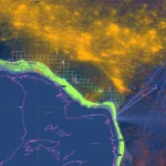
Brazil is helping to chart that course, by using cutting-edge technology in creative ways to oversee its coastline with tools that turn complex data into clear, actionable insights. At the heart of this effort is Marine Manager, Global Fishing Watch’s dynamic ocean intelligence platform, which is quietly reshaping how the country sees and manages its ocean resources.
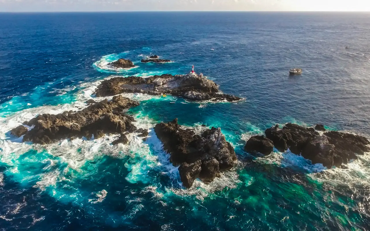
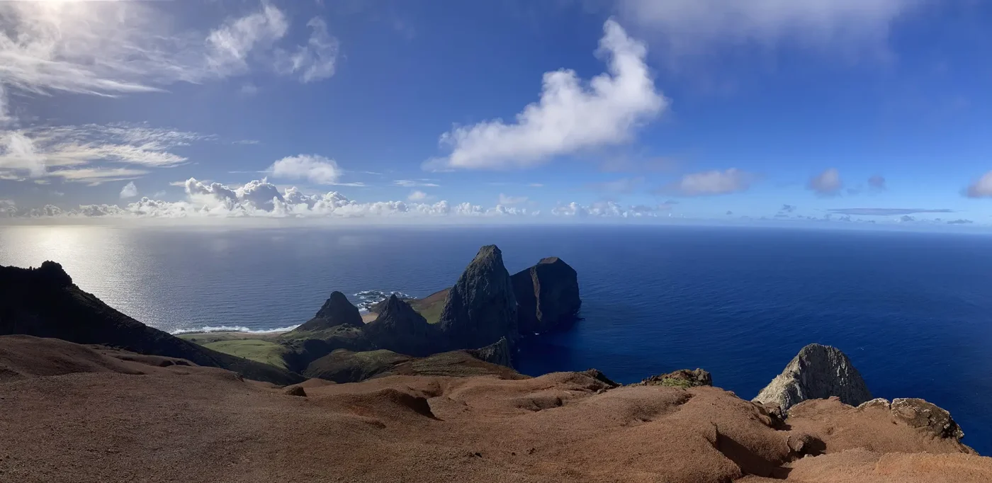
Far from Brazil’s bustling ports, two distant archipelagos—São Pedro and São Paulo and Trindade and Martin Vaz—rise from the Atlantic. These are some of the country’s most remote marine protected areas (MPAs), biodiversity jewels home to endangered hammerhead sharks, rare corals and fish found nowhere else. But their remoteness makes them challenging to manage, and that’s where the Global Fishing Watch Marine Manager comes in.
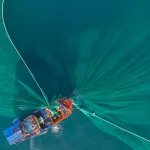
Only certain types of fishing are allowed in these waters, and every vessel is required to carry the right gear, maintain a functioning tracking system and submit detailed fishing logs to authorities. The Chico Mendes Institute for Biodiversity Conservation (ICMBio) is the national agency responsible for managing these MPAs. Here, officials use the Marine Manager platform to monitor vessel activity, verify fishing permits and cross-check logs against satellite data, confirming that vessels are where they say they are, and that protection is more than just a line on a map.
The insights gathered here also feed directly into MPAs’ management discussions in multi-stakeholder advisory committees made up of government officials, scientists, and civil society. This is important, because the authorities’ actions are not limited to monitoring, control and surveillance; they must also ensure that any protective measures introduced are grounded in accurate data and can adapt to emerging challenges, such as climate change.
Closer to shore, the Brazilian Institute of Environment and Renewable Natural Resources (IBAMA) is using our Marine Manager in a more tactical way to sharpen monitoring and control activities and add an additional layer of evidence.
When a vessel is suspected of breaking the rules—fishing in the wrong area, using unauthorized gear or working during a closed season—IBAMA taps into open data to verify the facts. Spatial data confirms whether fishing occurred beyond limited areas, satellite data show if a vessel crossed into an MPA, while movement and speed analysis help clarify if the vessel’s activity coincided with the gear it had originally been authorized to use.
This evidence strengthens infraction reports and supports actions by the enforcement agency. More importantly, though, it ensures enforcement is transparent and backed by verifiable proof, which builds trust between regulators and the fishing sector while deterring future violations.
Brazil’s rise as a global energy powerhouse has largely been fueled by oil extraction. In 2024, crude oil overtook soybeans as the country’s top export, bringing in nearly US$45 billion. Vast reserves of “pre-salt” oil—deep beneath the ocean floor—have made Brazil the world’s seventh-largest oil producer.
With this growth come immense challenges and significant opposition. Many groups stress that new fossil fuel development is incompatible with global climate goals and carries significant risks for marine biodiversity, coastal communities and fisheries that depend on healthy oceans.
Since 2024, Brazil has been using Global Fishing Watch data as one of the data sources to assess new offshore blocks considered for oil and gas exploration. The Ministry of Mines and Energy consults the Ministry of Environment and Climate Change (MMA) about overlaying fishing activity, bathymetry and ecological data to understand what is taking place beneath the surface: Are these waters rich fishing grounds? Are there sensitive habitats or seamounts that could be disturbed?
By May 2025, MMA had assessed 360 offshore blocks using Global Fishing Watch’s data and decided that:
The government has indicated it will also apply this approach for offshore wind energy planning because making the data accessible to decision-makers might help anticipate risks, identify potential conflicts, and ensure that development choices are grounded in transparent evidence.
While these safeguards represent progress, many organizations have raised critical concerns about the continued expansion of offshore oil and gas. National and international groups are advocating for prioritizing renewable energy investment and stronger protection of ecologically sensitive areas, warning that short-term economic gains from oil extraction may come at the expense of long-term climate stability, food security, and the resilience of Brazil’s marine ecosystems.
From energy to monitoring, from distant archipelagos to busy ports, Brazil’s agencies are using open data and transparency to inform policy and strengthen protection measures.
The benefits are already being felt because illegal activity is harder to hide when vessel tracks, permits and fishing logs can all be cross-checked. Biodiversity is better protected through stronger monitoring of MPAs. And control and monitoring are more credible when they are backed up by visible proof that builds trust.
Open data has evolved from a window into what’s happening at sea into a critical tool to shape a better future. With credible data and greater transparency, decisions become sharper, ecosystems are better protected, sustainable livelihoods are safeguarded and the horizon for our oceans grows brighter.