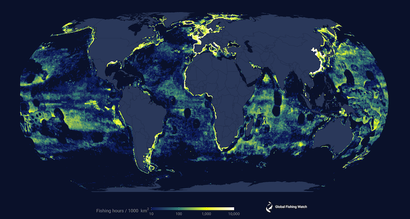
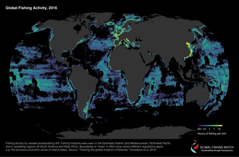
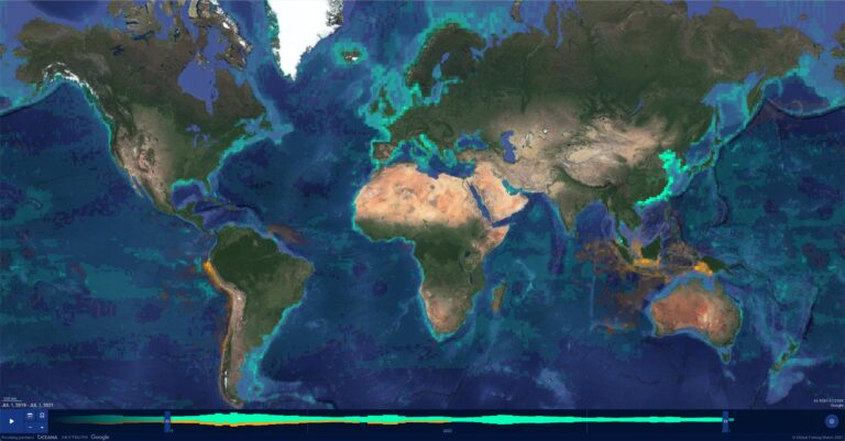
Commercial fishing is the most widespread human activity at sea. Defined as the for-profit practice of catching fish or other marine life by commercial fishing boats, its impact goes far beyond ocean health and the management of fish populations. Commercial fishing is essential in supporting the global livelihoods of nearly 60 million people who are directly employed in the fisheries and aquaculture sector, as well as ensuring food security for more than 3 billion people who rely on seafood as their primary source of protein. Underlining the significance of commercial fishing is the nearly $150 billion in global seafood exchange that takes place each year—the most valuable traded food commodity in the world.
New research uses GPS data to reveal longline vessels pose significant risk to threatened albatross
Fishing for tuna into daylight hours increases dangers for iconic seabirds, presents opportunity for better management
Contributions from the Ground Can Strengthen New Transshipment Guidelines
As the FAO and its Member States develop voluntary measures on transshipment, experience from the ground informs four key recommendations This year, the Food and Agricultural Organization of the United Nations and its Member States
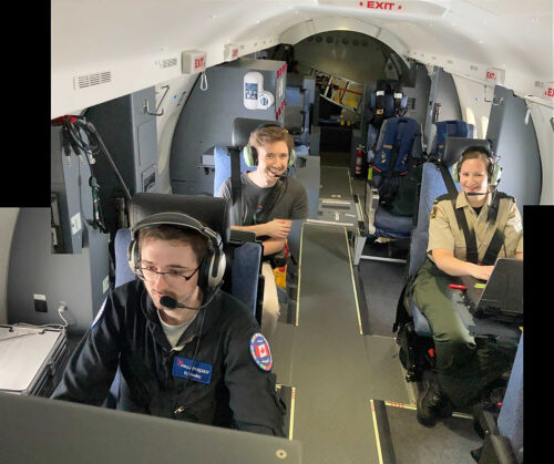
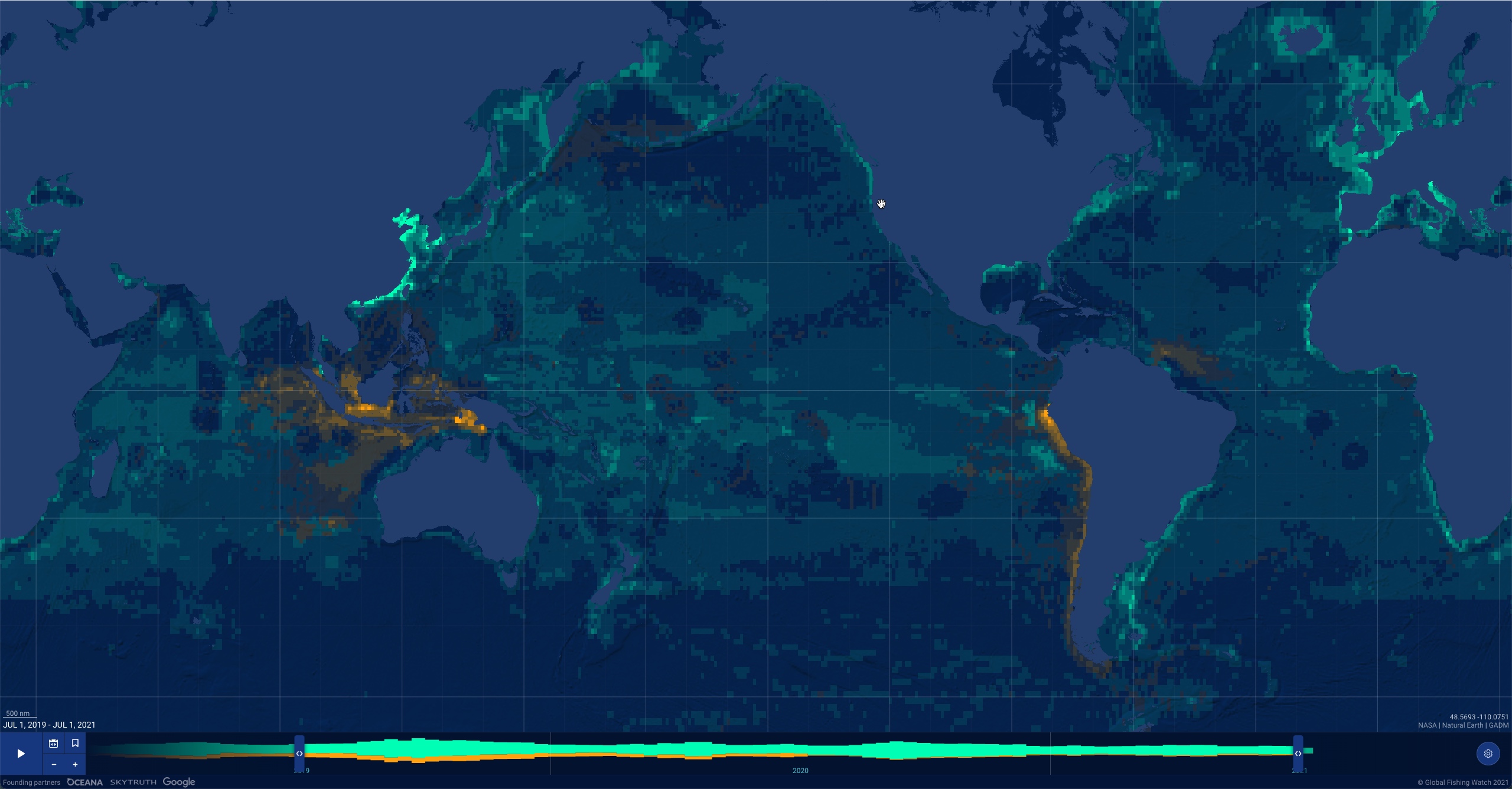
On the High Seas, Global Fishing Watch Helps Focus Law Enforcement Patrols
Annual international collaboration Operation North Pacific Guard targets illegal, unreported and unregulated fishing For three years, Global Fishing Watch has worked with the United States Coast Guard (USCG), Canada’s Department of Fisheries and Oceans
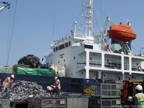
African Nations to Use New Technology in Tightening Port Controls, Fighting Illegal Fishing With Big Data
Pilot project delivers new vessel tracking technology and analysis where limited resources hamper detection and enforcement efforts Dakar, Senegal – Four African nations and a regional fisheries organization are harnessing new technology to strengthen port