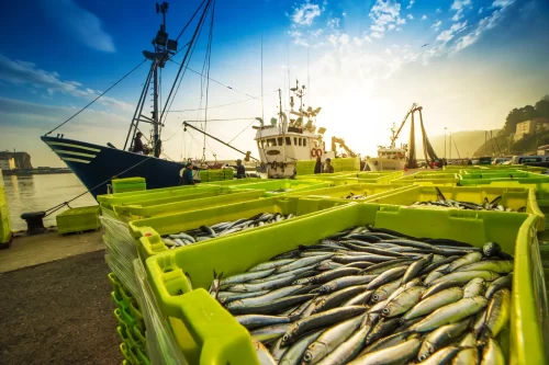
The first step in catching illegal and unreported fishing activity can feel a little like casting a net over a wide swath of the ocean. There’s going to be a lot of bycatch, because much of what fits in your net isn’t really what you’re after. It takes some background knowledge and often a little investigative work to find the keepers. Sometimes you come up empty handed.
Here are some reasons suspicious-looking behavior by commercial fishing vessels might actually represent perfectly legal activity.
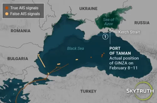
Gaps in AIS signals can make is seem as if a fishing vessel captain is intentionally turning off his or her AIS to avoid detection. Although it may look like a vessel has “gone dark” to fish in a restricted area, unintentional gaps are not uncommon.
Satellite coverage is not complete around the globe. In the central Pacific, for instance, we may record more than 50 AIS positions per hour from a single vessel and then receive nothing for several hours while there is no satellite overhead. These gaps will decrease as more satellites come on line, but for now, they are common in some areas.
In other regions, congestion can lead to long gaps. Satellites can only receive so many AIS messages at once, so in places where many fishing vessels tend to congregate, each vessel is “seen” less frequently by the satellites overhead.
Incursions into Marine Protected Areas (MPAs) get people’s hackles up. When ships cross into waters where fishing is restricted or prohibited, they may simply be transiting. In such cases their tracks may show up as a bee line straight through the protected area. At times, however, they linger, meandering across the border, or zig-zagging with an apparent purpose that could look suspiciously like the track you would expect if they were setting a longline or dragging a trawl. But not all zig-zagging behavior is fishing.
Research vessels that have permission to conduct surveys through MPAs may travel in a back and forth pattern or drift for long periods of time. Such vessels are often identified as fishing vessels in vessel registries and appear on the Global Fishing Watch map. Even fishing boats that aren’t conducting research may have a legitimate reason to dawdle in a no-take MPA. Storms and heavy seas sometimes send vessels fleeing the open ocean in search of shelter. Tucking into the leeward side of an island, a vessel may drift or motor slowly back and forth as it waits for fair weather.
Meeting up at sea doesn’t always signal an illegal transshipment. Two vessels may sidle up alongside one another to exchange crew or resupply one of the boats with fuel, gear, food or water. The Global Fishing Watch algorithm requires a specific set of criteria before suspecting transshipment. You can read more about that here, but basically we must see more than 20 AIS signals from two vessels that are within 500 meters of each other for three hours or more traveling at a speed of less than 2 knots. The encounter must occur more than 20 nautical miles from shore. It’s also more likely to be a transshipment if one of the vessels is a refrigerated cargo ship, because those are used to collect fish from multiple vessels and provide an easy way to mix legal and illegal catch.
Vetting suspicious behavior requires a deeper dive into a vessel’s identity, permissions and behavior as well as external circumstances such as weather and legal requirements. In the coming weeks, we’ll be taking a few such deep dives here on the blog as we evaluate suspicious looking vessel tracks from the Global Fishing Watch map.
We’ll post the links here as well as on the main blog page, so be sure to check back.
UPDATE:
Fishing in a marine park? Look again. Tracks reveal the rescue of a sinking fishing vessel on fire.
What’s Happening Inside Motu Maha Marine Reserve? Reserve provides protection for marine life and fishing vessels alike.