Palmyra Atoll Workspace Visualization

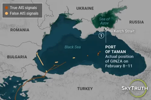
Intended for the media, but available to everyone.

Right click to download original image, or click to access the workspace.

Using the Global Fishing Watch Map, we are able to see the tracks of fishing vessels operating around U.S. Palmyra Atoll National Wildlife Refuge. /Credit Global Fishing Watch
Caption: U.S. Palmyra Atoll National Wildlife Refuge. /Credit Global Fishing Watch Using Global Fishing Watch, researchers were able to identify commercial fishing vessels operating around U.S. Palmyra Atoll National Wildlife Refuge from January 1, 2013 through December 31, December 14.  Credit: Global Fishing Watch

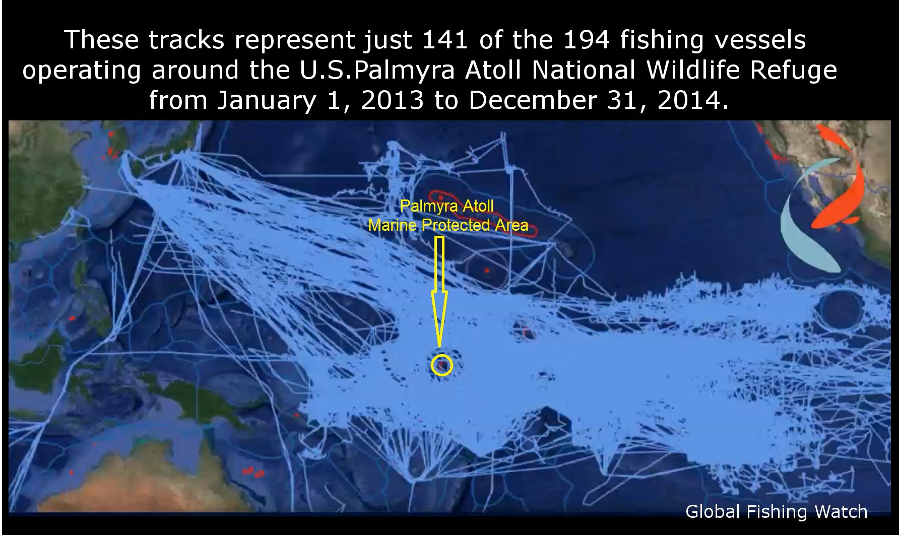
NOTE: THIS WORKSPACE shows the active map of these vessel tracks. You can change date ranges, zoom in, select a specific vessel, animate the timeline and much more.

For more information, contact:

Kimbra Cutlip
Global Fishing Watch
443-871-1634

Scroll to Top